Category:The Forbury (street)
Jump to navigation
Jump to search
street surrounding Forbury Gardens in the town centre of Reading, UK  | |||||
| Upload media | |||||
| Instance of | |||||
|---|---|---|---|---|---|
| Location | The Forbury, Reading Town Centre, Reading, West Berkshire, Berkshire, South East England, England | ||||
| Connects with | |||||
| |||||
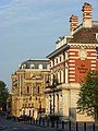
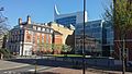
English: Media relating to The Forbury, a street which runs around the Forbury Gardens. Historically the term The Forbury refered to the area in front of Reading Abbey, much of which is now occupied by the Forbury Gardens, but in modern usage it refers to the road that borders the gardens on two sides. It should not be mistaken for Forbury Road, that runs from a junction with Blagrave Street, close to Reading railway station, to a junction with King's Road near to the site of the former Huntley & Palmers factory, and which connects with The Forbury near its intersection with Vastern Road.
Media in category "The Forbury (street)"
The following 5 files are in this category, out of 5 total.
-
 The Forbury, Reading - geograph.org.uk - 538988.jpg 480 × 640; 134 KB
-
 Forbury Square 2017-04-09 15.28.47.jpg 3,264 × 1,836; 2.51 MB
-
 The Forbury Bench Mark - geograph.org.uk - 2088910.jpg 600 × 800; 171 KB
-
 The Forbury, Reading - geograph.org.uk - 1006706.jpg 640 × 480; 131 KB
-
 The Forbury, Reading - geograph.org.uk - 671182.jpg 640 × 480; 165 KB


