Category:Thockrington
Jump to navigation
Jump to search
village in Northumberland, United Kingdom  | |||||
| Upload media | |||||
| Instance of | |||||
|---|---|---|---|---|---|
| Location | Bavington, Northumberland, North East England, England | ||||
 | |||||
English: Thockrington is a village in Northumberland, England. The village lies about north of Hexham.
Subcategories
This category has only the following subcategory.
A
Media in category "Thockrington"
The following 69 files are in this category, out of 69 total.
-
 Barn at Thockrington - geograph.org.uk - 271327.jpg 640 × 480; 65 KB
-
 Dovecot - geograph.org.uk - 100314.jpg 640 × 427; 29 KB
-
 Green road to Hallington Reservoir - geograph.org.uk - 271401.jpg 640 × 480; 68 KB
-
 Green road to Little Swinburne - geograph.org.uk - 271400.jpg 640 × 480; 67 KB
-

-
 Road through Thockrington - geograph.org.uk - 2694464.jpg 640 × 480; 43 KB
-

-
 Thockrington Burn - geograph.org.uk - 1179872.jpg 640 × 480; 88 KB
-
 Thockrington Burn - geograph.org.uk - 1179874.jpg 640 × 480; 97 KB
-
 Thockrington Crags Plantation - geograph.org.uk - 3009495.jpg 600 × 450; 98 KB
-
 Thockrington Farm - geograph.org.uk - 1179870.jpg 640 × 480; 72 KB
-
 Thockrington Farm - geograph.org.uk - 4606755.jpg 640 × 480; 71 KB
-
 Thockrington Plantation and Crag - geograph.org.uk - 5007163.jpg 5,312 × 2,988; 7.95 MB
-
 Turning for Thockrington - geograph.org.uk - 2694470.jpg 640 × 480; 92 KB
-
 Boat House Colt Crag Reservoir - geograph.org.uk - 116615.jpg 640 × 480; 95 KB
-
 Bridleway near Hedchester - geograph.org.uk - 271268.jpg 640 × 480; 88 KB
-
 Carrycoats Hall - geograph.org.uk - 104433.jpg 640 × 459; 92 KB
-
 Cheviot Farm, Hallington - geograph.org.uk - 116610.jpg 640 × 480; 97 KB
-
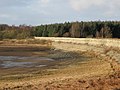
 Colt Crag Reservoir - geograph.org.uk - 100274.jpg 640 × 427; 82 KB
-
 Colt Crag Reservoir - geograph.org.uk - 122655.jpg 640 × 178; 29 KB
-
 Country road, Northumberland - geograph.org.uk - 72385.jpg 640 × 480; 218 KB
-
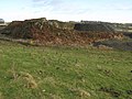
 Divethill Quarry - geograph.org.uk - 609583.jpg 640 × 480; 80 KB
-
 Divethill Quarry - geograph.org.uk - 623274.jpg 640 × 480; 86 KB
-
 Divethill Quarry - geograph.org.uk - 625060.jpg 640 × 480; 77 KB
-
 Divethill Quarry - geograph.org.uk - 625064.jpg 640 × 480; 67 KB
-
 Divethill Quarry - geograph.org.uk - 625067.jpg 640 × 480; 69 KB
-
 Divethill Quarry - geograph.org.uk - 625077.jpg 640 × 480; 77 KB
-
 Dovecot by Homilton Farm - geograph.org.uk - 271411.jpg 640 × 480; 69 KB
-
 Entrance to Divethill Quarry - geograph.org.uk - 271413.jpg 640 × 480; 62 KB
-
 Farmland near Great Bavington - geograph.org.uk - 100280.jpg 640 × 427; 112 KB
-

-
 Fields and shelter belt - geograph.org.uk - 271404.jpg 640 × 480; 81 KB
-

-

-
 Hedchester Cottage, North Heugh - geograph.org.uk - 271399.jpg 640 × 480; 73 KB
-
 Homestead near Sweethope - geograph.org.uk - 596550.jpg 640 × 480; 103 KB
-
 I'd stick to the path if I were you - geograph.org.uk - 627223.jpg 640 × 371; 64 KB
-
 Near Colt Crag Reservoir - geograph.org.uk - 271267.jpg 640 × 480; 77 KB
-
 New plantation near Sweethope - geograph.org.uk - 596569.jpg 640 × 480; 67 KB
-

-
 Pasture near Great Bavington - geograph.org.uk - 271418.jpg 640 × 480; 76 KB
-

-

-
 Pastures near Hawick Farm - geograph.org.uk - 623332.jpg 640 × 480; 77 KB
-
 Pastures north of Cheviot Farm - geograph.org.uk - 625029.jpg 640 × 480; 89 KB
-

-
 Plashetts Farm - geograph.org.uk - 271408.jpg 640 × 480; 75 KB
-
 Plashetts Farm - geograph.org.uk - 271409.jpg 640 × 480; 70 KB
-

-
 Road to Sweethope - geograph.org.uk - 575716.jpg 640 × 425; 70 KB
-
 Rough grazing near Great Bavington - geograph.org.uk - 271415.jpg 640 × 480; 94 KB
-
 Rough grazing near Little Swinburne - geograph.org.uk - 271271.jpg 640 × 480; 86 KB
-
 Rough pasture south from Thockrington - geograph.org.uk - 100348.jpg 640 × 427; 83 KB
-
 Small Burn Lake - geograph.org.uk - 122552.jpg 640 × 189; 41 KB
-
 Stelling by Lunga Crags - geograph.org.uk - 596579.jpg 640 × 480; 78 KB
-

-

-
-
-
 The road to Little Swinburne - geograph.org.uk - 271269.jpg 640 × 480; 66 KB
-
 The road to Thockrington - geograph.org.uk - 271402.jpg 640 × 480; 87 KB
-

-
 Three happy bunnies - geograph.org.uk - 625018.jpg 640 × 480; 72 KB
-
 Top end of Colt Crag Reservoir - geograph.org.uk - 271266.jpg 640 × 480; 75 KB
-
 Track just off the B6342 - geograph.org.uk - 271270.jpg 640 × 480; 83 KB
-
 Track north of Cheviot Farm - geograph.org.uk - 625014.jpg 640 × 480; 109 KB
-

-
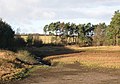
 Upper end of Colt Crag Reservoir - geograph.org.uk - 271265.jpg 640 × 480; 90 KB
-


