Category:Tipperary
Jump to navigation
Jump to search
Italiano: Tipperary è una cittadina nella parte sud-occidentale della contea di Tipperary, in Irlanda.
town in County Tipperary, Ireland  | |||||
| Upload media | |||||
| Instance of | |||||
|---|---|---|---|---|---|
| Location |
| ||||
| Elevation above sea level |
| ||||
 | |||||
Subcategories
This category has only the following subcategory.
F
- Famine Warhouse, Ballingarry (1 F)
Media in category "Tipperary"
The following 133 files are in this category, out of 133 total.
-
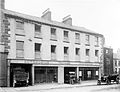
 "Success to New Tipperary; 'tis the glory of our land!" (8557077664).jpg 2,000 × 1,524; 1.65 MB
-
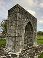 Abbey arch, Tipperary Town.jpg 3,000 × 4,000; 2.8 MB
-
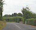
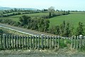
 Approaching the R663 - geograph.org.uk - 5914323.jpg 1,024 × 610; 94 KB
-
 Arcade, New Tipperary (8558487737).jpg 2,000 × 1,525; 1.51 MB
-
 Arcade, New Tipperary (8558487905).jpg 2,000 × 1,524; 1.57 MB
-
-
 BorrisTownlandBorrisleighParishNorthTipperary.jpg 600 × 758; 141 KB
-
 BoundariesOfElectoralDivisionsInNorthTipperary.jpg 1,600 × 1,664; 609 KB
-
 BoundariesOfElectoralDivisionsInNorthTipperaryIn2011.jpg 1,600 × 1,664; 608 KB
-
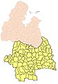 BoundariesOfElectoralDivisionsInTipperary.jpg 702 × 1,001; 327 KB
-
 Bridge over the River Ara, Tipperary.jpg 4,320 × 3,240; 5.77 MB
-
 Brigid's-cross-on-a-headstone-in-Tipperary.jpg 2,464 × 1,632; 1.57 MB
-
 Christ the King Statue - geograph.org.uk - 5917746.jpg 681 × 1,024; 166 KB
-
 Church Street, Tipperary - geograph.org.uk - 1296098.jpg 640 × 426; 181 KB
-
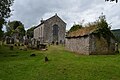
 Clonbeg Church - geograph.org.uk - 5917815.jpg 1,024 × 681; 164 KB
-
 Clonbeg Church - geograph.org.uk - 5917838.jpg 1,024 × 681; 177 KB
-
 Clonbeg Church - geograph.org.uk - 5917855.jpg 1,024 × 681; 198 KB
-
 Clonbeg Church - geograph.org.uk - 5917860.jpg 1,024 × 681; 160 KB
-
 Clonbeg Church - geograph.org.uk - 5917874.jpg 1,024 × 681; 178 KB
-
 Clonbeg Church - geograph.org.uk - 5927354.jpg 1,024 × 768; 247 KB
-
 Clonbeg Churchyard - geograph.org.uk - 5917789.jpg 1,024 × 681; 225 KB
-
 Cuteness alert! (6240409306).jpg 731 × 945; 291 KB
-
 Dillon Bridge Plaque.jpg 4,032 × 3,024; 4.69 MB
-

-
 ElectoralDivisionsInNorthTipperary.jpg 3,000 × 1,664; 1.5 MB
-
-
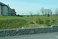
 Farm at Fihertagh - geograph.org.uk - 1820379.jpg 640 × 425; 157 KB
-
 Garret Ahearn constituency office.jpg 3,672 × 4,896; 5.75 MB
-
 Garrykennedy from pier.jpg 1,920 × 1,080; 734 KB
-
 Garrykennedy view of Lough Derg.jpg 1,920 × 1,080; 767 KB
-
 Glen of Aherlow - geograph.org.uk - 5927350.jpg 1,024 × 768; 104 KB
-
 GlenkeenCivilParishInNorthTipperary.jpg 550 × 532; 220 KB
-
 Hogan's Flying Column.gif 2,057 × 1,133; 809 KB
-
 It's a Long Way to Tipperary compass, Tipp town.jpg 2,448 × 3,264; 2.93 MB
-
 It's a long way to Tipperary! (29468662915).jpg 2,000 × 1,313; 1.54 MB
-
 Junction of roads near Dromomarka - geograph.org.uk - 5586724.jpg 4,000 × 3,000; 3.58 MB
-
 Junction of roads near Stonepark (Aherlow) - geograph.org.uk - 5586699.jpg 4,000 × 3,000; 4.11 MB
-
 L3102 - geograph.org.uk - 5914328.jpg 1,024 × 851; 255 KB
-
 L3102 - geograph.org.uk - 5914338.jpg 1,024 × 856; 154 KB
-
 Limerick Junction golf club - geograph.org.uk - 1820313.jpg 640 × 428; 168 KB
-
 Logo of Tipperary County Council.png 655 × 146; 76 KB
-
 Magnificent Millinery (7800418730).jpg 2,000 × 2,599; 1.25 MB
-
 Main Street, Carrick-on-Suir.jpg 4,032 × 3,024; 3.72 MB
-
 Main Street, Tiobraid Árann (Tipperary) - geograph.org.uk - 1296022.jpg 640 × 426; 193 KB
-
 Main Street, Tiobraid Árann (Tipperary) - geograph.org.uk - 1296133.jpg 428 × 640; 204 KB
-
 Main Street, Tiobraid Árann (Tipperary) - geograph.org.uk - 1296138.jpg 640 × 427; 195 KB
-
 Main Street, Tiobraid Árann (Tipperary) - geograph.org.uk - 1296145.jpg 640 × 428; 196 KB
-
 Main Street, Tiobraid Árann (Tipperary) - geograph.org.uk - 1296151.jpg 640 × 427; 170 KB
-
 Marl Bog, Dundrum Tipperary .jpg 4,032 × 3,024; 3.93 MB
-

-
 Mine rock crusher closeup.jpg 1,080 × 720; 736 KB
-
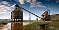 Mine rock crusher.jpg 1,565 × 800; 923 KB
-
 Miss W. Mandeville, 21 February 1920 (6915299403) (cropped).jpg 800 × 1,200; 228 KB
-
 Miss W. Mandeville, 21 February 1920 (6915299403).jpg 1,890 × 2,485; 1,012 KB
-
 Monastic Mechanic (6165643596).jpg 600 × 446; 65 KB
-
 Morrissey's Bar - geograph.org.uk - 1296075.jpg 640 × 427; 179 KB
-
 Mount Sion community residence - geograph.org.uk - 1296057.jpg 640 × 426; 184 KB
-
 Murgasty Road - geograph.org.uk - 1296062.jpg 640 × 427; 182 KB
-

-
 Noel Ryan's pub, Main Street, Tipperary Town - geograph.org.uk - 2544503.jpg 1,755 × 2,458; 970 KB
-
 OGorman Brothers Garage (8171949225).jpg 2,000 × 1,527; 1.41 MB
-
 Over the railway - geograph.org.uk - 1820332.jpg 640 × 427; 197 KB
-
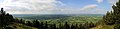 Panorama tipperary silvermines mountains.jpg 4,000 × 970; 1.17 MB
-
 Porter House, Tipperary Town.jpg 3,456 × 4,608; 3.36 MB
-
 Powers DIY - geograph.org.uk - 1296091.jpg 640 × 427; 166 KB
-
 R663 - geograph.org.uk - 5914321.jpg 1,019 × 829; 247 KB
-
 R663 - geograph.org.uk - 5917882.jpg 1,024 × 730; 133 KB
-
 R663 - geograph.org.uk - 5917915.jpg 992 × 1,024; 341 KB
-
 R663, Glen of Aherlow - geograph.org.uk - 5917896.jpg 1,024 × 881; 185 KB
-
 R663, Lisvernane - geograph.org.uk - 5917909.jpg 1,024 × 630; 130 KB
-
 R664 - geograph.org.uk - 5914313.jpg 854 × 1,024; 427 KB
-
 R664 - geograph.org.uk - 5917766.jpg 1,024 × 681; 152 KB
-
 Remembering the Moloney family - geograph.org.uk - 1296126.jpg 640 × 427; 239 KB
-
 Road (L31024) approaching Moneynaboola Upper - geograph.org.uk - 5586657.jpg 4,000 × 3,000; 3.86 MB
-
 Road (L31024) at Mackanagh Upper - geograph.org.uk - 5586694.jpg 4,000 × 3,000; 3.68 MB
-
 Road (L31024) between Moneynaboola Upper and Dungrud - geograph.org.uk - 5586650.jpg 4,000 × 3,000; 3.85 MB
-

-

-
 Road (L31024) near Moneynaboola - geograph.org.uk - 5586675.jpg 4,000 × 3,000; 4.57 MB
-
 Road (L4306) from Bansha joining the N74 - geograph.org.uk - 5577383.jpg 3,999 × 2,999; 1.98 MB
-

-
 Road (L8213) near Kilshane - geograph.org.uk - 5586798.jpg 4,000 × 3,000; 5 MB
-
 Road approaching Donaskeigh-Donaskeagh - geograph.org.uk - 5586842.jpg 4,000 × 3,000; 4.14 MB
-
 Road at Grantstown (Kilfeakle) - geograph.org.uk - 5586815.jpg 4,000 × 3,000; 2.99 MB
-
 Road at Grantstown (Kilfeakle) - geograph.org.uk - 5586817.jpg 4,000 × 3,000; 3.56 MB
-
 Road at Templenoe Cemetery - geograph.org.uk - 5586804.jpg 4,000 × 3,000; 3.98 MB
-
 Road between Ballinard (Donaskeigh) and Clonmaine - geograph.org.uk - 5586824.jpg 4,000 × 3,000; 3.17 MB
-
 Road between Clonmaine and Ballinard (Donaskeigh) - geograph.org.uk - 5586821.jpg 4,000 × 3,000; 3.82 MB
-
 Road between Comea and Drumclieve - geograph.org.uk - 5586806.jpg 4,000 × 3,000; 2.83 MB
-
 Road between Mountwilliam and Comea - geograph.org.uk - 5586810.jpg 4,000 × 3,000; 3.83 MB
-
 Road from Dromomarka to R663 - geograph.org.uk - 5586727.jpg 4,000 × 3,000; 3.17 MB
-
 Road junction at Ballinard (Doneskeigh) - geograph.org.uk - 5586827.jpg 4,000 × 3,000; 3.11 MB
-
 Road to Donaskeigh-Donaskeagh - geograph.org.uk - 5586831.jpg 4,000 × 3,000; 3.59 MB
-
 Road to Moneynaboola from R663 - geograph.org.uk - 5586667.jpg 4,000 × 3,000; 4.21 MB
-
 Road towards Donaskeigh-Donaskeagh - geograph.org.uk - 5586839.jpg 4,000 × 3,000; 4.36 MB
-
 ROCK OF CASHEL - Tipperary, Ireland - August 16, 2008 - panoramio - Giorgio Galeotti.jpg 2,133 × 2,900; 3.01 MB
-
 Rosanna Road - geograph.org.uk - 1296044.jpg 429 × 640; 185 KB
-
 Rossbog - geograph.org.uk - 5914335.jpg 1,024 × 844; 137 KB
-
 S. Hogan - Flying Column No. 2, 3rd Tipperary Brigade, IRA - 1921.JPG 570 × 341; 113 KB
-
 S. Michael's church - geograph.org.uk - 1296024.jpg 640 × 427; 174 KB
-
 Seamus Healy office, Tipp.jpg 2,448 × 3,264; 1.95 MB
-
 Sean Allen house, Tipp.jpg 3,264 × 2,448; 1.26 MB
-
 Sean Treacy Park, Tipperary town - ground for Arravale Rovers GAA.jpg 4,608 × 3,456; 7.49 MB
-
 St Sedna's Well - geograph.org.uk - 5917848.jpg 1,024 × 681; 329 KB
-
 St Sedna's Well - geograph.org.uk - 5917867.jpg 1,024 × 681; 310 KB
-
 St. Anne's Secondary School - geograph.org.uk - 1296053.jpg 640 × 426; 188 KB
-
 St. Mary's church - geograph.org.uk - 1296079.jpg 427 × 640; 187 KB
-
 St. Michael's church - geograph.org.uk - 1296026.jpg 428 × 640; 174 KB
-
 St. Michael's church - geograph.org.uk - 1296031.jpg 640 × 428; 174 KB
-
 St. Michael's church - geograph.org.uk - 1296033.jpg 426 × 640; 155 KB
-
 St. Michael's gardens - geograph.org.uk - 1296039.jpg 640 × 426; 153 KB
-

-
 St. Michael's Road - geograph.org.uk - 1296067.jpg 640 × 426; 187 KB
-
 Statue of Christ - geograph.org.uk - 5927347.jpg 768 × 1,024; 223 KB
-
 Strand Theatre Carrick.jpg 4,032 × 3,024; 3.27 MB
-
 The Coach Road - geograph.org.uk - 5914315.jpg 1,024 × 714; 93 KB
-
 The old church at Clonbeg - geograph.org.uk - 5917806.jpg 1,024 × 681; 242 KB
-
 The old church at Clonbeg - geograph.org.uk - 5917810.jpg 1,024 × 681; 265 KB
-

-
 Tipperary banner.jpg 4,000 × 571; 856 KB
-
 Tipperary Government Offices - geograph.org.uk - 1296071.jpg 640 × 426; 171 KB
-
 Tipperary Main Street.jpg 640 × 426; 190 KB
-
 Tipperary town arms.jpg 3,672 × 4,896; 6.95 MB
-
 TownlandsInBallymurreenCivilParishInTipperary2.jpg 500 × 858; 65 KB
-
 Track from road (L31024) into Glengarra Wood - geograph.org.uk - 5586710.jpg 4,000 × 3,000; 4.78 MB
-
 View from Devil's Bit.JPG 3,488 × 2,616; 1.97 MB
-
 View from public park outside Cahir Castle.jpg 3,000 × 4,000; 6.03 MB
-
 View from the Rock of Cashel - panoramio.jpg 2,304 × 1,728; 1.28 MB
-

-
-

-
 VR pillar box in Kilkenny, Ireland, painted green.gif 1,936 × 2,592; 3.14 MB
-
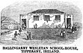
 Wesleyan Chapel, Thurles, Tipperary, Ireland (p.9, 1849) - Copy.jpg 896 × 652; 290 KB
.jpg)


.jpg)
.jpg)
_-_Copy.jpg)


.jpg)


.jpg)

_-_geograph.org.uk_-_5586699.jpg)


.jpg)

_-_geograph.org.uk_-_1296022.jpg)
_-_geograph.org.uk_-_1296133.jpg)
_-_geograph.org.uk_-_1296138.jpg)
_-_geograph.org.uk_-_1296145.jpg)
_-_geograph.org.uk_-_1296151.jpg)

_-_geograph.org.uk_-_1251573.jpg)


_(cropped).jpg)
.jpg)
.jpg)


_-_geograph.org.uk_-_1251593.jpg)

.jpg)


_approaching_Moneynaboola_Upper_-_geograph.org.uk_-_5586657.jpg)
_at_Mackanagh_Upper_-_geograph.org.uk_-_5586694.jpg)
_between_Moneynaboola_Upper_and_Dungrud_-_geograph.org.uk_-_5586650.jpg)
_between_Rossbog_(Bansha)_and_Gortnafurra_(Aherlow)_-_geograph.org.uk_-_5586706.jpg)
_between_Rossbog_(Bansha)_and_Rossbog_(Aherlow)_-_geograph.org.uk_-_5586717.jpg)
_near_Moneynaboola_-_geograph.org.uk_-_5586675.jpg)
_from_Bansha_joining_the_N74_-_geograph.org.uk_-_5577383.jpg)
_joining_the_N24_between_Fawnagowan_and_Knockanrawley_-_geograph.org.uk_-_5586794.jpg)
_near_Kilshane_-_geograph.org.uk_-_5586798.jpg)

_-_geograph.org.uk_-_5586815.jpg)
_-_geograph.org.uk_-_5586817.jpg)

_and_Clonmaine_-_geograph.org.uk_-_5586824.jpg)
_-_geograph.org.uk_-_5586821.jpg)


_-_geograph.org.uk_-_5586827.jpg)


_-_geograph.org.uk_-_1251580.jpg)


_schools_playing_fields_-_geograph.org.uk_-_1296029.jpg)


_into_Glengarra_Wood_-_geograph.org.uk_-_5586710.jpg)


_-_Copy.jpg)