Category:Tongue End
Jump to navigation
Jump to search
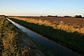
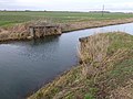
English: Tongue End is a small Lincolnshire village of Victorian redbrick farmworkers' cottages and early 20th century former council houses at . It is located alongside the Counter Drain Between Baston, Bourne, and Pode Hole, spread out along the road. It is large enough that it once had a village school (built in 1876), and small and remote enough to be known as a location of Treacle mines.
hamlet in Lincolnshire, England, UK  | |||||
| Upload media | |||||
| Instance of | |||||
|---|---|---|---|---|---|
| Location | Deeping St Nicholas, South Holland, Lincolnshire, East Midlands, England | ||||
 | |||||
Subcategories
This category has only the following subcategory.
C
Media in category "Tongue End"
The following 82 files are in this category, out of 82 total.
-
 A pink telephone box at Tongue End - geograph.org.uk - 3091093.jpg 800 × 600; 260 KB
-
 Black House Farm, Bourne South Fen, Lincs - geograph.org.uk - 453415.jpg 640 × 480; 307 KB
-
 Bridge over The River Glen at Tongue End - geograph.org.uk - 3837327.jpg 4,320 × 3,240; 5.49 MB
-
 Counter Drain - geograph.org.uk - 1565275.jpg 640 × 426; 58 KB
-
 Counter Drain - geograph.org.uk - 1565279.jpg 640 × 426; 51 KB
-
 Counter Drain - geograph.org.uk - 1565312.jpg 640 × 426; 61 KB
-
 Counter Drain - geograph.org.uk - 1565315.jpg 640 × 426; 57 KB
-
 Counter Drain - geograph.org.uk - 1565389.jpg 640 × 426; 70 KB
-
 Counter Drain - geograph.org.uk - 1565500.jpg 640 × 426; 64 KB
-
 Counter Drain at Tongue End - geograph.org.uk - 3091086.jpg 800 × 600; 227 KB
-
 Counter Drain at Tongue End - geograph.org.uk - 4104331.jpg 1,600 × 1,277; 445 KB
-
 Counter Drain at Tongue End - geograph.org.uk - 4106275.jpg 1,600 × 1,106; 337 KB
-
 Counter Drain at Tongue End - geograph.org.uk - 4106333.jpg 1,600 × 1,438; 455 KB
-
 Counter Drain Drove at Tongue End - geograph.org.uk - 4104324.jpg 1,600 × 1,286; 474 KB
-
 Counter Drain Drove at Tongue End - geograph.org.uk - 4106256.jpg 1,600 × 1,187; 525 KB
-
 Counter Drain Drove at Tongue End - geograph.org.uk - 4106313.jpg 1,600 × 1,467; 501 KB
-
 Counter Drain Drove at Tongue End - geograph.org.uk - 4106343.jpg 1,600 × 1,253; 464 KB
-
 Counter Drain Drove in Tongue End - geograph.org.uk - 4104354.jpg 1,600 × 1,200; 548 KB
-
 Counter Drain Drove near Tongue End - geograph.org.uk - 4097222.jpg 1,600 × 1,150; 374 KB
-
 Counter Drain Drove, Tongue End - geograph.org.uk - 2574123.jpg 800 × 600; 153 KB
-
 Counter Drain Drove, Tongue End - geograph.org.uk - 4409915.jpg 800 × 534; 73 KB
-
 Counter Drain heading towards Tongue End - geograph.org.uk - 4107569.jpg 1,600 × 1,200; 550 KB
-
 Crop field, Tongue End - geograph.org.uk - 3844410.jpg 640 × 480; 56 KB
-
 Derelict Tractor Next To Drain - geograph.org.uk - 649086.jpg 640 × 471; 86 KB
-
 Entering Tongue End - geograph.org.uk - 2574115.jpg 800 × 600; 224 KB
-
 Entering Tongue End - geograph.org.uk - 3091090.jpg 800 × 600; 206 KB
-
 Entering Tongue End along Counter Drain Drove - geograph.org.uk - 4411177.jpg 1,024 × 683; 143 KB
-
 Entrance to Tongue End - geograph.org.uk - 4985542.jpg 640 × 480; 42 KB
-
 Farm Track - geograph.org.uk - 649093.jpg 640 × 480; 72 KB
-
 Farmland on Deeping Fen - geograph.org.uk - 589807.jpg 640 × 427; 82 KB
-
 Farmland, Tongue End - geograph.org.uk - 3844419.jpg 640 × 480; 68 KB
-
 Fens in the evening - geograph.org.uk - 589796.jpg 640 × 427; 83 KB
-
 Houses at Tongue End - geograph.org.uk - 2574128.jpg 800 × 600; 204 KB
-
 Houses at Tongue End - geograph.org.uk - 4033177.jpg 1,600 × 1,096; 358 KB
-

-
 Ladder Stiles^ - geograph.org.uk - 437364.jpg 640 × 477; 94 KB
-
 North Drove, Deeping Fen - geograph.org.uk - 589839.jpg 640 × 427; 100 KB
-
 Oil seed rape crop at Tongue End - geograph.org.uk - 4104375.jpg 1,600 × 1,314; 484 KB
-
 On the bank of The River Glen near Tongue End - geograph.org.uk - 3857757.jpg 4,320 × 3,240; 5.44 MB
-

-
 Owl nesting boxes - geograph.org.uk - 302808.jpg 640 × 480; 101 KB
-
 Pepper Hill Farm, north of Tongue End - geograph.org.uk - 2574134.jpg 800 × 600; 205 KB
-
 Pumping stations, Bourne South Fen, Lincs - geograph.org.uk - 453312.jpg 640 × 480; 362 KB
-
 Remains of bridge over The Counter Drain, Tongue End - geograph.org.uk - 3835938.jpg 4,320 × 3,240; 5.93 MB
-
 River Glen from South Fen Bridge - geograph.org.uk - 437371.jpg 640 × 477; 62 KB
-

-
 Shillackers Farm near Tongue End - geograph.org.uk - 3880552.jpg 4,320 × 3,240; 5.17 MB
-
 The Counter Drain at Tongue End - geograph.org.uk - 3835942.jpg 4,320 × 3,240; 5.59 MB
-
 The Counter Drain at Tongue End, near Bourne, Lincolnshire - geograph.org.uk - 4324483.jpg 2,848 × 2,134; 1.43 MB
-
 The Counter Drain near Tongue End - geograph.org.uk - 3844141.jpg 640 × 480; 55 KB
-
 The Counter Drain, Tongue End - geograph.org.uk - 3844417.jpg 640 × 480; 56 KB
-
 The Master's House, Tongue End - geograph.org.uk - 4408625.jpg 3,776 × 2,520; 4.16 MB
-

-
 The River Glen near Tongue End - geograph.org.uk - 4033180.jpg 1,600 × 1,200; 633 KB
-
 Cow and Calf - geograph.org.uk - 437308.jpg 640 × 477; 97 KB
-
 Tongue End track Lincolnshire.jpg 640 × 474; 368 KB
-
 Tongue End, near Bourne, Lincolnshire - geograph.org.uk - 4340078.jpg 1,169 × 822; 389 KB
-
 Tongue End, western village sign - geograph.org.uk - 5274541.jpg 640 × 481; 49 KB
-
 Track to fenland near Tongue End - geograph.org.uk - 3835780.jpg 4,320 × 3,240; 5.82 MB
-
 Unrest in Tongue End - geograph.org.uk - 5088885.jpg 6,000 × 4,000; 7.25 MB
-
 A farmer ridging up potatoes - geograph.org.uk - 416557.jpg 640 × 480; 45 KB
-
 Boundary for the Avoidance of Doubt - geograph.org.uk - 437352.jpg 640 × 477; 74 KB
-

-
 Farm track across the Fen - geograph.org.uk - 589845.jpg 640 × 427; 75 KB
-

-
 Farmland off North Drove - geograph.org.uk - 589812.jpg 640 × 422; 94 KB
-
 Farmstead on Slipe Drove - geograph.org.uk - 436747.jpg 640 × 477; 86 KB
-
 Former rail route - geograph.org.uk - 472957.jpg 640 × 427; 88 KB
-
 Grays Farm - geograph.org.uk - 589846.jpg 640 × 427; 90 KB
-
 Hidden House - geograph.org.uk - 418609.jpg 640 × 480; 68 KB
-
 Lane to the Turbines - geograph.org.uk - 472969.jpg 640 × 427; 65 KB
-
 Leaving Pinchbeck West - geograph.org.uk - 436736.jpg 640 × 477; 90 KB
-
 More Rape Fields - geograph.org.uk - 437327.jpg 640 × 477; 92 KB
-
 Old Railway Bridge - geograph.org.uk - 436766.jpg 640 × 477; 81 KB
-
 On North Drove - geograph.org.uk - 589790.jpg 640 × 480; 75 KB
-
 Owl Houses - geograph.org.uk - 418614.jpg 640 × 480; 91 KB
-
 Remote River Glen - geograph.org.uk - 436749.jpg 640 × 477; 81 KB
-
 Remote River Glen - geograph.org.uk - 436763.jpg 640 × 477; 64 KB
-
 River Glen - geograph.org.uk - 436773.jpg 640 × 477; 77 KB
-
 Tongue End village - geograph.org.uk - 404217.jpg 640 × 480; 71 KB
-
 Variegated Thistle - geograph.org.uk - 437311.jpg 640 × 477; 171 KB
-
 Vast Lincolnshire Fields - geograph.org.uk - 437335.jpg 640 × 477; 71 KB


