Category:Topographic maps of Asia
Jump to navigation
Jump to search
Subcategories
This category has the following 10 subcategories, out of 10 total.
*
+
C
M
T
Media in category "Topographic maps of Asia"
The following 72 files are in this category, out of 72 total.
-
 179 of 'Eclectic Physical Geography' (11200812653).jpg 2,066 × 1,312; 727 KB
-

-

-
 Hypsographical Map of Asia.jpg 2,498 × 1,937; 461 KB
-
 American World War II Aeronautical Map of Eastern Asia.jpg 32,044 × 42,000; 215.8 MB
-
 20050516220851!Seidenstrasse GMT.jpg 2,000 × 964; 867 KB
-

-
 75 of '(Longmans' Junior School Geography, etc.)' (11212525966).jpg 2,704 × 2,001; 1.31 MB
-
 A physical map of Asia, from Cassel's Encyclopedia, 1899.jpg 3,201 × 2,534; 1.65 MB
-
 Advanced Geography (1899) (14758718926).jpg 3,312 × 2,830; 3.65 MB
-
 Advanced Geography (1899) (14781950715).jpg 2,270 × 1,892; 1.41 MB
-
 Asia vectorial map.jpg 2,607 × 1,796; 755 KB
-
 Asie physique - par P. Vidal Lablache... - btv1b525142358 (1 of 2).jpg 18,145 × 15,998; 59.3 MB
-
 Asie physique - par P. Vidal Lablache... - btv1b525142358 (2 of 2).jpg 18,204 × 16,036; 57.27 MB
-
 Asie physique. Relief du sol - cours d'eau par J. Forest... - btv1b531970550.jpg 15,730 × 12,155; 31.09 MB
-
 Asien 1844.jpg 5,475 × 4,481; 7.31 MB
-
 Asien. Flod- och bergssystem, Nordisk familjebok.jpg 3,089 × 2,461; 1.5 MB
-
 Bahrain Topography.png 1,069 × 1,486; 608 KB
-
 Brahmaputra system.png 1,047 × 501; 604 KB
-
 Chamagudao (no names).png 1,183 × 869; 1.77 MB
-
 Chamagudao.png 1,183 × 869; 1.74 MB
-
 DEMTibet annotated.png 3,145 × 1,763; 6.77 MB
-
 DEMTibet.png 3,145 × 1,763; 8.73 MB
-
 East Asia laea relief location map.jpg 337 × 599; 108 KB
-
 East Asia topographic map.png 2,876 × 2,094; 8.82 MB
-
 East China Sea.jpg 1,280 × 958; 275 KB
-
 French Indochina 1900-1945 relief location map.svg 703 × 1,013; 4.2 MB
-
 Geografia Fisica Asia.jpg 1,568 × 1,083; 201 KB
-
 Gnomonic Projection Japan.jpg 2,048 × 2,048; 1.06 MB
-

-
 Indo-Gangetic Plain.en.png 922 × 630; 458 KB
-
 Indo-Gangetic Plain.hu.png 922 × 630; 473 KB
-
 Indo-Gangetic Plain.png 922 × 630; 467 KB
-
 Korea topographic map.png 896 × 1,376; 1.18 MB
-
 Lange diercke sachsen asien hoechstes gebiet des himalaya.jpg 949 × 751; 460 KB
-
 Lange diercke sachsen asien japan.jpg 1,564 × 1,526; 1.22 MB
-
 Lange diercke sachsen asien peking.jpg 950 × 752; 451 KB
-
 Lange diercke sachsen asien tokio.jpg 950 × 752; 449 KB
-
 Lange diercke sachsen asien tsingtau.jpg 948 × 752; 449 KB
-
 Map of High Mountain Asia - 50091108786.png 1,535 × 958; 1.59 MB
-

-
 McMahon Line Simla Accord Treaty 1914 Map1.jpg 3,595 × 2,640; 2.46 MB
-
 Mediterranean Basin and Near East before 1000 AD topographic map.jpg 3,000 × 1,856; 2.23 MB
-
 Mediterranean Sea surface.jpg 1,274 × 628; 237 KB
-
 Metro Manila Elevation Map.png 1,000 × 1,584; 2.22 MB
-
 Natsudomari Peninsula.png 618 × 537; 356 KB
-

-
 Oro- und Hydrographische Karte von Asien Platt 1848.pdf 2,881 × 2,372; 661 KB
-
 Ph physical map blank.png 600 × 920; 94 KB
-
 Ph physical map small.png 300 × 456; 26 KB
-
 Ph physical map.png 600 × 940; 114 KB
-
 Puerta de Zungaria.png 1,709 × 1,088; 1.55 MB
-
 Red Sea topographic map-en.jpg 1,655 × 2,705; 1.63 MB
-
 Red Sea topographic map-fr.jpg 1,655 × 2,705; 1.69 MB
-
 Red Sea topographic map-ar.png 1,771 × 2,751; 4.59 MB
-
 Relief map of Eurasia.png 3,269 × 1,624; 4.91 MB
-
 Relief Map of Taihe.png 2,552 × 1,442; 5.91 MB
-
 Siam, Indochina and Malaya LOC 2014589786.jpg 3,088 × 4,116; 2.21 MB
-
 South asia cia map.jpg 421 × 541; 86 KB
-
 South Asia relief map blank.png 772 × 762; 1.05 MB
-
 Suyan rock1.svg 560 × 420; 12.34 MB
-
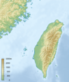 Taiwan relief location map.png 464 × 553; 217 KB
-
 TaiwanFromSRTM30.PNG 449 × 799; 113 KB
-
 Tea-Horse-Road.png 1,183 × 869; 1.73 MB
-
 Tee-Pferde-Straße.png 1,183 × 869; 1.73 MB
-
 Physical map of Tibet.png 833 × 490; 446 KB
-
 Topografic map of Tibetan Plateau.png 1,365 × 732; 663 KB
-

-

-
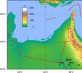 United Arab Emirates Topography.png 1,967 × 1,730; 2 MB
-
 Unterwasser-Quellen Mittelmeer Schwarzes-Meer und Anrainerstaaten.jpg 1,600 × 800; 1.28 MB
-
 Ачех.png 600 × 630; 290 KB
.jpg)
.jpg)
.jpg)


.jpg)
%27_(11212525966).jpg)

_(14758718926).jpg)
_(14781950715).jpg)

.jpg)
.jpg)


.png)


.jpg)


_(cropped).jpg)


_1.jpg)
_2.jpg)


