Category:Topographic maps of Slovakia
Jump to navigation
Jump to search
Subcategories
This category has only the following subcategory.
S
Media in category "Topographic maps of Slovakia"
The following 37 files are in this category, out of 37 total.
-
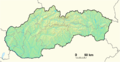
 Relief Map of Slovakia.png 1,000 × 493; 532 KB
-
 1 White Slovakia Location GeoMap.png 1,032 × 533; 670 KB
-
 1SGF-Kontrast.png 800 × 424; 564 KB
-
 1SGF.png 800 × 424; 547 KB
-
 1SGFskuska.png 800 × 424; 534 KB
-
 1SK-GGF.png 800 × 424; 557 KB
-
 1SK-KR-GFM.png 800 × 424; 580 KB
-
 1skuska-GGF.png 800 × 424; 580 KB
-
 1Slovakia Location GeoMap.png 1,032 × 533; 625 KB
-
 1TGF-Adaptivny.png 800 × 424; 589 KB
-
 1TGF-Ziadny.png 800 × 424; 602 KB
-
 Backsteingotik HU, HR, SK.png 537 × 441; 417 KB
-
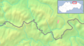 Beskid Sądecki SVK.png 648 × 361; 135 KB
-
 HR+HU+SK relief.png 957 × 778; 1.25 MB
-
 Mureș basin.png 600 × 300; 301 KB
-
 Preklado.png 250 × 129; 61 KB
-
 Sajó Basin.png 300 × 300; 166 KB
-
 La2-demis-slovakia.png 971 × 515; 223 KB
-
 Slovakia - NEW background map.png 800 × 424; 580 KB
-
 Slovakia - physical map.png 1,170 × 630; 2.12 MB
-
 Slovakia demis.png 2,340 × 1,259; 1.61 MB
-
 Slovakia location GEO map.png 1,032 × 533; 625 KB
-
 Slovakia location GEOmap.png 1,032 × 533; 632 KB
-
 Slovakia Location GeoMap.png 1,032 × 533; 675 KB
-
 Slovakia topo.jpg 1,400 × 962; 582 KB
-
 SlovakiaGEO location map.png 1,032 × 533; 681 KB
-
 Slovensko topo blank.jpg 1,400 × 962; 571 KB
-
 Slowakei topo.jpg 1,400 × 962; 583 KB
-
 Someș basin.png 400 × 300; 239 KB
-
 Tatry SVK.jpg 811 × 501; 48 KB
-
 Tisza Karte.png 838 × 821; 1.2 MB
-
 Topografické pomery v k.ú. Nová Bošáca.jpg 3,761 × 4,672; 2.44 MB
-
 Topografischer Hintergrund HU + SK.png 728 × 681; 768 KB
-
 Vienna Basin physical.png 926 × 1,066; 1.81 MB
-
 Vychodné Slovensko1.png 842 × 596; 496 KB
-
 Загорье.png 500 × 548; 439 KB
-
 Словакия-рельеф.png 853 × 499; 673 KB


