Category:Topographic maps of the United Kingdom
Jump to navigation
Jump to search

Subcategories
This category has the following 4 subcategories, out of 4 total.
Media in category "Topographic maps of the United Kingdom"
The following 29 files are in this category, out of 29 total.
-
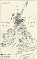 163 of 'The International Geography. ... Edited by H. R. Mill' (11288092744).jpg 800 × 1,234; 282 KB
-
-

-
 A short history of England and the British Empire (1915) (14580507139).jpg 3,104 × 2,148; 910 KB
-
 Central England relief map.png 1,086 × 824; 1.25 MB
-
 Crsel.png 451 × 415; 266 KB
-
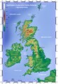
 Great Britain-United Kingdom Topographic Map.jpg 1,100 × 1,158; 1.22 MB
-
 Grossbritannien Topographie Staedte.jpeg 1,400 × 1,670; 595 KB
-
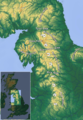
 Highlands location.png 647 × 766; 683 KB
-
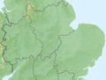
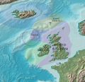
 Irish Sea – relief, ports, limits.tif 1,043 × 1,507; 4.5 MB
-
 IrishSeaReliefmap.png 1,043 × 1,507; 535 KB
-
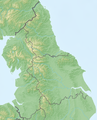 Northern England relief map.png 878 × 1,088; 1.26 MB
-
 Northern Scotland relief map.png 1,696 × 1,839; 2.12 MB
-
 Pennines location map.png 2,000 × 2,000; 5.66 MB
-
 Reliefkarte Vereinigtes Königreich.png 2,825 × 4,478; 7.79 MB
-
 Rockall EEZ.jpg 864 × 832; 97 KB
-
 Roman.Britain.northern.topo.with.walls.jpg 1,067 × 959; 291 KB
-
 Southern England relief map.png 1,736 × 889; 1.46 MB
-
 Southern Scotland and Northern Ireland relief map.png 1,324 × 1,010; 1.77 MB
-
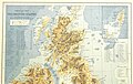
 The international geography (1916) (14593098617).jpg 1,280 × 2,004; 277 KB
-
 Topo Map Pennines.png 1,250 × 1,803; 3.2 MB
-
 Topographic Map of the UK - Blank.png 1,750 × 2,545; 3.63 MB
-
 Topographic Map of the UK - Bulgarian.png 1,750 × 2,545; 3.75 MB
-
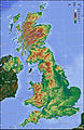
 Topographic Map of the UK - English.png 1,750 × 2,545; 3.8 MB
-
 Topographic Map of the UK - hr.pdf 1,210 × 1,752; 4.17 MB
-
 Topographic Map of the UK - Lithuanian.png 1,750 × 2,545; 3.74 MB
-
 Uk topo de.jpg 2,000 × 3,089; 1.65 MB
-
 Uk topo en.jpg 2,000 × 3,089; 1.65 MB
-
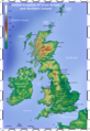
 United Kingdom relief location map.jpg 1,348 × 2,083; 831 KB
.jpg)
.jpg)
.jpg)
_(14580507139).jpg)


_(14593098617).jpg)


