Category:Udaipur district
Jump to navigation
Jump to search
district of Rajasthan, India .svg) | |||||
| Upload media | |||||
| Instance of | |||||
|---|---|---|---|---|---|
| Location | Udaipur division, Rajasthan, India | ||||
| Capital | |||||
| Population |
| ||||
| Area |
| ||||
| Elevation above sea level |
| ||||
| official website | |||||
 | |||||
Udaipur district (Sanskrit:उदैपुर दिस्त्रिच्त) is a unit of Republic of India.
Subcategories
This category has the following 6 subcategories, out of 6 total.
Media in category "Udaipur district"
The following 88 files are in this category, out of 88 total.
-
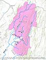
 Elevations in Kotra Tehsil.jpg 2,233 × 3,441; 1.34 MB
-
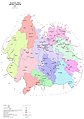
 Gogunda Tehsil Map from District Census Handbook 2011.jpg 1,108 × 1,571; 440 KB
-
 Kotra tehsil map Census 2011.jpg 1,035 × 1,497; 376 KB
-
 Map of Kherwara tehsil from Census of India 2011.jpg 4,534 × 6,553; 11.67 MB
-
 Map of Udaipur District, Rajasthan, India.jpg 544 × 568; 53 KB
-
 Primary Roads of Kotra Tehsil.jpg 1,785 × 2,625; 856 KB
-
 Rivers of Kotra tehsil, Udaipur district, Rajasthan, India.jpg 2,691 × 3,541; 1.41 MB
-
 Udaipur district map.jpg 2,129 × 3,025; 1.04 MB
-
 Udaipur in Rajasthan (India).svg 1,093 × 916; 1.02 MB
-
 Udaipur-stub.png 780 × 711; 39 KB
-
 Udaipur.png 1,231 × 896; 868 KB
-
 A mother (5580893303).jpg 2,770 × 1,950; 1.18 MB
-

-

-
 Bahubali Hills, Udaipur.jpg 1,868 × 1,080; 1.22 MB
-
 Barua River in Udaipur District.jpg 720 × 960; 1.13 MB
-
 Beasts of burden (5581481484).jpg 4,752 × 3,168; 3.22 MB
-
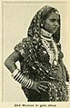 Bhil woman circa 1914.jpg 399 × 620; 59 KB
-
 Bhuri river, a tributary of Wakal River in Kotra tehsil, Udaipur district, Rajasthan.jpg 5,152 × 3,864; 5.88 MB
-
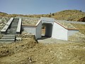 Box Culvert.jpg 4,160 × 3,120; 5.3 MB
-
 Feisty child (5580893659).jpg 3,168 × 4,752; 2.18 MB
-
 Gangaur Ghat 2.jpg 4,000 × 3,000; 5.36 MB
-
 Gangaur Ghat 3.jpg 4,000 × 3,000; 6.12 MB
-
 Gopal mp pic.jpg 1,071 × 1,472; 209 KB
-
 Govindgiri.jpg 1,953 × 3,130; 985 KB
-
 IMG-20200829-WA0109.jpg 576 × 1,280; 129 KB
-
 Inde Rajasthan (240983481).jpeg 1,366 × 2,048; 655 KB
-
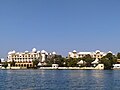
 Lake in Udaipur district.jpg 9,296 × 3,744; 20.84 MB
-
 Micknik.fs.jpg 3,264 × 1,952; 1.2 MB
-
 Nahar Niwas, Kanore Palace.pdf 1,650 × 1,275; 72 KB
-
 Pamri River near Kotra village, Udaipur, Rajasthan.jpg 1,024 × 683; 113 KB
-
 Pt. uday Jain.jpeg 480 × 480; 40 KB
-
 Rajasthani dancing (4571280795).jpg 1,898 × 2,848; 2.24 MB
-
 Rajasthani dancing (4571918844).jpg 681 × 1,024; 186 KB
-
 Rayastán, animales (2002) 04.jpg 689 × 1,012; 607 KB
-
 RJ MDR 20-Bijaipur-20131015.jpg 5,472 × 3,648; 8.89 MB
-
 Rock Garden - panoramio.jpg 800 × 559; 102 KB
-
 Rock Garden,Udaipur - panoramio.jpg 549 × 800; 82 KB
-
 Sabarmati Irrigation Project Embankment and Reservoir.jpg 4,128 × 3,096; 4.14 MB
-
 Sabarmati Irrigation Project Embankment.jpg 4,128 × 3,096; 6.14 MB
-
 Sabarmati Irrigation Project Information Board.jpg 4,128 × 3,096; 4.27 MB
-
 Sabarmati Irrigation Project Reservoir.jpg 4,128 × 3,096; 3.14 MB
-
 Sarang Vilas, Kanore Raj Mahal.pdf 1,650 × 1,275; 69 KB
-
 Slag retort.jpg 2,324 × 1,745; 1.65 MB
-
 SUN BURN THE EARTH BEAUTIFUL VIEW.jpg 4,160 × 3,120; 4.25 MB
-
 The journey.jpg 5,184 × 2,912; 2.93 MB
-
 The marrying kind (5581481752).jpg 2,557 × 3,642; 1.66 MB
-
 Towards Udaipurr.jpg 3,456 × 2,304; 1.73 MB
-
 Trumpeter accompanies Rajasthani dancing (4571917908).jpg 2,332 × 3,498; 3.09 MB
-
 Udaipur (distrito) 2002 01.jpg 1,067 × 710; 906 KB
-
 Udaipur (distrito) 2002 02.jpg 1,036 × 686; 1.12 MB
-
 Udaipur (distrito) 2002 03.jpg 1,013 × 665; 623 KB
-
 Udaipur (distrito) 2002 04.jpg 1,061 × 710; 853 KB
-
 Udaipur (distrito) 2002 05.jpg 1,029 × 701; 736 KB
-
 Udaipur (distrito) 2002 06.jpg 713 × 1,063; 685 KB
-
 Udaipur (distrito) 2002 07.jpg 713 × 1,069; 892 KB
-
 Udaipur (distrito) 2002 08.jpg 713 × 1,044; 778 KB
-
 Udaipur (distrito) 2002 09.jpg 708 × 1,042; 860 KB
-
 Udaipur (distrito) 2002 10.jpg 1,003 × 664; 898 KB
-
 Udaipur (distrito) 2002 11.jpg 1,010 × 699; 851 KB
-
 Udaipur (distrito) 2002 12.jpg 883 × 586; 789 KB
-
 Udaipur (distrito) 2002 13.jpg 1,013 × 687; 963 KB
-
 Udaipur (distrito) 2002 14.jpg 1,017 × 639; 732 KB
-
 Udaipur (distrito) 2002 15.jpg 710 × 1,077; 676 KB
-
 Udaipur (distrito) 2002 16.jpg 1,034 × 670; 928 KB
-
 Udaipur (distrito) 2002 17.jpg 1,037 × 672; 976 KB
-
 Udaipur (distrito) 2002 18.jpg 719 × 1,065; 796 KB
-
 Udaipur (distrito) 2002 19.jpg 663 × 1,029; 874 KB
-
 Udaipur (distrito) 2002 20.jpg 623 × 944; 799 KB
-
 Udaipur (distrito) 2002 21.jpg 1,048 × 680; 948 KB
-
 Udaipur (distrito) 2002 22.jpg 1,038 × 692; 729 KB
-
 Udaipur (distrito) 2002 23.jpg 1,047 × 713; 1,022 KB
-
 Udaipur (distrito) 2002 24.jpg 995 × 674; 792 KB
-
 Udaipur (distrito) 2002 25.jpg 1,071 × 713; 678 KB
-
 Udaipur (distrito) 2002 26.jpg 1,025 × 675; 839 KB
-
 Udaipur (distrito) 2002 27.jpg 1,016 × 634; 664 KB
-
 Udaipur (distrito) 2002 28.jpg 1,074 × 707; 1 MB
-
 Udaipur (distrito) 2002 29.jpg 1,065 × 681; 989 KB
-
 Udaipur (distrito) 2002 30.jpg 1,038 × 672; 909 KB
-
 Udaipur (distrito) 2002 31.jpg 719 × 1,071; 754 KB
-
 Upre.jpg 2,797 × 2,797; 1.27 MB
-
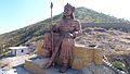 Veer Shiromani Maharana Pratap .jpg 4,000 × 2,250; 3.33 MB
-
 View from Ratan Palace Guest House,Udaipur - panoramio.jpg 800 × 554; 69 KB
-
 View from Rock Garden - panoramio.jpg 800 × 545; 108 KB
-
 Wakal River in Wali village, Kotra tehsil, Udaipur district of Rajasthan, India.jpg 5,152 × 3,864; 5.12 MB
-
 Озёрный дворец.jpg 4,000 × 3,000; 4.49 MB
-
 Удайпур 2.jpg 3,000 × 4,000; 6.01 MB
-
 Удайпур 3.jpg 4,000 × 3,000; 4.86 MB


.jpg)


.jpg)


.jpg)


.jpeg)


.jpg)
.jpg)
_04.jpg)


.jpg)

.jpg)
_2002_01.jpg)
_2002_02.jpg)
_2002_03.jpg)
_2002_04.jpg)
_2002_05.jpg)
_2002_06.jpg)
_2002_07.jpg)
_2002_08.jpg)
_2002_09.jpg)
_2002_10.jpg)
_2002_11.jpg)
_2002_12.jpg)
_2002_13.jpg)
_2002_14.jpg)
_2002_15.jpg)
_2002_16.jpg)
_2002_17.jpg)
_2002_18.jpg)
_2002_19.jpg)
_2002_20.jpg)
_2002_21.jpg)
_2002_22.jpg)
_2002_23.jpg)
_2002_24.jpg)
_2002_25.jpg)
_2002_26.jpg)
_2002_27.jpg)
_2002_28.jpg)
_2002_29.jpg)
_2002_30.jpg)
_2002_31.jpg)


