Category:Uffington, Shropshire
Jump to navigation
Jump to search
village in Shropshire, England, UK  | |||||
| Upload media | |||||
| Instance of | |||||
|---|---|---|---|---|---|
| Location | Shropshire, West Midlands, England | ||||
| Located in or next to body of water | |||||
 | |||||
Subcategories
This category has the following 2 subcategories, out of 2 total.
H
T
Media in category "Uffington, Shropshire"
The following 185 files are in this category, out of 185 total.
-
 A49 Crossing The River Severn - geograph.org.uk - 2906734.jpg 640 × 480; 58 KB
-
 A49 Near Shrewsbury - geograph.org.uk - 5156186.jpg 640 × 462; 48 KB
-
 A49 northbound near Pimley Manor - geograph.org.uk - 2959868.jpg 640 × 480; 40 KB
-

-

-
 A49 Shrewsbury bypass - geograph.org.uk - 2944944.jpg 2,048 × 1,536; 1.29 MB
-
 A49 Shrewsbury bypass - southern Severn crossing - geograph.org.uk - 2944947.jpg 2,048 × 1,536; 1.2 MB
-
 Abbey Wood - geograph.org.uk - 2422786.jpg 800 × 600; 214 KB
-
 Abbey Wood parking - geograph.org.uk - 2124517.jpg 1,024 × 683; 196 KB
-
 Across the river to Haughmond Hill - geograph.org.uk - 4689454.jpg 1,142 × 857; 340 KB
-
 Across the Severn - geograph.org.uk - 4691609.jpg 1,142 × 857; 398 KB
-
 Ancient oak near Colins Rough - geograph.org.uk - 3954351.jpg 1,142 × 857; 307 KB
-

-
 Arable farmland near Ebury Hill - geograph.org.uk - 5944953.jpg 1,024 × 768; 167 KB
-
 B 5062 View - geograph.org.uk - 2422802.jpg 800 × 600; 165 KB
-
 Back towards Wheatley - geograph.org.uk - 3954092.jpg 1,142 × 857; 343 KB
-
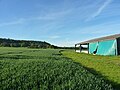 Barn in a field of wheat - geograph.org.uk - 6184516.jpg 1,306 × 979; 465 KB
-
 Bridleway near Colins Rough - geograph.org.uk - 3954104.jpg 1,142 × 857; 457 KB
-
 Bridleway past Wheatley Farm - geograph.org.uk - 3953684.jpg 1,142 × 857; 332 KB
-
 Bridleway south of Wheatley - geograph.org.uk - 3953676.jpg 1,044 × 783; 458 KB
-
 Bridleway to Wheatley - geograph.org.uk - 3953670.jpg 1,110 × 832; 449 KB
-
 Bridleway to Wheatley - geograph.org.uk - 3954100.jpg 857 × 1,142; 421 KB
-
 Bungalow in grounds of Haughmond Abbey - geograph.org.uk - 6458220.jpg 1,024 × 680; 265 KB
-
 Campsite Gate - geograph.org.uk - 2423027.jpg 800 × 600; 119 KB
-
 Canal Bridge View - geograph.org.uk - 2422722.jpg 800 × 600; 214 KB
-
 Canal Cottage view - geograph.org.uk - 2425002.jpg 800 × 600; 140 KB
-
 Canal View North - geograph.org.uk - 2422736.jpg 800 × 600; 244 KB
-
 Canal View South - geograph.org.uk - 2422728.jpg 800 × 600; 149 KB
-
 Caravan Site, Ebury - geograph.org.uk - 2124556.jpg 1,024 × 683; 200 KB
-
 Cereal field near Coppice Farm - geograph.org.uk - 5944961.jpg 1,024 × 768; 239 KB
-
 Church and churchyard - geograph.org.uk - 6490265.jpg 3,888 × 5,184; 5.45 MB
-
 Church Road - geograph.org.uk - 2424997.jpg 800 × 600; 169 KB
-
 Church Road looking north, Uffington, Shropshire - geograph.org.uk - 3765408.jpg 1,024 × 756; 164 KB
-
 Church Road, Uffington, Shropshire - geograph.org.uk - 3765401.jpg 1,024 × 756; 177 KB
-
 Colins Rough - geograph.org.uk - 2423125.jpg 800 × 600; 107 KB
-
 Corbet Arms Bowling - geograph.org.uk - 2425066.jpg 800 × 600; 139 KB
-
 Corbet Arms View - geograph.org.uk - 2422082.jpg 600 × 800; 161 KB
-
 Corbet Arms, Uffington - geograph.org.uk - 159464.jpg 640 × 480; 71 KB
-
 Country road approaching Ebury Hill - geograph.org.uk - 5944957.jpg 1,024 × 768; 228 KB
-
 Course of the Shrewsbury Canal - geograph.org.uk - 1504932.jpg 480 × 640; 364 KB
-
 Cracked concrete farm track - geograph.org.uk - 3953012.jpg 857 × 1,142; 380 KB
-
 Dell Farm View - geograph.org.uk - 2427749.jpg 800 × 600; 101 KB
-
 Dried duckpond at Haughmond Farm - geograph.org.uk - 3954364.jpg 979 × 734; 432 KB
-
 Duckpond and buildings at Sundorne Farm - geograph.org.uk - 3953013.jpg 1,142 × 857; 452 KB
-
 Ebury Camp View - geograph.org.uk - 2423063.jpg 800 × 600; 215 KB
-
 Ebury Hill Fort - geograph.org.uk - 2124553.jpg 683 × 1,024; 328 KB
-
 Ebury Hill View - geograph.org.uk - 2423137.jpg 800 × 600; 146 KB
-
 Edge of field - geograph.org.uk - 6490261.jpg 5,184 × 3,888; 5.68 MB
-
 Enclosed Path - geograph.org.uk - 2422903.jpg 800 × 600; 149 KB
-
 Farmland by the River Severn - geograph.org.uk - 4411580.jpg 640 × 426; 45 KB
-
 Field drain feeding into Sundorne Pool - geograph.org.uk - 3953011.jpg 1,044 × 783; 391 KB
-
 Field edge - geograph.org.uk - 6490301.jpg 5,184 × 3,888; 5.41 MB
-
 Field Edge Path - geograph.org.uk - 2423163.jpg 800 × 600; 146 KB
-
 Field Path View - geograph.org.uk - 2427684.jpg 800 × 600; 130 KB
-
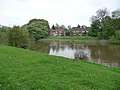
 Field Pool - geograph.org.uk - 2423200.jpg 800 × 600; 122 KB
-
 Field View - geograph.org.uk - 2423207.jpg 800 × 600; 100 KB
-
 Fish pond at Haughmond Abbey - geograph.org.uk - 2124533.jpg 1,024 × 683; 286 KB
-
 Footpath Gate - geograph.org.uk - 2423112.jpg 800 × 600; 223 KB
-
 Footpath heading for Uffington village - geograph.org.uk - 6184513.jpg 3,264 × 2,448; 2.08 MB
-
 Footpath just south of Sundorne - geograph.org.uk - 6184508.jpg 1,306 × 979; 593 KB
-
 Footpath near Haughmond Abbey - geograph.org.uk - 3952744.jpg 857 × 1,142; 354 KB
-
 Footpath to Uffington - geograph.org.uk - 2124548.jpg 1,024 × 683; 240 KB
-
 Fork in the Track - geograph.org.uk - 2124541.jpg 1,024 × 683; 252 KB
-
 Fresh coots cooking - geograph.org.uk - 3953034.jpg 1,142 × 857; 458 KB
-
 Gas Pipe Marker - geograph.org.uk - 2422918.jpg 480 × 640; 111 KB
-
 Gordon's Row - geograph.org.uk - 2423043.jpg 800 × 600; 186 KB
-
 Haughmond - geograph.org.uk - 4355818.jpg 800 × 600; 482 KB
-
 Haughmond Abbey - geograph.org.uk - 5923345.jpg 5,184 × 3,888; 4.71 MB
-
 Haughmond Abbey - geograph.org.uk - 6178927.jpg 800 × 600; 617 KB
-
 Haughmond Abbey - geograph.org.uk - 6382929.jpg 1,024 × 768; 316 KB
-
 Haughmond Abbey - geograph.org.uk - 6382931.jpg 1,024 × 680; 209 KB
-
 Haughmond Abbey - geograph.org.uk - 6458195.jpg 1,024 × 768; 289 KB
-
 Haughmond Abbey - geograph.org.uk - 6458200.jpg 1,024 × 680; 246 KB
-
 Haughmond Abbey - geograph.org.uk - 6458201.jpg 1,024 × 680; 205 KB
-
 Haughmond Abbey - geograph.org.uk - 6493774.jpg 1,799 × 1,199; 523 KB
-
 Haughmond Abbey - geograph.org.uk - 6493776.jpg 1,800 × 1,200; 219 KB
-
 Haughmond Abbey from the east - geograph.org.uk - 3952733.jpg 979 × 734; 328 KB
-
 Haughmond Abbey Remains - geograph.org.uk - 6178925.jpg 800 × 600; 768 KB
-
 Haughmond Abbey ruins - geograph.org.uk - 4070179.jpg 1,600 × 1,066; 314 KB
-

-
 Haughmond Abbey, Chapter House Carvings - geograph.org.uk - 6178934.jpg 800 × 600; 609 KB
-
 Haughmond Abbey, Remains of the Abbot's house and refectory - geograph.org.uk - 6174087.jpg 7,221 × 4,814; 7.66 MB
-
 Haughmond Abbey, West Wall - geograph.org.uk - 6178929.jpg 800 × 600; 654 KB
-
 Haughmond Hill Shrewsbury - geograph.org.uk - 2888670.jpg 4,288 × 3,216; 4.16 MB
-
 Haughmond Hill Shrewsbury - geograph.org.uk - 2888699.jpg 4,288 × 3,216; 6.65 MB
-

-
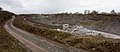 Haughmond Quarry - geograph.org.uk - 2233217.jpg 2,000 × 875; 611 KB
-
 Haughton Lone Tree - geograph.org.uk - 2423121.jpg 800 × 600; 142 KB
-
 Hay Stack - geograph.org.uk - 2423186.jpg 800 × 600; 116 KB
-
 High Stile - geograph.org.uk - 2422892.jpg 800 × 600; 233 KB
-
 Hill Fort View - geograph.org.uk - 2423075.jpg 800 × 600; 216 KB
-
 Hill View - geograph.org.uk - 2427739.jpg 800 × 600; 97 KB
-
 Hillside Farm - geograph.org.uk - 2422876.jpg 800 × 600; 136 KB
-
 Houghmond Hill - geograph.org.uk - 2427679.jpg 800 × 600; 229 KB
-
-
 Left for the NCR 81 to Shrewsbury - geograph.org.uk - 1036657.jpg 640 × 480; 122 KB
-
 Making use of the flood - geograph.org.uk - 1588970.jpg 640 × 429; 88 KB
-
 Near Downton Hall - geograph.org.uk - 67763.jpg 640 × 480; 153 KB
-
 Newport Road View - geograph.org.uk - 2425122.jpg 800 × 600; 145 KB
-
 No access or right of way - geograph.org.uk - 3953667.jpg 1,142 × 857; 317 KB
-
 No sign of the footpath - geograph.org.uk - 6490284.jpg 5,184 × 3,888; 5.53 MB
-
 Old Village Pump - geograph.org.uk - 2362092.jpg 732 × 2,036; 296 KB
-
 Old Water Mill - geograph.org.uk - 1504982.jpg 640 × 480; 268 KB
-
 On the track to Sunderton - geograph.org.uk - 3953015.jpg 1,142 × 857; 408 KB
-
 One of Shrewsbury Canal's remaining bridges - geograph.org.uk - 2888682.jpg 4,288 × 3,216; 3.85 MB
-
 OS benchmark - Sunderton, farm building - geograph.org.uk - 3953652.jpg 857 × 1,142; 614 KB
-

-
 Path Bench - geograph.org.uk - 2423092.jpg 800 × 600; 169 KB
-
 Path Junction - geograph.org.uk - 2233252.jpg 640 × 427; 93 KB
-
 Path through Abbey Wood - geograph.org.uk - 3952738.jpg 857 × 1,142; 461 KB
-
 Path to Stile - geograph.org.uk - 2423239.jpg 800 × 600; 136 KB
-
 Pond north of Hillside Farm - geograph.org.uk - 3952750.jpg 1,044 × 783; 354 KB
-
 Pond north of The Meadows Farm - geograph.org.uk - 3952759.jpg 1,044 × 783; 340 KB
-
 Pool with Stile - geograph.org.uk - 2423233.jpg 800 × 600; 179 KB
-
 Private Lane - geograph.org.uk - 2423181.jpg 800 × 600; 167 KB
-

-

-

-

-
 Railway Bridge over the A49 - geograph.org.uk - 3149241.jpg 640 × 430; 43 KB
-
 Railway Bridge over the A49 - geograph.org.uk - 6178867.jpg 800 × 600; 655 KB
-
 Remains of an 18th Century Folly known as Haughmond Castle (geograph 7390201).jpg 1,600 × 1,200; 1.02 MB
-
 River Severn between Monkmoor and Uffington - geograph.org.uk - 4691862.jpg 1,142 × 857; 369 KB
-
 River Severn View - geograph.org.uk - 2425052.jpg 800 × 600; 181 KB
-
 Severn valley east of Shrewsbury - geograph.org.uk - 5017794.jpg 1,600 × 1,064; 233 KB
-
 Sheep grazing west of Sunderton - geograph.org.uk - 3953019.jpg 979 × 734; 292 KB
-
 Shelterbelt south of Sunderton - geograph.org.uk - 3953018.jpg 1,044 × 783; 428 KB
-
 Shrewsbury Canal - geograph.org.uk - 1504875.jpg 480 × 640; 329 KB
-
 Shrewsbury Canal - geograph.org.uk - 1504913.jpg 480 × 640; 300 KB
-
 Shrewsbury Club - geograph.org.uk - 2425082.jpg 800 × 600; 95 KB
-
 Shrewsbury Rugby Club ground - geograph.org.uk - 6184505.jpg 1,306 × 979; 366 KB
-
 Shropshire Way - geograph.org.uk - 2423129.jpg 800 × 600; 185 KB
-
 Shropshire Way Dog-leg - geograph.org.uk - 2124529.jpg 1,024 × 683; 136 KB
-
 Shropshire Way Gate - geograph.org.uk - 2423148.jpg 800 × 600; 164 KB
-

-
 Shropshire Way View - geograph.org.uk - 2422764.jpg 600 × 800; 266 KB
-
 Site of Haughmond Castle - geograph.org.uk - 2233197.jpg 1,000 × 667; 429 KB
-
 Southern Rampart of Ebury Hill Hillfort (geograph 7390325).jpg 1,600 × 900; 812 KB
-
 Specimen oak near New Coppice - geograph.org.uk - 3954356.jpg 1,142 × 857; 369 KB
-
 Sports Path - geograph.org.uk - 2425099.jpg 600 × 800; 227 KB
-
 Stile Bridge - geograph.org.uk - 2423193.jpg 800 × 600; 219 KB
-
 Stone 'Housie' near Haughmond - geograph.org.uk - 2124524.jpg 683 × 1,024; 287 KB
-
 Stone 'Housie' near Haughmond - geograph.org.uk - 2124567.jpg 683 × 1,024; 288 KB
-
 Stone-working plant in Haughmond Quarry - geograph.org.uk - 3916574.jpg 1,142 × 857; 316 KB
-
 Straight Track to Haughmond Farm - geograph.org.uk - 2124561.jpg 1,024 × 683; 260 KB
-
 Stream Stile - geograph.org.uk - 2423252.jpg 800 × 600; 190 KB
-
 Sunderton Cattle Grid - geograph.org.uk - 2424765.jpg 800 × 600; 130 KB
-
 Sunderton Farm - geograph.org.uk - 3953029.jpg 1,044 × 783; 341 KB
-
 Sunderton Farm View - geograph.org.uk - 2423173.jpg 800 × 600; 161 KB
-
 Sunderton Pool - geograph.org.uk - 3953026.jpg 1,044 × 783; 441 KB
-
 Sundorne Castle gatehouse - geograph.org.uk - 6490290.jpg 3,888 × 5,184; 4.1 MB
-
 Sundorne Farm Track - geograph.org.uk - 2424756.jpg 800 × 600; 87 KB
-
 Sundorne Walled Garden - geograph.org.uk - 2424745.jpg 800 × 600; 217 KB
-

-
 The A49, East of Shrewsbury - geograph.org.uk - 6178870.jpg 800 × 600; 640 KB
-
 The Chapter House, Haughmond Abbey - geograph.org.uk - 6178928.jpg 800 × 533; 713 KB
-

-

-
 The Corbet Arms - geograph.org.uk - 2422069.jpg 800 × 600; 182 KB
-
 The Hollies - geograph.org.uk - 2422778.jpg 800 × 600; 201 KB
-
 The Hollies Way - geograph.org.uk - 2422751.jpg 600 × 800; 253 KB
-
 The last houses in Uffington - geograph.org.uk - 6490274.jpg 4,819 × 3,600; 3.19 MB
-
 The Shropshire Way - geograph.org.uk - 2422755.jpg 800 × 600; 241 KB
-
 The Shropshire Way - geograph.org.uk - 3954361.jpg 734 × 979; 447 KB
-
 The western edge of Haughmond Hill - geograph.org.uk - 2281536.jpg 864 × 1,152; 332 KB
-
 Track to The Meadows farm - geograph.org.uk - 6184519.jpg 1,306 × 979; 586 KB
-
 Tractor Showroom - geograph.org.uk - 2425113.jpg 800 × 600; 134 KB
-
 Tree Lined Banks of the River Severn - geograph.org.uk - 2002420.jpg 3,168 × 4,224; 5.61 MB
-

-
 Uffington No. 2 - geograph.org.uk - 2233241.jpg 640 × 427; 130 KB
-
 Uffington Scene - geograph.org.uk - 2425008.jpg 800 × 600; 108 KB
-
 Uffington Wharf - Shrewsbury Canal - geograph.org.uk - 1504960.jpg 640 × 480; 218 KB
-
 Uffington01.JPG 1,600 × 1,200; 433 KB
-
 Uffington02.JPG 1,600 × 1,200; 407 KB
-
 UffingtonShropshire.JPG 2,592 × 1,067; 1.12 MB
-
 Uphill on the Shropshire Way - geograph.org.uk - 2422769.jpg 600 × 800; 249 KB
-

-
 View to New Coppice - geograph.org.uk - 2423218.jpg 800 × 600; 100 KB
-
 Village Hall, Uffington.jpg 800 × 600; 161 KB
-
 Way Marker - geograph.org.uk - 2422745.jpg 800 × 600; 260 KB
-
 Way View - geograph.org.uk - 2422924.jpg 800 × 600; 127 KB
-
 Wet kissing gate - geograph.org.uk - 1589027.jpg 640 × 396; 88 KB
-
 Wheatle Farm Track - geograph.org.uk - 2423155.jpg 800 × 600; 151 KB
-
 Woodland Edge - geograph.org.uk - 2423099.jpg 800 × 600; 156 KB
-
 Woodland Path - geograph.org.uk - 2422740.jpg 800 × 600; 256 KB


_-_geograph.org.uk_-_2670399.jpg)


.jpg)


.jpg)


,_Church_Road,_Uffington,_Shropshire_-_geograph.org.uk_-_3765368.jpg)
_-_sign,_Church_Road,_Uffington,_Shropshire_-_geograph.org.uk_-_3765388.jpg)


