Category:United Kingdom photographs taken on 2009-05-09
Jump to navigation
Jump to search
Countries of Europe: Austria · Belarus · Belgium · Bosnia and Herzegovina · Cyprus‡ · Czech Republic · Denmark · Finland · France‡ · Germany · Greece · Hungary · Iceland · Republic of Ireland · Italy · Latvia · Malta · Montenegro · Netherlands‡ · Norway · Poland · Portugal‡ · Romania · Russia‡ · Serbia · Slovakia · Spain‡ · Sweden · Switzerland · Turkey‡ · Ukraine · United Kingdom
Limited recognition: Kosovo
‡: partly located in Europe
Limited recognition: Kosovo
‡: partly located in Europe
| ← | 9 May 2009 | → | ||
| ← | May 2009 | → | ||

United Kingdom photographs taken on 9 May 2009.
Image files should be categorized here automatically using {{taken on}} template. Direct categorisation is also possible, if automatic is impossible.
Subcategories
This category has the following 2 subcategories, out of 2 total.
L
Media in category "United Kingdom photographs taken on 2009-05-09"
The following 200 files are in this category, out of 1,465 total.
(previous page) (next page)-
 "Gorron Hayling" - geograph.org.uk - 1298098.jpg 640 × 480; 63 KB
-

-
 (0391) Glyphipterix simpliciella (3514723511).jpg 841 × 674; 69 KB
-
 (1136) Epinotia immundana (3514724513).jpg 1,500 × 1,004; 1.53 MB
-
 (1286) Dichrorampha sedatana (3515534578).jpg 1,500 × 1,004; 1.25 MB
-
 (1728) Garden Carpet (Xanthorhoe fluctuata) (3514722703).jpg 1,500 × 1,004; 1.2 MB
-
 (1738) Common Carpet (Epirrhoe alternata) (3514720163).jpg 1,500 × 1,004; 1.29 MB
-
 (2450) The Spectacle (Abrostola tripartita) (3520073830).jpg 1,500 × 1,004; 1.35 MB
-
 , Bromsgrove cottage of 15 century - panoramio.jpg 2,816 × 2,112; 2.8 MB
-
 14 Park Lane - geograph.org.uk - 1306995.jpg 640 × 432; 104 KB
-

-
 A 'side street' in Lealholm - geograph.org.uk - 1598510.jpg 640 × 480; 92 KB
-
 A blustery day in mid May - geograph.org.uk - 1295065.jpg 640 × 480; 65 KB
-
 A bomb in the church at Clyst St George - geograph.org.uk - 1309389.jpg 640 × 480; 144 KB
-
 A carpet of bluebells - geograph.org.uk - 1294527.jpg 640 × 480; 153 KB
-
 A dip in the ground - geograph.org.uk - 1294950.jpg 630 × 581; 97 KB
-
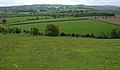
 A farm surrounded by fields - geograph.org.uk - 1295121.jpg 640 × 480; 69 KB
-
 A farm track on Boon Hill - geograph.org.uk - 1295694.jpg 427 × 640; 132 KB
-
 A feeding station at Boon - geograph.org.uk - 1295686.jpg 640 × 427; 139 KB
-

-

-
 A fine view from Deffer Woods - geograph.org.uk - 1295273.jpg 640 × 372; 62 KB
-

-
 A pair of Conifers - geograph.org.uk - 1298470.jpg 640 × 480; 55 KB
-
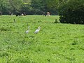 A pair of Herons - geograph.org.uk - 1298766.jpg 640 × 480; 91 KB
-
 A path through the forest - geograph.org.uk - 1337066.jpg 640 × 480; 104 KB
-
 A rural lane - Wolterton Road - geograph.org.uk - 1295155.jpg 640 × 502; 72 KB
-
 A sheltered area for cattle - geograph.org.uk - 1294969.jpg 640 × 480; 144 KB
-
 Abandoned chapel. Belstead - geograph.org.uk - 1294539.jpg 640 × 480; 81 KB
-
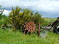 Abandoned farm machinery, Wester Arboll. - geograph.org.uk - 1294951.jpg 640 × 480; 170 KB
-
 Abandoned Water Feature Penshurst Place - geograph.org.uk - 1295890.jpg 640 × 480; 121 KB
-
 Above Balnahard Wood - geograph.org.uk - 1305735.jpg 640 × 428; 205 KB
-
 Above Llwyngwril - geograph.org.uk - 1310688.jpg 640 × 480; 98 KB
-
 Access road to Dairy Farm - geograph.org.uk - 1295117.jpg 640 × 480; 72 KB
-
 Access road, Spire Hospital - geograph.org.uk - 1295574.jpg 640 × 427; 88 KB
-
 Across Mill Clough - geograph.org.uk - 1295315.jpg 640 × 480; 152 KB
-
 Afon Conwy - geograph.org.uk - 1295648.jpg 640 × 480; 78 KB
-
 Afon Conwy with reeds - geograph.org.uk - 1295662.jpg 640 × 480; 95 KB
-
 Afon Gwy - River Wye - geograph.org.uk - 1298727.jpg 640 × 480; 158 KB
-
 Afon Gwy - River Wye - geograph.org.uk - 1302038.jpg 640 × 480; 96 KB
-
 Agricultural storage barns - geograph.org.uk - 1294474.jpg 640 × 480; 52 KB
-
 Ailt a' Chamabhreac - geograph.org.uk - 1386052.jpg 640 × 427; 71 KB
-
 Aish Bridge - geograph.org.uk - 1296206.jpg 640 × 480; 125 KB
-

-
 Albert Street Whitstable - geograph.org.uk - 1295813.jpg 640 × 480; 72 KB
-
 Alexandra Mill Uppermill - geograph.org.uk - 1296452.jpg 640 × 480; 121 KB
-
 Alexandra Park - geograph.org.uk - 1294328.jpg 640 × 427; 68 KB
-
 All Saints Church Kirby Underdale 1.jpg 640 × 480; 73 KB
-
 All Saints Church Kirby Underdale 2.jpg 480 × 640; 109 KB
-
 All Saints Church Kirby Underdale Churchyard.jpg 640 × 480; 104 KB
-
 All Saints Church Kirby Underdale Interior.jpg 480 × 640; 59 KB
-
 All Saints Church Kirby Underdale Tower.jpg 480 × 640; 90 KB
-
 All Souls, Langham Place - geograph.org.uk - 1298538.jpg 480 × 640; 51 KB
-
 Alleyway off Clapton Passage - geograph.org.uk - 1295859.jpg 640 × 480; 115 KB
-
 Allt an Uisge Mhaith - geograph.org.uk - 1301936.jpg 640 × 480; 112 KB
-
 Allt Ban - geograph.org.uk - 1576706.jpg 480 × 640; 92 KB
-
 Allt Cadnant Hill - geograph.org.uk - 1294510.jpg 640 × 480; 76 KB
-
 Allt Laogain - geograph.org.uk - 1301898.jpg 640 × 480; 122 KB
-
 Allt na Cuilionn burn - geograph.org.uk - 1295347.jpg 640 × 480; 148 KB
-
 Alpaca at Darts Farm - geograph.org.uk - 1310778.jpg 640 × 479; 168 KB
-
 Alpacas at Darts Farm - geograph.org.uk - 1310771.jpg 640 × 479; 161 KB
-

-
 Alton Business Centre - geograph.org.uk - 1294509.jpg 640 × 480; 87 KB
-
 Anchor Inn, Yateley - geograph.org.uk - 1294972.jpg 640 × 480; 86 KB
-
 Ancient track - geograph.org.uk - 1298486.jpg 640 × 428; 111 KB
-
 Ancient track - geograph.org.uk - 1298825.jpg 640 × 428; 82 KB
-
 Ancient Wall and Ditch - geograph.org.uk - 1298631.jpg 640 × 428; 91 KB
-
 Anne's Court - geograph.org.uk - 1296321.jpg 640 × 480; 67 KB
-
 Another view of Pistyll Gwyn - geograph.org.uk - 1337068.jpg 640 × 480; 116 KB
-
 Approach to Bwlch Tyddiad - geograph.org.uk - 1337080.jpg 640 × 480; 106 KB
-
 Approach to Itteringham - geograph.org.uk - 1295158.jpg 550 × 630; 118 KB
-
 Approach to Trawsfynydd footbridge - geograph.org.uk - 1344507.jpg 640 × 480; 94 KB
-

-
 Approaching Dyrham Park - geograph.org.uk - 1391597.jpg 640 × 488; 55 KB
-

-
-

-

-

-

-

-

-

-

-

-

-

-

-

-

-

-
 Approaching Wolterton Road - geograph.org.uk - 1294835.jpg 640 × 480; 120 KB
-
 Arable field near Shippon - geograph.org.uk - 1299000.jpg 640 × 425; 66 KB
-
 Arable field next to Dalton Barracks - geograph.org.uk - 1299003.jpg 640 × 427; 81 KB
-
 Ardtaraig House - geograph.org.uk - 1295382.jpg 640 × 480; 84 KB
-
 Armada beacon, Priory Park - geograph.org.uk - 1307065.jpg 426 × 640; 88 KB
-

-

-
 Art exhibits in Whitethorn Road - geograph.org.uk - 1299825.jpg 640 × 480; 88 KB
-

-

-

-
-

-

-

-
 Ash tree by Cantilupe Road, Ross-on-Wye - geograph.org.uk - 1297711.jpg 640 × 480; 244 KB
-
 Ash tree cleaved by a lightning bolt - geograph.org.uk - 1299192.jpg 640 × 480; 184 KB
-
 Ash tree cleaved by a lightning bolt - geograph.org.uk - 1299201.jpg 480 × 640; 199 KB
-
 Ashford Road - geograph.org.uk - 1318457.jpg 640 × 457; 342 KB
-
 Aston Cross From Rocky Lane. - geograph.org.uk - 1295915.jpg 640 × 436; 49 KB
-
 Auto Liner docked on the Tyne - geograph.org.uk - 1306348.jpg 480 × 640; 62 KB
-
 Avenue Gardens, Regent's Park - geograph.org.uk - 1297238.jpg 640 × 480; 111 KB
-
 Avenue Garndens, Regent's Park - geograph.org.uk - 1297247.jpg 640 × 480; 118 KB
-
 Avinagillean Burn - geograph.org.uk - 1296007.jpg 480 × 640; 98 KB
-
 Avoncroft Museum Of Historic Buildings, Bromsgrove - panoramio (1).jpg 2,816 × 2,112; 2.63 MB
-
 Avoncroft Museum Of Historic Buildings, Bromsgrove - panoramio (2).jpg 2,816 × 2,112; 2.93 MB
-
 Avoncroft Museum Of Historic Buildings, Bromsgrove - panoramio (3).jpg 2,816 × 2,112; 2.86 MB
-
 Avoncroft Museum Of Historic Buildings, Bromsgrove - panoramio (4).jpg 2,816 × 2,112; 2.74 MB
-
 Avoncroft Museum Of Historic Buildings, Bromsgrove - panoramio (5).jpg 2,816 × 2,112; 1.71 MB
-
 Avoncroft Museum Of Historic Buildings, Bromsgrove - panoramio (6).jpg 2,816 × 2,112; 2.64 MB
-
 Avoncroft Museum Of Historic Buildings, Bromsgrove - panoramio (7).jpg 2,816 × 2,112; 2.2 MB
-
 Avoncroft Museum Of Historic Buildings, Bromsgrove - panoramio (8).jpg 2,816 × 2,112; 2.8 MB
-
 Avoncroft Museum Of Historic Buildings, Bromsgrove - panoramio.jpg 2,816 × 2,112; 2.65 MB
-

-
 B4429 approaching M45 - A45 roundabout - geograph.org.uk - 1295708.jpg 640 × 448; 101 KB
-
 Back Burn of Arnbarrow - geograph.org.uk - 1295402.jpg 640 × 480; 128 KB
-
 Back of MandS - geograph.org.uk - 1306324.jpg 640 × 426; 38 KB
-
 Ball Gate - geograph.org.uk - 1297627.jpg 640 × 480; 81 KB
-
 Balnahard Wood - geograph.org.uk - 1305966.jpg 640 × 428; 196 KB
-
 Band Hall, Innerleithen - geograph.org.uk - 1296279.jpg 640 × 480; 83 KB
-
 Bandstand, Hartshill Park - geograph.org.uk - 1294679.jpg 640 × 499; 293 KB
-
 Bank of bluebells - geograph.org.uk - 1298352.jpg 640 × 480; 96 KB
-
 Banks of Allt Coire Sgoireadail - geograph.org.uk - 1576721.jpg 640 × 480; 102 KB
-

-
 Barn and machinery on Lock Farm - geograph.org.uk - 1296575.jpg 640 × 480; 66 KB
-
 Barn at Edgebold - geograph.org.uk - 1294596.jpg 640 × 480; 110 KB
-
 Barn at Edgebold - geograph.org.uk - 1294603.jpg 640 × 480; 100 KB
-
 Barn on the Lairdmannoch Estate - geograph.org.uk - 1299160.jpg 640 × 480; 146 KB
-
 Barn on the Lairdmannoch Estate - geograph.org.uk - 1299166.jpg 640 × 480; 150 KB
-
 Barn on the lairdmannoch Estate - geograph.org.uk - 1299175.jpg 640 × 480; 162 KB
-
 Barns on Biggin Hall Lane, Thurlaston - geograph.org.uk - 1295713.jpg 640 × 437; 134 KB
-
 Bassells Lane - geograph.org.uk - 1301381.jpg 640 × 480; 124 KB
-
 Battersea Power Station - geograph.org.uk - 1301861.jpg 640 × 480; 54 KB
-
 Battersea Power Station - geograph.org.uk - 1301893.jpg 480 × 640; 99 KB
-
 Bayfield Loch. - geograph.org.uk - 1295221.jpg 640 × 480; 166 KB
-
 Bayfield Loch. - geograph.org.uk - 1295230.jpg 640 × 480; 123 KB
-
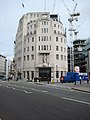 BBC Broadcasting House - geograph.org.uk - 1297784.jpg 480 × 640; 70 KB
-
 Beach Huts - geograph.org.uk - 1324175.jpg 640 × 457; 296 KB
-
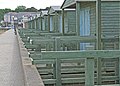
 Beach huts on Hayling Seafront - geograph.org.uk - 1296303.jpg 640 × 480; 53 KB
-

-
 Beach Walk - geograph.org.uk - 1324183.jpg 640 × 457; 326 KB
-
 Bearsted CC site - geograph.org.uk - 1318444.jpg 640 × 457; 283 KB
-
 Beautiful trees in Lealholm - geograph.org.uk - 1598466.jpg 640 × 480; 115 KB
-
 Beck Brook - geograph.org.uk - 1308693.jpg 640 × 480; 116 KB
-
 Belle Vue Island, Great Malvern - geograph.org.uk - 1305068.jpg 640 × 417; 255 KB
-
 Belted Galloways - geograph.org.uk - 1308647.jpg 640 × 480; 95 KB
-
 Bembridge Court - geograph.org.uk - 1301472.jpg 640 × 480; 64 KB
-
 Bend in Bacon Lane - geograph.org.uk - 1295183.jpg 640 × 480; 66 KB
-
 Bend in Mengham Avenue - geograph.org.uk - 1299743.jpg 640 × 480; 65 KB
-
 Bend in Rails Lane - geograph.org.uk - 1299830.jpg 640 × 480; 58 KB
-
 Bend in St Leonard's Road - geograph.org.uk - 1302978.jpg 640 × 480; 77 KB
-
 Bend in Webb Lane - geograph.org.uk - 1299721.jpg 640 × 480; 101 KB
-

-
 Big Kid Circus - Llantwit Major - geograph.org.uk - 1294545.jpg 640 × 425; 99 KB
-

-

-

-

-
 Birkheads Road - geograph.org.uk - 1306794.jpg 640 × 426; 81 KB
-
 Bisley Ranges - geograph.org.uk - 1294795.jpg 640 × 427; 49 KB
-
 Black Wood of Rannoch - geograph.org.uk - 1298987.jpg 640 × 480; 113 KB
-
 Black Wood of Rannoch - geograph.org.uk - 1298990.jpg 640 × 480; 120 KB
-
 Blakey Tor cist - geograph.org.uk - 1300815.jpg 640 × 427; 124 KB
-
 Bletchingley High Street - geograph.org.uk - 1564617.jpg 640 × 445; 100 KB
-
 Blocking the river - geograph.org.uk - 1306527.jpg 640 × 426; 69 KB
-
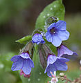
 Blue flowers (3515471483).jpg 1,500 × 1,200; 593 KB
-
 Blue plaque to Simon Bolivar - geograph.org.uk - 1299307.jpg 480 × 640; 83 KB
-
 Blue1 (3515466419).jpg 2,328 × 2,370; 2.89 MB
-
 Blue10 (3516239718).jpg 1,688 × 2,480; 2.32 MB
-
 Blue11 (3515436531).jpg 1,632 × 1,818; 1.61 MB
-
 Blue2 (3516251016).jpg 2,670 × 1,830; 2.24 MB
-
 Blue3 (3516243112).jpg 2,304 × 2,360; 2.39 MB
-
 Blue4 (3515446631).jpg 2,184 × 4,104; 4.15 MB
-
 Blue5 (3515453865).jpg 3,174 × 2,796; 4.41 MB
-
 Blue7 (3515461817).jpg 2,490 × 2,190; 2.65 MB
-
 Blue8 (3515433961).jpg 1,080 × 2,120; 1.07 MB
-
 Blue9 (3515456895).jpg 1,764 × 1,608; 1.81 MB
-
 Bluebell bank - geograph.org.uk - 1298354.jpg 640 × 480; 96 KB
-
 Bluebell Bloom - geograph.org.uk - 1294860.jpg 640 × 480; 126 KB
-
 Bluebell Wood - geograph.org.uk - 1294958.jpg 640 × 480; 175 KB
-
-
 Bluebells (Hyacinthoides non-scripta) - geograph.org.uk - 1295142.jpg 640 × 480; 161 KB
-
 Bluebells by Waterland Farm - geograph.org.uk - 1294970.jpg 640 × 480; 150 KB
-
 Bluebells in Deffer Wood - geograph.org.uk - 1295298.jpg 480 × 640; 163 KB
-
 Bluebells, Foredown Plantation - geograph.org.uk - 1300289.jpg 640 × 480; 99 KB
-
 Bluebells, Foredown Plantation - geograph.org.uk - 1301971.jpg 480 × 640; 128 KB
-
 Bluebells, Foredown Plantation - geograph.org.uk - 1301987.jpg 640 × 480; 127 KB
-
 Boathouse and slipway at Ardtaraig - geograph.org.uk - 1295301.jpg 640 × 480; 81 KB
-


_Glyphipterix_simpliciella_(3514723511).jpg)
_Epinotia_immundana_(3514724513).jpg)
_Dichrorampha_sedatana_(3515534578).jpg)
_Garden_Carpet_(Xanthorhoe_fluctuata)_(3514722703).jpg)
_Common_Carpet_(Epirrhoe_alternata)_(3514720163).jpg)
_The_Spectacle_(Abrostola_tripartita)_(3520073830).jpg)


.jpg)
.jpg)
.jpg)
.jpg)
.jpg)
.jpg)
.jpg)
.jpg)


_-_geograph.org.uk_-_1295727.jpg)

_-_geograph.org.uk_-_1295732.jpg)


.jpg)

.jpg)
.jpg)
.jpg)
.jpg)
.jpg)
.jpg)
.jpg)
.jpg)
.jpg)
.jpg)


_-_geograph.org.uk_-_1295142.jpg)


