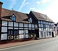
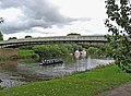
Category:Upton-upon-Severn
Jump to navigation
Jump to search
town in Worcestershire, United Kingdom Apr2006.jpg) | |||||
| Upload media | |||||
| Instance of | |||||
|---|---|---|---|---|---|
| Location | Upton-upon-Severn, Malvern Hills, Worcestershire, West Midlands, England | ||||
| Located in or next to body of water | |||||
| official website | |||||
 | |||||
Subcategories
This category has the following 11 subcategories, out of 11 total.
B
H
M
P
T
- Tunnel Hill, Worcestershire (13 F)
U
- Upton Blues Festival (1 F)
- Upton-upon-Severn Memorial Hall (10 F)
Media in category "Upton-upon-Severn"
The following 200 files are in this category, out of 1,515 total.
(previous page) (next page)-
 "Conway Castle" rides out the flood - geograph.org.uk - 5187475.jpg 4,000 × 3,000; 2.05 MB
-
 "Upton Blues" seat in the flood water - geograph.org.uk - 3282265.jpg 640 × 406; 235 KB
-

-
 'Conway Castle', Upton upon Severn - geograph.org.uk - 307697.jpg 640 × 426; 117 KB
-
 'Cromwell' the shaggy dog - geograph.org.uk - 6179637.jpg 768 × 1,024; 345 KB
-
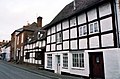
 1 and 3 Church Street, Upton-upon-Severn.jpg 3,264 × 2,448; 1.17 MB
-
 11-13 Old Str Upton upon Severn.jpg 5,184 × 3,456; 6.05 MB
-
 23 Old Street, Upton-upon-Severn - geograph.org.uk - 3735920.jpg 633 × 800; 135 KB
-
 39-43 Old Street, Upton-upon-Severn - geograph.org.uk - 4456890.jpg 1,600 × 1,200; 340 KB
-
 51 Old Street, Upton-upon-Severn - geograph.org.uk - 4456881.jpg 1,600 × 1,200; 406 KB
-
 53 and 55 Old Street Upton-upon-Severn - geograph.org.uk - 3876899.jpg 2,084 × 1,370; 666 KB
-
 53 Old Str Upton Upon Severn.jpg 5,184 × 3,456; 5.93 MB
-
 53-55 Old Street, Upton-upon-Severn - geograph.org.uk - 4456871.jpg 1,600 × 1,200; 364 KB
-
 9 New Street Upton upon Severn.jpg 5,184 × 3,456; 6.84 MB
-
 A cuckoo and wood pigeon - geograph.org.uk - 6177958.jpg 1,024 × 768; 186 KB
-
 A cuckoo in a tree - geograph.org.uk - 6177955.jpg 1,024 × 768; 155 KB
-
 A David Brown Tractor - geograph.org.uk - 5217818.jpg 1,024 × 768; 288 KB
-
 A ditch draining meadowland - geograph.org.uk - 4408392.jpg 800 × 600; 197 KB
-
 A festive White Lion, Upton-upon-Severn - geograph.org.uk - 3794211.jpg 1,024 × 680; 219 KB
-
-
 A flooded Severn below Upton Bridge - geograph.org.uk - 6185274.jpg 1,024 × 768; 165 KB
-
 A frozen Upton Marina - geograph.org.uk - 2204392.jpg 1,024 × 681; 192 KB
-
 A glimpse of Upton Baptist Church - geograph.org.uk - 787282.jpg 640 × 608; 183 KB
-
 A letterbox no more... - geograph.org.uk - 5231315.jpg 450 × 800; 66 KB
-
 A muddy River Severn - geograph.org.uk - 5277116.jpg 1,024 × 768; 143 KB
-
 A new coat of paint... - geograph.org.uk - 2713725.jpg 1,024 × 768; 138 KB
-
 A new look bridge^ - geograph.org.uk - 2713727.jpg 1,024 × 768; 205 KB
-
 A pub and a Bangladeshi restaurant - geograph.org.uk - 4924322.jpg 800 × 600; 98 KB
-
 A railway bridge used to be here - geograph.org.uk - 3548495.jpg 640 × 480; 105 KB
-
-
 A rusty gate bars the Severn Way - geograph.org.uk - 3192941.jpg 640 × 480; 116 KB
-
 A summer's afternoon by the river - geograph.org.uk - 307870.jpg 640 × 360; 116 KB
-
 A swollen River Severn - geograph.org.uk - 6007482.jpg 768 × 1,024; 173 KB
-
 A wintry Upton-upon-Severn - geograph.org.uk - 2203388.jpg 1,024 × 681; 251 KB
-
 A4104 and view of the Malvern Hills - geograph.org.uk - 5298749.jpg 4,662 × 2,840; 3.06 MB
-
 A4104 at Upton upon Severn - geograph.org.uk - 2335125.jpg 640 × 480; 119 KB
-
 A4104 Bridge in to Upton Upon Severn - geograph.org.uk - 4481535.jpg 4,000 × 2,000; 2.6 MB
-
 A4104 crosses a small watercourse - geograph.org.uk - 3461935.jpg 3,147 × 2,351; 968 KB
-
 A4104 flooded at Upton - geograph.org.uk - 3843995.jpg 640 × 398; 270 KB
-
 A4104 junction with B4211 - geograph.org.uk - 3461930.jpg 3,414 × 2,545; 1.77 MB
-
 A4104 leaving Upton - geograph.org.uk - 5298726.jpg 4,256 × 2,632; 3.06 MB
-
 A4104 near Upton Marina - geograph.org.uk - 2204409.jpg 1,024 × 681; 199 KB
-
 A4104 passes Duckswich Farm - geograph.org.uk - 3461925.jpg 3,648 × 2,736; 1.59 MB
-
 A4104 road work nears completion in Upton - geograph.org.uk - 2524326.jpg 3,997 × 2,239; 7.14 MB
-
 A4104 south of Lower Hook Farm - geograph.org.uk - 3461914.jpg 3,511 × 2,549; 1.36 MB
-
 A4104 towards the Malvern Hills - geograph.org.uk - 5298731.jpg 4,711 × 3,019; 3.85 MB
-
 A4104 Welland Road - geograph.org.uk - 3570110.jpg 800 × 451; 185 KB
-
 A4104 Welland road - geograph.org.uk - 5301427.jpg 4,718 × 3,050; 3.44 MB
-
 A4104 Welland Road at Tunnel Hill - geograph.org.uk - 5298728.jpg 4,406 × 2,728; 3.48 MB
-

-
 Acorns shop in Upton-upon-Severn - geograph.org.uk - 3735956.jpg 797 × 800; 180 KB
-

-
 After the flood - geograph.org.uk - 1867556.jpg 640 × 480; 123 KB
-
 Aggragate spoil heap - geograph.org.uk - 5721374.jpg 1,024 × 576; 201 KB
-
 Aggregate barge Elver - geograph.org.uk - 1830724.jpg 4,125 × 2,541; 5.51 MB
-
 Aggregate pile at Ryall Quarry - geograph.org.uk - 1832813.jpg 640 × 409; 227 KB
-
 Alleyway in Upton-upon-Severn - geograph.org.uk - 5124914.jpg 800 × 600; 159 KB
-

-
 Angler walks the towpath, Upton - geograph.org.uk - 2615833.jpg 4,115 × 2,294; 7.41 MB
-

-
 Arable land near The Hook - geograph.org.uk - 1609593.jpg 640 × 480; 107 KB
-
 Archaeological bridge remains, Upton upon Severn - geograph.org.uk - 2787571.jpg 1,024 × 680; 226 KB
-
 Archaeological remains in Upton upon Severn - geograph.org.uk - 2787581.jpg 1,024 × 680; 238 KB
-
 Archaeological remains, Upton upon Severn - geograph.org.uk - 2787577.jpg 1,024 × 680; 253 KB
-
 Avon Belle, Upton-upon-Severn - geograph.org.uk - 4027911.jpg 800 × 695; 168 KB
-
 Back of Old Street - geograph.org.uk - 5602788.jpg 1,600 × 1,200; 398 KB
-
 Back of Old Street with the Pepperpot, Upton-upon-Severn - geograph.org.uk - 5602783.jpg 1,200 × 1,600; 475 KB
-

-
 Bankside bench on the Severn Way - geograph.org.uk - 3089488.jpg 1,600 × 1,067; 781 KB
-
 Barge by Ryall Quarry - geograph.org.uk - 6178554.jpg 1,024 × 768; 220 KB
-
 Barges on the River Severn - geograph.org.uk - 6178560.jpg 1,024 × 768; 145 KB
-
 Barges on the Severn - geograph.org.uk - 4628072.jpg 800 × 531; 129 KB
-
 Barley field near Hanley Castle - geograph.org.uk - 6167077.jpg 1,024 × 768; 268 KB
-

-
 Bed of the old railway to Upton - geograph.org.uk - 1138593.jpg 640 × 427; 337 KB
-
 Before the deluge - geograph.org.uk - 3267214.jpg 640 × 418; 286 KB
-
 Behind the Flood Barrier, Upton - geograph.org.uk - 292014.jpg 640 × 427; 278 KB
-

-
 Bell House restaurant, Upton-upon-Severn - geograph.org.uk - 4570293.jpg 683 × 800; 127 KB
-
 Below Upton Bridge - geograph.org.uk - 3801777.jpg 1,024 × 680; 202 KB
-
 Bench mark, Hook church - geograph.org.uk - 3655792.jpg 640 × 427; 333 KB
-
 Birley Farm - geograph.org.uk - 4903909.jpg 800 × 600; 135 KB
-
-
 Black nameboard, Spar, Upton-upon-Severn - geograph.org.uk - 3931440.jpg 665 × 800; 145 KB
-

-
 Boarded up Talbot Head Hotel - geograph.org.uk - 4933138.jpg 1,024 × 768; 194 KB
-
 Boat launching at Upton Marina - geograph.org.uk - 4408948.jpg 1,024 × 768; 256 KB
-
 Boat on the flooded River Severn - geograph.org.uk - 4758401.jpg 800 × 600; 105 KB
-
 Boat passing Upton upon Severn - geograph.org.uk - 5160949.jpg 800 × 600; 106 KB
-
 Boathouse on the Severn - geograph.org.uk - 2201972.jpg 1,024 × 681; 283 KB
-
 Boathouse, Upton-upon-Severn - geograph.org.uk - 4071035.jpg 800 × 729; 139 KB
-
 Boats in the Marina - geograph.org.uk - 2357785.jpg 640 × 480; 58 KB
-
 Boats moored on the River Severn - geograph.org.uk - 5811335.jpg 6,000 × 4,000; 5.06 MB
-
 Boats on a swollen Severn - geograph.org.uk - 4773650.jpg 800 × 600; 109 KB
-
 Bookies at Upton Point-to-Point - geograph.org.uk - 3397393.jpg 1,024 × 680; 176 KB
-
 Boots the Chemist - geograph.org.uk - 6033266.jpg 2,159 × 2,879; 1.3 MB
-
 Bottom of High Street - geograph.org.uk - 4456955.jpg 1,200 × 1,600; 442 KB
-

-
 Boyes Meadow - geograph.org.uk - 1361585.jpg 640 × 427; 261 KB
-

-
 Bridge crossing the River Severn - geograph.org.uk - 4773651.jpg 800 × 600; 76 KB
-
 Bridge on the old driveway to Ham Court - geograph.org.uk - 2104487.jpg 4,272 × 2,848; 7.41 MB
-
 Bridge over Pool Brook and Birley farm - geograph.org.uk - 4948889.jpg 1,600 × 1,199; 791 KB
-

-
 Bridge over the River Severn (1) - geograph.org.uk - 2030557.jpg 800 × 589; 108 KB
-
 Bridge over the River Severn (2) - geograph.org.uk - 2030629.jpg 800 × 589; 118 KB
-

-
 Bridleway below Upper Hook - geograph.org.uk - 3574793.jpg 1,024 × 680; 300 KB
-
 Bridleway to Lower Hook - geograph.org.uk - 3574787.jpg 1,024 × 680; 252 KB
-
 Bridleway to Southend farm - geograph.org.uk - 3089449.jpg 1,600 × 1,066; 583 KB
-
 British Camp from Upton-upon-Severn - geograph.org.uk - 2808384.jpg 640 × 357; 197 KB
-
 Brotheridge Green - geograph.org.uk - 1609342.jpg 640 × 480; 122 KB
-

-
 Brotheridge Green Road - geograph.org.uk - 1171148.jpg 640 × 427; 300 KB
-
 Brown Square, School Lane, Upton - geograph.org.uk - 625657.jpg 640 × 427; 220 KB
-
 Building on New Street - geograph.org.uk - 2328100.jpg 1,024 × 768; 190 KB
-

-
 Building site at Tunnel Hill - geograph.org.uk - 5986347.jpg 1,024 × 683; 159 KB
-
 Building site at Tunnel Hill - geograph.org.uk - 5987961.jpg 1,024 × 768; 252 KB
-
 Building site at Tunnel Hill - geograph.org.uk - 5987968.jpg 1,024 × 768; 251 KB
-
 Building site at Tunnel Hill - geograph.org.uk - 6033813.jpg 1,024 × 768; 184 KB
-
 Building site at Tunnel Hill - geograph.org.uk - 6033817.jpg 1,024 × 768; 192 KB
-
 Building site at Tunnel Hill - geograph.org.uk - 6226095.jpg 1,024 × 768; 213 KB
-
 Building site at Tunnel Hill - geograph.org.uk - 6226962.jpg 1,024 × 768; 176 KB
-
 Building the bund - geograph.org.uk - 2285220.jpg 4,272 × 2,848; 6.32 MB
-
 Buildings at Upton Marina - geograph.org.uk - 2204405.jpg 1,024 × 681; 169 KB
-
 Buildings at Upton Marina - geograph.org.uk - 5218018.jpg 800 × 600; 121 KB
-
 Bungalow on Old Street, Upton upon Severn - geograph.org.uk - 6229291.jpg 1,920 × 1,280; 840 KB
-

-
 Bunting on Old Street, Upton upon Severn - geograph.org.uk - 5000246.jpg 800 × 600; 142 KB
-
 Bury End Lane - geograph.org.uk - 1819956.jpg 640 × 427; 252 KB
-
 Buryend Farm - geograph.org.uk - 1820463.jpg 1,691 × 1,178; 1.33 MB
-
 Bust of Admiral Sir William Tennant - geograph.org.uk - 6179622.jpg 768 × 1,024; 344 KB
-
 Buttercup meadow, Upton - geograph.org.uk - 3984845.jpg 640 × 427; 351 KB
-
 Buttercups - geograph.org.uk - 3574820.jpg 1,024 × 680; 180 KB
-
 B^m crossing the Upton bridge - geograph.org.uk - 4944028.jpg 800 × 450; 114 KB
-
 Cables, Saxon's Lode Gauging Station - geograph.org.uk - 1349414.jpg 640 × 455; 82 KB
-

-
 Campers at the Upton Blues Festival - geograph.org.uk - 4581691.jpg 800 × 531; 125 KB
-
 Campers at the Upton Blues Festival - geograph.org.uk - 4587082.jpg 800 × 531; 108 KB
-
 Campers at the Upton Blues Festival - geograph.org.uk - 5050767.jpg 1,024 × 576; 193 KB
-
 Campers at Upton Blues Festival - geograph.org.uk - 4581683.jpg 800 × 531; 126 KB
-
 Campers at Upton Blues Festival - geograph.org.uk - 5049558.jpg 1,024 × 357; 139 KB
-
 Campers beside the River Severn - geograph.org.uk - 4581712.jpg 800 × 531; 112 KB
-
 Campsite entrance, Upton Blues Festival - geograph.org.uk - 4587067.jpg 800 × 531; 110 KB
-
 Canada geese - geograph.org.uk - 6007484.jpg 1,024 × 768; 142 KB
-
 Caravan park north of Upton - geograph.org.uk - 1346841.jpg 640 × 455; 131 KB
-
 Caravan park, north of Upton - geograph.org.uk - 1346832.jpg 640 × 455; 101 KB
-
 Caravaners at Upton Blues Festival - geograph.org.uk - 5051767.jpg 1,024 × 576; 156 KB
-
 Cat and mouse - geograph.org.uk - 2181310.jpg 1,024 × 753; 235 KB
-
 Catkins near Tiltridge - geograph.org.uk - 1144296.jpg 640 × 427; 273 KB
-
 Cattle feeders near Southend Farm - geograph.org.uk - 2110831.jpg 4,165 × 2,684; 5.38 MB
-
 Cattle on Lower Ham - geograph.org.uk - 5801432.jpg 5,177 × 3,453; 2.31 MB
-
 Cemetery chapel, Upton-upon-Severn - geograph.org.uk - 737318.jpg 640 × 426; 96 KB
-
 Cemetery chapel, Upton-upon-Severn - geograph.org.uk - 737320.jpg 426 × 640; 87 KB
-
 Cemetery Lodge (geograph 6718957).jpg 1,024 × 768; 255 KB
-
 Chaffich on a car mirror - geograph.org.uk - 4458064.jpg 1,600 × 1,200; 193 KB
-
 Charges Apply At All Times - geograph.org.uk - 3844241.jpg 1,024 × 680; 194 KB
-
 Cherry Orchard, Upton-upon-Severn - geograph.org.uk - 2615377.jpg 5,184 × 3,456; 7.06 MB
-
 Children's playground, New Street, Upton - geograph.org.uk - 2524174.jpg 4,000 × 2,313; 5.87 MB
-

-
 Cholera burial ground - geograph.org.uk - 5987945.jpg 1,024 × 768; 350 KB
-

-

-
 Christmas market, Upton-upon-Severn - geograph.org.uk - 3788419.jpg 1,024 × 768; 163 KB
-
 Christmas market, Upton-upon-Severn - geograph.org.uk - 3788423.jpg 1,024 × 768; 172 KB
-
 Christmas tree on Upton's High Street - geograph.org.uk - 5224314.jpg 768 × 1,024; 197 KB
-
 Church Cottages, Upton upon Severn - geograph.org.uk - 4030207.jpg 800 × 663; 154 KB
-
 Church of St Peter and St Paul, Upton-upon-Severn - geograph.org.uk - 1818565.jpg 4,272 × 2,848; 5.84 MB
-
 Church of St Peter ^ St Paul Upton on Severn - geograph.org.uk - 3089362.jpg 1,200 × 1,600; 625 KB
-
 Church on the edge of Upton on Severn - geograph.org.uk - 2277663.jpg 3,000 × 4,000; 4.05 MB
-
 Church Room, Upton-upon-Severn - geograph.org.uk - 3733287.jpg 800 × 661; 146 KB
-
 Church Room, Upton-upon-Severn - geograph.org.uk - 5197340.jpg 1,024 × 768; 210 KB
-
 Church Street houses, Upton upon Severn - geograph.org.uk - 4030213.jpg 800 × 798; 139 KB
-
 Church Street, early March 2016 - geograph.org.uk - 4886698.jpg 640 × 480; 63 KB
-
 Church Street, Upton-Upon-Severn - geograph.org.uk - 1321206.jpg 640 × 427; 268 KB
-
 Church Street, Upton-upon-Severn - geograph.org.uk - 4458115.jpg 1,600 × 1,200; 384 KB
-
 Church Walk, Upton-upon-Severn - geograph.org.uk - 3733285.jpg 800 × 677; 208 KB
-
 Classic Lorries in Upton on Severn - geograph.org.uk - 4944011.jpg 800 × 500; 131 KB
-
 Clay bund flood defence being built around Upton - geograph.org.uk - 2304751.jpg 4,272 × 2,848; 4.91 MB
-
 Clive's Fruit Farm - geograph.org.uk - 1867577.jpg 640 × 469; 86 KB
-
 Clive's Fruit Farm - geograph.org.uk - 5141096.jpg 800 × 600; 119 KB
-
 Clive's Fruit Farm, Willingsworth, Upton-upon-Severn - geograph.org.uk - 6242034.jpg 1,600 × 1,200; 422 KB
-
 Clives Fruit Farm - geograph.org.uk - 2807977.jpg 4,000 × 2,383; 5.49 MB
-
 Coach at the Regal Garage - geograph.org.uk - 4944043.jpg 800 × 450; 105 KB
-

-

-
 Commemorative plaque to the new viaduct, Upton - geograph.org.uk - 2636953.jpg 5,184 × 3,011; 7.43 MB
-
 Commonwealth War Graves sign - geograph.org.uk - 5629855.jpg 1,600 × 1,200; 385 KB
-

-
 Construction site at Tunnel Hill - geograph.org.uk - 6077401.jpg 1,024 × 768; 205 KB
-
 Construction work on the A4104 - geograph.org.uk - 6004862.jpg 1,024 × 683; 147 KB
-
 Converted warehouse, Upton-on-severn - geograph.org.uk - 4458062.jpg 1,600 × 1,200; 385 KB
-
 Conway Castle on the River Severn - geograph.org.uk - 2203349.jpg 1,024 × 681; 158 KB
-
 Conway Castle, Upton upon Severn - geograph.org.uk - 5019831.jpg 1,024 × 768; 257 KB
-
 Conway Castle, Upton-upon-Severn - geograph.org.uk - 929083.jpg 640 × 480; 91 KB
-
 Cooks Bakery, Upton-upon-Severn - geograph.org.uk - 3733382.jpg 770 × 800; 152 KB
-
 Cooling off - geograph.org.uk - 3548493.jpg 640 × 480; 77 KB
-
 Copse and water trough - geograph.org.uk - 859591.jpg 640 × 427; 316 KB
-
 Corrugated iron hall - geograph.org.uk - 5455454.jpg 1,600 × 1,200; 638 KB


,_9_New_Street_-_geograph.org.uk_-_2029857.jpg)


_-_geograph.org.uk_-_2030557.jpg)
_-_geograph.org.uk_-_2030629.jpg)


.jpg)


