Category:Urbanisation maps of Nancy
Jump to navigation
Jump to search
| NO WIKIDATA ID FOUND! Search for Urbanisation maps of Nancy on Wikidata | |
| Upload media |
Media in category "Urbanisation maps of Nancy"
The following 17 files are in this category, out of 17 total.
-
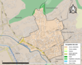
 54395-Nancy-Sols.png 3,270 × 2,598; 8.46 MB
-
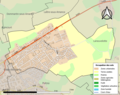
 54025-Art-sur-Meurthe-Sols.png 3,270 × 2,598; 2.65 MB
-
 54357-Maxéville-Sols.png 3,270 × 2,598; 3.61 MB
-
 54339-Malzéville-Sols.png 3,270 × 2,598; 3.98 MB
-
 54184-Essey-lès-Nancy-Sols.png 3,270 × 2,598; 3.62 MB
-
 54197-Fléville-devant-Nancy-Sols.png 3,270 × 2,598; 3.15 MB
-
 54257-Heillecourt-Sols.png 3,270 × 2,598; 4.07 MB
-
 54265-Houdemont-Sols.png 3,270 × 2,598; 2.67 MB
-
 54274-Jarville-la-Malgrange-Sols.png 3,270 × 2,598; 4.16 MB
-
 54300-Laneuveville-devant-Nancy-Sols.png 3,270 × 2,598; 2.96 MB
-
 54304-Laxou-Sols.png 3,270 × 2,598; 3.18 MB
-
 54439-Pulnoy-Sols.png 3,270 × 2,598; 2.75 MB
-
 54482-Saint-Max-Sols.png 3,270 × 2,598; 4.35 MB
-
 54495-Saulxures-lès-Nancy-Sols.png 3,270 × 2,598; 2.23 MB
-
 54498-Seichamps-Sols.png 3,270 × 2,598; 2.7 MB
-
 54526-Tomblaine-Sols.png 3,270 × 2,598; 4.76 MB
-
 54547-Vandœuvre-lès-Nancy-Sols.png 3,270 × 2,598; 5.48 MB


