Category:Valtournenche
Jump to navigation
Jump to search
Wikimedia disambiguation page | |||||
| Instance of | |||||
|---|---|---|---|---|---|
| |||||
This is a disambiguation – a navigational aid which lists categories that might otherwise share the same name.
This category page should not hold any files. See also: Special:Categories/Valtournenche, Special:PrefixIndex/Category:Valtournenche, Wikidata or categories with "Valtournenche" in name |
|

Subcategories
This category has the following 16 subcategories, out of 16 total.
B
- Lago Blu (64 F)
G
- Lago Goillet (16 F)
- Gouffre des Busserailles (72 F)
- Grand Tournalin (15 F)
H
L
- Lacs du Tramail de Vieille (3 F)
- Laghi delle Cime Bianche (3 F)
- Lago di Loz (1 F)
M
- Mont Pancherot (20 F)
- Mont Rous (6 F)
P
- People in Valtournenche (5 F)
- Petit Tournalin (4 F)
- Postcards of Valtournanche (1 F)
S
- South side of Matterhorn (120 F)
Media in category "Valtournenche"
The following 200 files are in this category, out of 206 total.
(previous page) (next page)-
 "House" at ski run Reine Bianche (Gran Pista di Valtournenche) - panoramio (1).jpg 4,608 × 2,304; 4.63 MB
-
 "House" at ski run Reine Bianche (Gran Pista di Valtournenche) - panoramio.jpg 4,608 × 2,932; 5.4 MB
-
 Achillea 2.jpg 4,680 × 3,535; 4.49 MB
-
 Alba sul Cervino.jpg 1,000 × 667; 972 KB
-
 Ancora Plateau Rosà - panoramio.jpg 2,304 × 1,728; 435 KB
-
 Apartements in Breuil-Cervino - panoramio.jpg 4,394 × 3,156; 5.87 MB
-
 Area Picnic Cervinia - fountain.jpg 5,211 × 3,539; 6.2 MB
-
 Area Picnic Cervinia - Matterhorn.jpg 5,472 × 3,648; 5.44 MB
-
 Area Picnic Cervinia 2.jpg 5,472 × 3,648; 5.03 MB
-
 Batse 2.jpg 5,204 × 3,483; 5.18 MB
-
 Bec Carré 2.jpg 1,955 × 1,332; 1.22 MB
-
 Bec Carré.jpg 2,136 × 1,477; 1.02 MB
-
 Becca di Salé.jpg 4,434 × 3,443; 3.64 MB
-
 Bobba + Guin + Jumeaux.JPG 2,816 × 2,112; 2.69 MB
-
 Breithorn Centrale e gruppo del Rosa - panoramio.jpg 7,176 × 1,614; 2.13 MB
-
 Breuil - Cervinia and the Matterhorn in the background - panoramio.jpg 2,592 × 3,888; 2.27 MB
-
 Breuil-Cervinia - panoramio (4).jpg 4,608 × 2,848; 5.28 MB
-
 Breuil-Cervinia - panoramio.jpg 4,608 × 2,660; 4.9 MB
-
 Breuil-Cervinia view of the Alps - panoramio (2).jpg 5,184 × 3,456; 9.58 MB
-
 Brown mushroom 4.jpg 1,502 × 1,374; 838 KB
-
 Bryophyta 4.jpg 2,700 × 1,938; 2.35 MB
-
 Cabinovia Valtournenche-Salette.jpg 2,486 × 1,865; 841 KB
-
 Camping Breuil-Cervinia 2.jpg 4,198 × 1,287; 1.27 MB
-
 Caterpillar 924G.jpg 3,608 × 2,168; 2.6 MB
-
 Caterpillar excavators.jpg 4,487 × 1,841; 2.57 MB
-
 Cattle and Segnavia 13EE.jpg 5,456 × 2,956; 5.18 MB
-
 Cattle in Valtournenche.jpg 4,434 × 3,045; 4.22 MB
-
 Centaurea 2.jpg 1,336 × 1,145; 325 KB
-
 Centrale Idroelettrica Promoron.jpg 3,930 × 3,337; 3.45 MB
-
 Cervinia - Golf Club - panoramio.jpg 3,888 × 2,592; 6.17 MB
-
 Cervinia - Pic-nic area - panoramio.jpg 3,888 × 2,592; 2.19 MB
-
 Cervinia dalla funivia mt.3480 temp.-25 - panoramio.jpg 1,600 × 1,067; 740 KB
-
 Cervinia pista del Ghiacciaio Ventina - panoramio.jpg 1,600 × 1,067; 1.15 MB
-
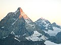
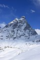
 Cervino (7628572134).jpg 5,184 × 3,456; 11.66 MB
-
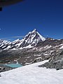
 Cervino (7628574010).jpg 3,264 × 4,902; 10.79 MB
-
 Cervino - panoramio (1).jpg 2,288 × 1,712; 856 KB
-
 Cervino - panoramio - Mario Penner.jpg 2,816 × 2,112; 2.74 MB
-
 Cervino - panoramio - Matteo Bartoli.jpg 2,304 × 1,728; 915 KB
-
 Cervino - panoramio.jpg 1,728 × 2,304; 750 KB
-
 Cervino tra i Rami - panoramio.jpg 3,648 × 2,736; 2.32 MB
-
 Cliff in Italy.jpg 5,472 × 3,648; 6.59 MB
-
 Cryptogramma.jpg 3,876 × 2,786; 3.46 MB
-
 Dent d'Herens da Cervinia - Cime Bianche - panoramio.jpg 1,600 × 1,067; 890 KB
-
 Gentiana purpurea in Italy.jpg 2,092 × 1,433; 800 KB
-
 Ghiacciaio di Mont Tabel.jpg 4,969 × 3,204; 4.32 MB
-
 Golf Club del Cervino - river.jpg 3,148 × 3,918; 3.4 MB
-
 Grand Tournalin - Petit Tournalin.jpg 3,434 × 3,248; 4.35 MB
-
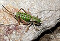
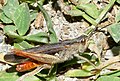 Grasshopper in Valtournenche.jpg 1,000 × 674; 341 KB
-
 High wind (view from Matterhorn glacier paradise direction Valtournenche) - panoramio.jpg 2,686 × 1,637; 1.45 MB
-
 High wind - panoramio.jpg 4,608 × 2,116; 3.62 MB
-
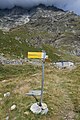
 Hike signs 26 and 29.jpg 3,645 × 2,673; 2.35 MB
-
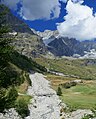
 Hiking trail from Salette to Valtournenche - panoramio (1).jpg 4,608 × 3,456; 6.56 MB
-
 Hiking trail from Salette to Valtournenche - panoramio.jpg 4,608 × 3,456; 7.27 MB
-
 Hotel Lac Bleu - SR46.jpg 1,616 × 1,022; 768 KB
-
 Hotel Rascard, Valtournenche - panoramio (1).jpg 4,608 × 2,666; 6.45 MB
-
 Hyles euphorbiae caterpillar.jpg 1,421 × 459; 363 KB
-
 Il Cervino con le frecce tricolori per il 150° anniversario della prima ascesa.jpg 3,888 × 2,592; 1.99 MB
-
 Juniperus communis subsp alpina, Valtournenche, Italy.jpg 4,196 × 2,478; 2.78 MB
-
 Lac Bleu - panoramio.jpg 1,600 × 828; 406 KB
-
 Laghi Cime Bianche 2812 m - Plateau Rosa Testa Grigia 3480 m - panoramio.jpg 4,608 × 2,783; 4.1 MB
-
 Laghi delle Cime Bianche 2.jpg 8,989 × 2,612; 5.92 MB
-
 Lago di Maen 2134.jpg 2,448 × 3,264; 1.86 MB
-
 Layet and mountains.jpg 3,434 × 2,374; 2.65 MB
-
 Layet.jpg 2,626 × 1,321; 1.68 MB
-
 Matterhorn Cervinio 4478 m from skilift to Plateau Rosa Testa Grigia 3480 m - panoramio.jpg 4,608 × 3,016; 4.93 MB
-
 Matterhorn Cervino 4478 m - panoramio (4).jpg 4,608 × 2,738; 4.33 MB
-
 Matterhorn glacier paradise - panoramio.jpg 4,590 × 2,304; 3.13 MB
-
 Matterhorn touches clouds (Unsplash).jpg 3,264 × 4,896; 9.01 MB
-
 Mont Pancherot - lichen.jpg 3,800 × 2,787; 2.93 MB
-
 Monte Roisetta - punta nord 2.jpg 5,297 × 3,441; 5.86 MB
-
 Monte Roisetta - punta nord.jpg 5,472 × 3,648; 4.25 MB
-
 Monte Saleron.jpg 3,131 × 2,087; 2.32 MB
-
 Morces.jpg 3,184 × 928; 1.25 MB
-
 Moss in Italy.jpg 1,890 × 1,256; 773 KB
-
 Mountain stream 5.jpg 5,418 × 3,578; 5.22 MB
-
 Mountain stream 6.jpg 5,472 × 3,648; 5.03 MB
-
 Mountain stream in Italy 2.jpg 4,736 × 4,367; 6.64 MB
-
 Mountain stream in Italy.jpg 3,648 × 5,472; 5.98 MB
-
 Near Salette 2245 m, Valtournenche - panoramio.jpg 4,608 × 3,456; 5.29 MB
-
 Nobile Scoglio - panoramio.jpg 1,067 × 1,600; 690 KB
-
 Old house - panoramio (27).jpg 4,608 × 3,456; 5.06 MB
-
 Orthoptera 5.jpg 2,006 × 1,366; 794 KB
-
 Panor Valtournenche abc1.jpg 4,752 × 3,168; 2.72 MB
-
-

-
 Panorama from Hotel Rascard - panoramio.jpg 3,200 × 560; 1,011 KB
-
-

-
 Panorama from ski run Reine Bianche (Gran Pista di Valtournenche) - panoramio.jpg 4,608 × 3,456; 6.39 MB
-

-
 Panorama from Theodulpass 3301 m direction Breuil-Cervinia - panoramio.jpg 4,608 × 2,777; 5.39 MB
-

-
 Panorama from Theodulpass at Breuil-Cervinia - panoramio.jpg 4,608 × 2,964; 5.62 MB
-
 Panorama Salette 2245 m, Valtournenche - panoramio.jpg 3,200 × 560; 819 KB
-
 Panorama to ski run Reine Bianche (Gran Pista di Valtournenche) - panoramio.jpg 3,200 × 560; 852 KB
-
 Panorama Valtournenche from skilift to Salette - panoramio.jpg 4,608 × 3,113; 6.07 MB
-
 Paquier 2022.jpg 5,454 × 1,688; 3.27 MB
-
 Photo Goillet Dam 1958 - Touring Club Italiano 2 6281.jpg 2,662 × 2,036; 581 KB
-
 Piccolo Cervino e sullo sfondo il Rosa - panoramio.jpg 1,600 × 1,067; 509 KB
-
 Plan Maison - Laghi Cime Bianche - panoramio.jpg 4,608 × 3,456; 5.9 MB
-
 Pulsatilla 2.jpg 2,794 × 2,890; 2.3 MB
-
 Punta di Fontanella - Monte Dragone.jpg 3,434 × 1,167; 1.24 MB
-
 Residence Cervino 2, Valtournenche - panoramio.jpg 4,608 × 2,790; 5.26 MB
-
 Rifugio Barmasse - Lac de Cortinaz.jpg 3,434 × 2,289; 3.34 MB
-
 Riparo Alpino - panoramio.jpg 2,592 × 1,944; 1.09 MB
-
 Ristorante - panoramio (3).jpg 4,608 × 2,841; 4.96 MB
-
 Rock formation in Italy 2.jpg 5,472 × 3,648; 4.99 MB
-
 Rock formation in Italy 3.jpg 4,758 × 1,817; 1.93 MB
-
 Rock formation in Italy 4.jpg 2,906 × 2,230; 1.8 MB
-
 Rope on trail to Bobba.jpg 3,434 × 2,289; 3.13 MB
-
 Salette 2245 m ü. NN, Valtournenche - panoramio.jpg 4,608 × 2,647; 5.22 MB
-
 Salette 2245 m, Valtournenche - panoramio (1).jpg 4,608 × 3,456; 6.06 MB
-
 Salette 2245 m, Valtournenche - panoramio.jpg 4,608 × 3,456; 6.28 MB
-
 Sciendendo dal Pancherot - panoramio.jpg 2,592 × 1,944; 1,013 KB
-
 Sempervivum 2.jpg 1,838 × 2,022; 1.13 MB
-
 Sheep - panoramio (7).jpg 3,074 × 2,304; 3.28 MB
-
 Skilift Valtournenche - Salette - panoramio (1).jpg 4,608 × 3,456; 6.32 MB
-
 Skilift Valtournenche - Salette - panoramio.jpg 4,608 × 2,970; 6.5 MB
-
 Snow - panoramio (60).jpg 4,608 × 2,990; 5.87 MB
-
 SR46 in Valtournenche.jpg 5,018 × 3,425; 4.59 MB
-
 SR46 Valtournenche.jpg 2,817 × 2,615; 1.66 MB
-
 Sua Maestà il Cervino - panoramio.jpg 4,752 × 3,168; 6.08 MB
-
 Sunset over Matterhorn (Unsplash).jpg 5,399 × 3,037; 6.6 MB
-
 Thamnolia.jpg 2,974 × 2,550; 2.7 MB
-
 The Almighty Matterhorn (245914433).jpeg 1,365 × 2,048; 542 KB
-
 The Matterhorn taken from Giomein - panoramio.jpg 2,508 × 3,888; 2.32 MB
-
 The Maën lake, Valtournenche, Italy.jpeg 350 × 233; 18 KB
-
 Torrente Cors 2.jpg 3,648 × 5,472; 7.15 MB
-
 Torrente Porteiller - waterfall 2.jpg 3,648 × 4,546; 4.62 MB
-
 Torrente Porteiller - waterfall 3.jpg 3,648 × 5,167; 5.27 MB
-
 Torrente Porteiller - waterfall.jpg 2,966 × 2,821; 2.63 MB
-
 Torrente Porteiller.jpg 3,648 × 5,023; 5.47 MB
-
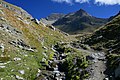
 Trail - Grand Tournalin.jpg 5,472 × 3,648; 6.25 MB
-
 Trail 11 and 65.jpg 3,648 × 5,472; 7.21 MB
-
 Trail 11.jpg 4,874 × 3,346; 4.14 MB
-
 Trail 26.jpg 5,472 × 3,648; 6.55 MB
-
 Trail near Breuil-Cervinia.jpg 6,397 × 2,989; 4.14 MB
-
 Trail to Rifugio Bobba.jpg 8,287 × 3,399; 7.66 MB
-
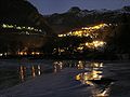 Valtournenche (Pâquier) la nuit.jpg 720 × 540; 68 KB
-
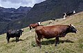 Valtournenche - cattle 2.jpg 4,605 × 2,966; 3.39 MB
-
 Valtournenche - cattle.jpg 1,655 × 1,592; 1.36 MB
-
 Valtournenche - flower 2.jpg 1,215 × 1,371; 494 KB
-
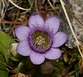 Valtournenche - flower.jpg 962 × 890; 288 KB
-
 Valtournenche - forest trail 2.jpg 3,434 × 2,736; 4.36 MB
-
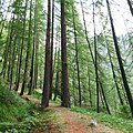 Valtournenche - forest trail.jpg 3,434 × 3,448; 5.13 MB
-
 Valtournenche - glacier 2022.jpg 2,424 × 1,616; 1.27 MB
-
 Valtournenche - glacier 3.jpg 5,472 × 3,648; 7.01 MB
-
 Valtournenche - glacier 4.jpg 4,258 × 2,461; 3.44 MB
-
 Valtournenche - panoramio (1).jpg 4,608 × 3,456; 6.84 MB
-
 Valtournenche - panoramio (2).jpg 4,608 × 3,456; 6.51 MB
-
 Valtournenche - panoramio (3).jpg 4,608 × 3,456; 6.36 MB
-
 Valtournenche - panoramio (4).jpg 3,200 × 560; 1.05 MB
-
 Valtournenche - panoramio (5).jpg 4,608 × 2,873; 6.18 MB
-
 Valtournenche - panoramio (6).jpg 4,608 × 3,456; 6.08 MB
-
 Valtournenche - panoramio.jpg 4,608 × 3,456; 5.65 MB
-
 Valtournenche - plant 2.jpg 1,570 × 1,442; 561 KB
-
 Valtournenche - plant 3.jpg 2,194 × 1,801; 1.24 MB
-
 Valtournenche - plant.jpg 1,555 × 1,383; 897 KB
-
 Valtournenche - river.jpg 4,120 × 3,299; 4.47 MB
-
 Valtournenche - rock formation.jpg 5,472 × 3,648; 4.2 MB
-
 Valtournenche - sheep.jpg 5,472 × 3,235; 6.06 MB
-
 Valtournenche - trail 2.jpg 5,472 × 2,994; 4.54 MB
-
 Valtournenche - trail 26.jpg 5,472 × 3,648; 5.09 MB
-
 Valtournenche - trail 3.jpg 10,672 × 3,488; 9.11 MB
-
 Valtournenche - trail 4.jpg 3,827 × 888; 1.18 MB
-
 Valtournenche - trail 5.jpg 5,273 × 3,402; 4.23 MB
-
 Valtournenche - trail 6.jpg 10,128 × 3,488; 9.59 MB
-
 Valtournenche - trail.jpg 5,472 × 3,648; 4.93 MB
-
 Valtournenche - tree.jpg 3,050 × 5,472; 4.84 MB
-
 Valtournenche 12.jpg 5,472 × 3,648; 5.72 MB
-
 Valtournenche 13.jpg 5,472 × 3,648; 5.84 MB
-
 Valtournenche 15.jpg 5,051 × 2,527; 3.14 MB
-
 Valtournenche 2.jpg 7,878 × 2,415; 4.94 MB
-
 Valtournenche 3.jpg 4,646 × 1,847; 2.84 MB
-
 Valtournenche 4.jpg 2,464 × 2,450; 1.83 MB
-
 Valtournenche from ski run Reine Bianche (Gran Pista di Valtournenche) - panoramio (1).jpg 4,608 × 3,456; 6.83 MB
-
 Valtournenche from ski run Reine Bianche (Gran Pista di Valtournenche) - panoramio.jpg 4,608 × 3,456; 8.07 MB
-
 Valtournenche, view from Hotel Rascard - panoramio.jpg 4,608 × 2,847; 4.46 MB
-
 Valtournenche-Salette - panoramio.jpg 1,600 × 1,067; 685 KB
-
 Valtournenche.jpg 3,434 × 2,289; 2.1 MB
-
 Valtournenche.Paquier - panoramio.jpg 5,184 × 3,456; 10.02 MB
-
-
-
 View from Furgsattel 3365 m to Plateau Rosa Testa Grigia - panoramio.jpg 4,608 × 3,456; 5.85 MB
-
-
 View from Laghi Cime Bianche - Plateau Rosa to Breuil Cervinia - panoramio.jpg 4,608 × 3,456; 5.62 MB
-
 View from Laghi Cime Bianche 2812 m to Plateau Rosa Testa Grigia 3480 m - panoramio.jpg 4,608 × 2,556; 4.43 MB
-
 View from Rifugio Bobba.jpg 8,787 × 3,286; 9.78 MB
-
 View from ski run Reine Bianche (Gran Pista di Valtournenche) - panoramio.jpg 4,608 × 2,304; 3.48 MB
-
 View north - panoramio (3).jpg 4,608 × 3,456; 7.15 MB
-
 View north direction Breuil-Cervinia - panoramio.jpg 4,608 × 3,456; 6.29 MB
-
 View north to Singlin - panoramio.jpg 4,459 × 2,841; 5.95 MB
-
 View north, Singlin - panoramio.jpg 4,608 × 3,456; 7.13 MB
-
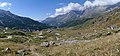
 View over Valtournenche - panoramio.jpg 4,608 × 2,757; 5.61 MB
-
 View over Valtournenche direction Valle D'aosta - panoramio.jpg 4,608 × 2,731; 4.93 MB
-
 View south to valley aosta - panoramio.jpg 4,608 × 3,456; 5.38 MB
-
 View to Breuil-Cervinina - panoramio.jpg 4,608 × 3,456; 6.78 MB
-
 View to Hotel Rascard, Valtournenche - panoramio.jpg 2,233 × 1,469; 1.75 MB
-
-
 View to Residence Cervino 2, Valtournenche - panoramio.jpg 4,608 × 3,456; 5.77 MB
_-_panoramio_(1).jpg)
_-_panoramio.jpg)


.jpg)

.jpg)


.jpg)
.jpg)
.jpg)


_-_panoramio.jpg)


.jpg)


.jpg)


.jpg)

.jpg)


.jpg)


_-_panoramio.jpg)
_direction_Valle_D%27aosta_-_panoramio.jpg)


.jpg)


.jpg)


.jpg)
.jpg)

.jpg)


.jpg)

.jpeg)


_la_nuit.jpg)


.jpg)
.jpg)
.jpg)
.jpg)
.jpg)


_-_panoramio_(1).jpg)
_-_panoramio.jpg)


_-_panoramio.jpg)
.jpg)


_-_panoramio_(1).jpg)
_-_panoramio.jpg)
.jpg)