Category:Verbund-Wasserwerk Witten
Jump to navigation
Jump to search
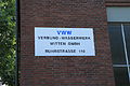
Deutsch: Wasserwerk Ruhrstraße 110, Witten
| Object location | | View all coordinates using: OpenStreetMap |
|---|
This is the category for an architectural monument.
It is on the list of cultural monuments of Witten, no. 225.
It is on the list of cultural monuments of Witten, no. 225.
 | |||||
| Upload media | |||||
| Instance of | |||||
|---|---|---|---|---|---|
| Location | Witten, Ennepe-Ruhr-Kreis, Arnsberg Government Region, North Rhine-Westphalia, Germany | ||||
| Heritage designation | |||||
 | |||||
Media in category "Verbund-Wasserwerk Witten"
The following 5 files are in this category, out of 5 total.
-
 Witten - Ruhrstraße - VWW 01 ies.jpg 5,616 × 3,744; 9.23 MB
-
 Witten - Ruhrstraße - VWW 02 ies.jpg 5,616 × 3,744; 7.42 MB
-
 Witten - Ruhrstraße - VWW 03 ies.jpg 5,616 × 3,744; 12.01 MB
-
 Witten Wasserwerk Ruhrstrasse.jpg 1,600 × 1,200; 658 KB
-
 Witten Wasserwerk.JPG 5,089 × 3,739; 1.87 MB


