Category:Wellensiek (Bielefeld)
Jump to navigation
Jump to search
| Object location | | View all coordinates using: OpenStreetMap |
|---|
 | |||||
| Upload media | |||||
| Instance of |
| ||||
|---|---|---|---|---|---|
| Location | Dornberg, Bielefeld, Detmold Government Region, North Rhine-Westphalia, Germany | ||||
| Heritage designation | |||||
| Inception |
| ||||
 | |||||
Subcategories
This category has only the following subcategory.
Media in category "Wellensiek (Bielefeld)"
The following 5 files are in this category, out of 5 total.
-
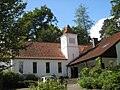 Christuskirche (ehem.) Bielefeld.jpg 2,272 × 1,704; 1.14 MB
-
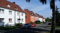 Wellensiek 1.jpg 1,632 × 918; 234 KB
-
 Wellensiek 3.jpg 1,632 × 918; 330 KB
-
 Wellensiek stadtbahn bielefeld.jpg 640 × 360; 46 KB
-
 Wellensiek2.jpg 1,632 × 918; 349 KB
_Bielefeld.jpg)


