Category:West Keal
Jump to navigation
Jump to search
English: Keal Cotes, forming part of West Keal parish, is a small linear village in the English county of Lincolnshire located on the A16 road one mile (1.6 kilometres) south of West Keal and one mile (1.6 kilometres) north of Stickford. The nearest Market town is Spilsby, some six miles (9.7 kilometres) to the north and market day is on Mondays.

village and civil parish in East Lindsey, Lincolnshire, England  | |||||
| Upload media | |||||
| Instance of | |||||
|---|---|---|---|---|---|
| Location | East Lindsey, Lincolnshire, East Midlands, England | ||||
 | |||||
Subcategories
This category has the following 2 subcategories, out of 2 total.
C
K
- Keal Cotes (4 F)
Media in category "West Keal"
The following 168 files are in this category, out of 168 total.
-
 A bend in the A155 - geograph.org.uk - 3898799.jpg 640 × 480; 79 KB
-
 A Sea of Red, White and Gold, High Barn - geograph.org.uk - 871542.jpg 640 × 480; 152 KB
-
 A Sea of Red, White and Gold, High Barn - geograph.org.uk - 871587.jpg 480 × 640; 130 KB
-
 A155 heading east - geograph.org.uk - 3898795.jpg 640 × 480; 42 KB
-
 A16 southbound entering Keal Cotes - geograph.org.uk - 3005647.jpg 640 × 470; 59 KB
-
 A16 towards Stickford - geograph.org.uk - 3898813.jpg 640 × 480; 38 KB
-
 Bank and Broom Holt - geograph.org.uk - 6318671.jpg 1,024 × 768; 163 KB
-
 Beside Wheelabout Wood - geograph.org.uk - 1020808.jpg 640 × 480; 95 KB
-
 Broccoli Plant, High Barn - geograph.org.uk - 469368.jpg 640 × 480; 87 KB
-

-

-
 Cottage garden - geograph.org.uk - 1020617.jpg 640 × 480; 105 KB
-
 Cottages, High Barn - geograph.org.uk - 3879502.jpg 640 × 480; 89 KB
-
 Country lane - geograph.org.uk - 3879505.jpg 640 × 480; 97 KB
-
 Country Lane, High Barn - geograph.org.uk - 3879503.jpg 640 × 480; 61 KB
-
 County lane - geograph.org.uk - 3879508.jpg 640 × 480; 75 KB
-
 Crop field towards The Piggery - geograph.org.uk - 3898797.jpg 640 × 480; 65 KB
-
 Crop field, High Barn - geograph.org.uk - 3879501.jpg 640 × 480; 71 KB
-
 Crop field, West Keal - geograph.org.uk - 3898801.jpg 640 × 480; 72 KB
-

-

-
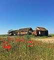 Derelict barns near Old Bolingbroke (geograph 5432930).jpg 580 × 640; 238 KB
-
 Down Mardon Hill towards East Keal - geograph.org.uk - 5327595.jpg 640 × 426; 39 KB
-
 Drain near Mager Farm - geograph.org.uk - 2597519.jpg 1,280 × 960; 270 KB
-
 East Fen - geograph.org.uk - 1265623.jpg 640 × 426; 86 KB
-
 East Fen Catchwater Drain - geograph.org.uk - 2600499.jpg 1,238 × 902; 872 KB
-
 East Keal, Highfield Farm - geograph.org.uk - 5120873.jpg 1,280 × 960; 537 KB
-
 Entering West Keal - geograph.org.uk - 3898800.jpg 640 × 480; 74 KB
-
 Farm buildings on Keal Hill - geograph.org.uk - 5327529.jpg 640 × 426; 52 KB
-
 Farmland Laythorpe House Farm - geograph.org.uk - 3898792.jpg 640 × 480; 55 KB
-
 Farmland, near West Keal - geograph.org.uk - 1740185.jpg 640 × 480; 93 KB
-
 Farmland, near West Keal - geograph.org.uk - 1740188.jpg 640 × 480; 87 KB
-
 Farmland, near West Keal - geograph.org.uk - 1742310.jpg 640 × 480; 89 KB
-
 Farmland, near West Keal - geograph.org.uk - 1742665.jpg 640 × 480; 136 KB
-
 Farmland, near West Keal - geograph.org.uk - 1742678.jpg 640 × 480; 105 KB
-
 Farmland, near West Keal - geograph.org.uk - 1742690.jpg 640 × 480; 118 KB
-
 Farmland, near West Keal - geograph.org.uk - 1742703.jpg 640 × 480; 104 KB
-
 Farmland, near West Keal - geograph.org.uk - 1743195.jpg 640 × 480; 121 KB
-
 Farmland, near West Keal - geograph.org.uk - 1743232.jpg 640 × 480; 100 KB
-
 Farmland, near West Keal - geograph.org.uk - 1743629.jpg 640 × 480; 100 KB
-
 Farmland, near West Keal - geograph.org.uk - 1743652.jpg 640 × 480; 88 KB
-
 Farmland, near West Keal - geograph.org.uk - 1743673.jpg 640 × 480; 91 KB
-
 Farmland, near West Keal - geograph.org.uk - 1743681.jpg 640 × 480; 96 KB
-
 Farmland, near West Keal - geograph.org.uk - 1743739.jpg 640 × 480; 120 KB
-

-

-
 Footpath near Wheelabout Wood - geograph.org.uk - 6318469.jpg 1,024 × 768; 370 KB
-
 Footpath past Wheelabout Wood - geograph.org.uk - 4130172.jpg 640 × 427; 87 KB
-
 Footpath West Keal - geograph.org.uk - 1021888.jpg 640 × 480; 174 KB
-
 Former East Kirkby Aerodrome - geograph.org.uk - 1743858.jpg 640 × 480; 75 KB
-
 Former East Kirkby Aerodrome - geograph.org.uk - 1743860.jpg 640 × 480; 62 KB
-
 Former East Kirkby Aerodrome - geograph.org.uk - 1743862.jpg 640 × 480; 102 KB
-
 Former Wesleyan Chapel in Keal Cotes - geograph.org.uk - 3596641.jpg 640 × 427; 63 KB
-
 Frosty morning, Lincolnshire fens - geograph.org.uk - 1022000.jpg 640 × 371; 59 KB
-
 Grazing, Keal Cotes - geograph.org.uk - 3898809.jpg 640 × 480; 49 KB
-
 Hall Hill, near West Keal - geograph.org.uk - 720340.jpg 640 × 480; 131 KB
-
 Hall Lane leading to West Keal - geograph.org.uk - 5327532.jpg 640 × 426; 64 KB
-
 Harvested field of maize - geograph.org.uk - 6318475.jpg 1,024 × 768; 225 KB
-
 Harvesting field along the A155 near West Keal - geograph.org.uk - 2520139.jpg 1,600 × 1,200; 705 KB
-
 High Barn - geograph.org.uk - 1020609.jpg 640 × 483; 119 KB
-
 High Barn - geograph.org.uk - 1738258.jpg 640 × 480; 151 KB
-
 High Barn - geograph.org.uk - 3614458.jpg 1,600 × 1,064; 336 KB
-

-

-
 High Barn, near West Keal - geograph.org.uk - 3290062.jpg 640 × 480; 90 KB
-
 High Barn, near West Keal - geograph.org.uk - 3290067.jpg 480 × 640; 95 KB
-
 High Barn, near West Keal - geograph.org.uk - 3770048.jpg 480 × 640; 107 KB
-
 High Barn, near West Keal - geograph.org.uk - 3770050.jpg 640 × 480; 107 KB
-
 High Barn, near West Keal - geograph.org.uk - 3770915.jpg 480 × 640; 92 KB
-
 High Barn, near West Keal - geograph.org.uk - 3770999.jpg 480 × 640; 107 KB
-
 High Barn, near West Keal - geograph.org.uk - 3933597.jpg 640 × 426; 27 KB
-
 Junction of roads on Mardon Hill - geograph.org.uk - 5755887.jpg 4,000 × 3,000; 3.58 MB
-
 Junction of the A155 with the A16 - geograph.org.uk - 3898806.jpg 640 × 480; 48 KB
-
 Keal Cotes, aerial 2016 - geograph.org.uk - 5229871.jpg 640 × 390; 43 KB
-
 Keal Cotes, aerial 2017 - geograph.org.uk - 5325939.jpg 427 × 640; 64 KB
-
 Keal Hill leading towards Old Bolingbroke, Lincs - geograph.org.uk - 4282505.jpg 1,024 × 768; 161 KB
-
 Keal Hill near Old Bolingbroke - geograph.org.uk - 5432931.jpg 546 × 640; 188 KB
-
 Keal Hill, Old Bolingbroke - geograph.org.uk - 3771009.jpg 640 × 480; 169 KB
-
 Keal Hill, Old Bolingbroke - geograph.org.uk - 5327523.jpg 640 × 426; 40 KB
-

-

-
 Laythorpe House Farm, near West Keal - geograph.org.uk - 1742862.jpg 640 × 480; 64 KB
-
 Laythorpe House Farm, near West Keal - geograph.org.uk - 1743776.jpg 640 × 480; 78 KB
-
 Lincolnshire Wolds road junction - geograph.org.uk - 1020636.jpg 640 × 416; 65 KB
-

-
 Looking northwards from High Barn - geograph.org.uk - 3614492.jpg 1,600 × 1,064; 495 KB
-

-
 Loxley airstrip fly-in - geograph.org.uk - 3087594.jpg 640 × 427; 70 KB
-
 Main Road (A155), West Keal - geograph.org.uk - 3898805.jpg 640 × 480; 93 KB
-
 Main Road (A16) - geograph.org.uk - 3898810.jpg 640 × 480; 60 KB
-

-
 Mill Lane near Keal Cotes - geograph.org.uk - 2597527.jpg 1,280 × 960; 251 KB
-

-

-

-

-
 Old Bolingbroke, aerial 2016 - geograph.org.uk - 5229306.jpg 640 × 427; 58 KB
-
 Ordnance Survey Cut Mark - geograph.org.uk - 5481723.jpg 640 × 484; 109 KB
-

-
 Poppies, High Barn - geograph.org.uk - 871579.jpg 640 × 480; 121 KB
-
 Potato harvesting, Lincoln wolds - geograph.org.uk - 1020823.jpg 640 × 480; 89 KB
-
 Road from West Keal to Raithby - geograph.org.uk - 5327581.jpg 640 × 388; 34 KB
-
 Road junction - geograph.org.uk - 950892.jpg 640 × 480; 62 KB
-

-
 Road junction Lincoln wolds - geograph.org.uk - 1021884.jpg 640 × 480; 123 KB
-

-
 Road junction, Mardon - Marden Hill - geograph.org.uk - 3614505.jpg 1,600 × 1,064; 596 KB
-
 Road to Toynton all Saints from A16 - geograph.org.uk - 3006174.jpg 640 × 480; 67 KB
-
 Road to West Keal church - geograph.org.uk - 2458419.jpg 640 × 480; 61 KB
-
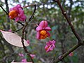 Spindle tree fruits - geograph.org.uk - 1025468.jpg 640 × 480; 61 KB
-
 The Coach house at Keal Cotes - geograph.org.uk - 3006178.jpg 640 × 480; 71 KB
-
 The Coach House pub, Keal Cotes - geograph.org.uk - 3898811.jpg 640 × 480; 48 KB
-
 The Lincolnshire Wolds signpost - geograph.org.uk - 443604.jpg 640 × 480; 93 KB
-
 The road to Old Bolingbroke - geograph.org.uk - 3290186.jpg 640 × 480; 104 KB
-
 The road to Old Bolingbroke - geograph.org.uk - 3290198.jpg 640 × 480; 62 KB
-
 Track at West Keal - geograph.org.uk - 2771384.jpg 640 × 427; 113 KB
-
 Track to East Kirkby Landing Strip - geograph.org.uk - 3430387.jpg 2,256 × 1,504; 2.02 MB
-
 Track to Laythorpe House Farm - geograph.org.uk - 3898793.jpg 640 × 480; 56 KB
-
 Tree on Hall Hill, near West Keal - geograph.org.uk - 720334.jpg 640 × 480; 157 KB
-
 View across the fenlands from above West Keal - geograph.org.uk - 3614498.jpg 1,600 × 1,064; 347 KB
-
 View from the churchyard, West Keal - geograph.org.uk - 6318676.jpg 1,024 × 768; 126 KB
-

-
 Water pipeline works south of Wheelabout Wood - geograph.org.uk - 3615327.jpg 1,600 × 1,064; 304 KB
-
 West Keal - geograph.org.uk - 2771381.jpg 640 × 427; 137 KB
-
 West Keal - geograph.org.uk - 2771399.jpg 640 × 427; 85 KB
-
 West Keal - geograph.org.uk - 3898804.jpg 640 × 480; 42 KB
-
 West Keal church across the fields - geograph.org.uk - 3614493.jpg 1,600 × 1,064; 352 KB
-
 Wild Camomile and Poppies, High Barn - geograph.org.uk - 871551.jpg 640 × 480; 153 KB
-
 Wild Camomile, High Barn - geograph.org.uk - 871555.jpg 640 × 480; 117 KB
-
 Angling in Lincolnshire - geograph.org.uk - 1020582.jpg 640 × 480; 78 KB
-

-
 Bridleway - geograph.org.uk - 444118.jpg 640 × 480; 70 KB
-
 Country lane, West Keal - geograph.org.uk - 565730.jpg 480 × 640; 113 KB
-
 Farm Road near Keal Cotes - geograph.org.uk - 443748.jpg 640 × 480; 90 KB
-
 Farm Track leading to Laythorpe Farm - geograph.org.uk - 443579.jpg 640 × 480; 100 KB
-
 Farm Track near Keal Cotes - geograph.org.uk - 443743.jpg 640 × 480; 96 KB
-
 Farm Track, West Keal - geograph.org.uk - 443618.jpg 640 × 480; 97 KB
-
 Footpath at Hall Hill, near West Keal - geograph.org.uk - 720327.jpg 640 × 480; 91 KB
-

-
 Footpath to Hall Hill, near West Keal - geograph.org.uk - 717542.jpg 640 × 480; 112 KB
-
 Footpath to Hall Hill, near West Keal - geograph.org.uk - 717544.jpg 640 × 480; 96 KB
-
 Footpath to Hall Hill, near West Keal - geograph.org.uk - 717864.jpg 640 × 480; 96 KB
-
 Footpath to Hall Hill, near West Keal - geograph.org.uk - 717875.jpg 640 × 480; 96 KB
-
 Footpath to Hall Hill, near West Keal - geograph.org.uk - 717883.jpg 640 × 480; 123 KB
-
 Footpath to Hall Hill, near West Keal - geograph.org.uk - 717893.jpg 640 × 480; 112 KB
-
 Footpath to Hall Hill, near West Keal - geograph.org.uk - 717901.jpg 640 × 480; 126 KB
-
 Footpath to Hall Hill, near West Keal - geograph.org.uk - 717912.jpg 640 × 480; 109 KB
-
 Footpath to Hall Hill, near West Keal - geograph.org.uk - 717980.jpg 640 × 480; 116 KB
-
 Footpath to Hall Hill, near West Keal - geograph.org.uk - 718052.jpg 640 × 480; 95 KB
-
 Footpath to Hall Hill, near West Keal - geograph.org.uk - 718079.jpg 640 × 480; 128 KB
-
 Hall Hill footpath, near West Keal - geograph.org.uk - 720347.jpg 640 × 480; 115 KB
-
 Hall Hill footpath, near West Keal - geograph.org.uk - 720355.jpg 640 × 480; 153 KB
-
 Hall Hill footpath, near West Keal - geograph.org.uk - 720378.jpg 640 × 480; 108 KB
-
 Hall Hill, near West Keal - geograph.org.uk - 718098.jpg 640 × 480; 91 KB
-
 Hall Hill, near West Keal - geograph.org.uk - 718100.jpg 640 × 480; 81 KB
-
 High Barn - geograph.org.uk - 106415.jpg 640 × 480; 107 KB
-
 High Barn - geograph.org.uk - 721401.jpg 640 × 480; 105 KB
-
 High Barn - geograph.org.uk - 721405.jpg 640 × 480; 99 KB
-
 High Barn - geograph.org.uk - 721411.jpg 640 × 480; 140 KB
-
 High Barn - geograph.org.uk - 721415.jpg 640 × 480; 104 KB
-
 High Barn Hill - geograph.org.uk - 721418.jpg 640 × 480; 78 KB
-
 Junction of the A16(T) and A155 - geograph.org.uk - 443650.jpg 640 × 480; 93 KB
-

-
 Pig Farm near Keal Cotes - geograph.org.uk - 443749.jpg 640 × 480; 47 KB
-
 Road Junction east of Old Bolingbroke - geograph.org.uk - 106422.jpg 640 × 480; 107 KB
-

-

-


.jpg)


,_West_Keal_-_geograph.org.uk_-_3898805.jpg)
_-_geograph.org.uk_-_3898810.jpg)


_-_geograph.org.uk_-_6336745.jpg)


_road,_West_Keal_-_geograph.org.uk_-_869513.jpg)


_and_A155_-_geograph.org.uk_-_443650.jpg)


_road,_West_Keal_-_geograph.org.uk_-_443633.jpg)
_-_geograph.org.uk_-_443642.jpg)
