Category:Wilton, Herefordshire
Jump to navigation
Jump to search
village in Herefordshire, England, UK | |||||
| Upload media | |||||
| Instance of | |||||
|---|---|---|---|---|---|
| Location | Bridstow, Herefordshire, West Midlands, England | ||||
 | |||||
Cymraeg: Pentref yn Swydd Henffordd, Gorllewin Canolbarth Lloegr, Lloegr ydy Wilton. (→Wilton, Swydd Henffordd)
English: Wilton is a village in south Herefordshire, England just under a mile west of the market town of Ross-on-Wye. (→Wilton, Herefordshire)
Polski: Wilton – wieś w Anglii, w hrabstwie Herefordshire. Leży 19 km na południowy wschód od miasta Hereford i 177 km na zachód od Londynu. (→Wilton (Herefordshire))

Subcategories
This category has the following 4 subcategories, out of 4 total.
W
- Wilton wayside cross (2 F)
- Wilton Bridge, Herefordshire (41 F)
Media in category "Wilton, Herefordshire"
The following 68 files are in this category, out of 68 total.
-

-
 A40 bridge, Wilton near Ross-on-Wye - geograph.org.uk - 3192411.jpg 640 × 415; 78 KB
-
 Bales and Chase Hill - geograph.org.uk - 996598.jpg 640 × 480; 61 KB
-

-
 BP garage, Wilton - geograph.org.uk - 4086603.jpg 1,600 × 836; 415 KB
-
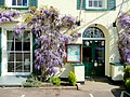 Castle Lodge entrance with wisteria - geograph.org.uk - 1274713.jpg 640 × 480; 222 KB
-
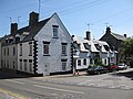
 Castle Lodge Hotel - geograph.org.uk - 1169722.jpg 640 × 460; 91 KB
-

-
 Cedar stump at Castle Lodge. - geograph.org.uk - 1274729.jpg 480 × 640; 219 KB
-
 Celandine-covered bank - geograph.org.uk - 1226106.jpg 640 × 480; 184 KB
-
 Commemorative garden near Wilton Bridge - geograph.org.uk - 1601811.jpg 640 × 480; 205 KB
-
 Converted Granary Mill - geograph.org.uk - 1227121.jpg 640 × 480; 144 KB
-
 Cottages on Wilton Lane - geograph.org.uk - 1300923.jpg 640 × 480; 95 KB
-
 Down the Wye towards the Welsh border - geograph.org.uk - 450966.jpg 640 × 421; 220 KB
-
 Downstream from Wilton Bridge - geograph.org.uk - 1387581.jpg 480 × 640; 85 KB
-
 Drainage Tunnels under the A40 - geograph.org.uk - 167008.jpg 640 × 426; 122 KB
-
 Fast flowing Wye downstream from Wilton - geograph.org.uk - 482300.jpg 640 × 452; 284 KB
-
 Field with a view to Chase Wood - geograph.org.uk - 964049.jpg 640 × 480; 135 KB
-

-
 Footpath from Wilton Village Green - geograph.org.uk - 458699.jpg 640 × 504; 504 KB
-
 Footpath to Wilton Village Green - geograph.org.uk - 1227080.jpg 466 × 640; 161 KB
-
 Formerly, the Bear Inn - geograph.org.uk - 1601806.jpg 640 × 480; 72 KB
-
 Hole in the roof - geograph.org.uk - 1169727.jpg 640 × 480; 90 KB
-
 Hotel garden, Wilton - geograph.org.uk - 1691169.jpg 640 × 480; 118 KB
-

-
 Houses in Wilton - geograph.org.uk - 4862210.jpg 4,608 × 3,456; 1.99 MB
-
 Old barn by the A40 at Wilton - geograph.org.uk - 1274731.jpg 640 × 480; 211 KB
-
 Orles Barn - geograph.org.uk - 1226116.jpg 640 × 480; 99 KB
-
 Pitstop on the River Wye - geograph.org.uk - 453759.jpg 640 × 529; 416 KB
-

-
 River Wye at Wilton - geograph.org.uk - 3620812.jpg 8,858 × 2,800; 7.68 MB
-
 River Wye at Wilton - geograph.org.uk - 619684.jpg 640 × 480; 53 KB
-
 River Wye at Wilton Bridge - geograph.org.uk - 453758.jpg 640 × 465; 318 KB
-

-
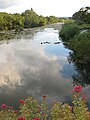
 River Wye from Ross Churchyard (2) - geograph.org.uk - 462149.jpg 640 × 480; 142 KB
-
 Riverside path - geograph.org.uk - 1576510.jpg 640 × 480; 248 KB
-
 Rocks in the river - geograph.org.uk - 1227128.jpg 640 × 480; 139 KB
-
 Sadlers Mill, Wilton, Ross-on-Wye - geograph.org.uk - 4632548.jpg 800 × 648; 153 KB
-
 Shingle bank in the River Wye - geograph.org.uk - 450973.jpg 640 × 515; 505 KB
-
 Simple porch - geograph.org.uk - 1226149.jpg 480 × 640; 90 KB
-
 Swollen River Wye - geograph.org.uk - 482306.jpg 640 × 480; 362 KB
-
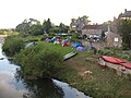 Tent village, Wilton - geograph.org.uk - 1387591.jpg 640 × 480; 96 KB
-
 The Bridge at Wilton - geograph.org.uk - 1226078.jpg 640 × 480; 82 KB
-
 The Bridge at Wilton - geograph.org.uk - 1437865.jpg 640 × 426; 65 KB
-
 The Castle Lodge Hotel (Wilton) - geograph.org.uk - 5894068.jpg 1,920 × 1,080; 1.02 MB
-
 The Castle Lodge Hotel (Wilton) - geograph.org.uk - 5894069.jpg 1,920 × 1,080; 1,012 KB
-
 The Castle Lodge Hotel, Wilton - geograph.org.uk - 1274706.jpg 640 × 481; 238 KB
-
 The Gaol Restaurant - geograph.org.uk - 1169544.jpg 480 × 640; 116 KB
-
 The Pippins - geograph.org.uk - 1226098.jpg 640 × 449; 76 KB
-
 The Pippins, Wilton, Ross-on-Wye - geograph.org.uk - 2672234.jpg 640 × 359; 54 KB
-
 Towards Wilton Bridge - geograph.org.uk - 4086610.jpg 1,600 × 1,063; 535 KB
-

-
 View over Wilton roundabout 1 - geograph.org.uk - 1629299.jpg 640 × 504; 223 KB
-
 View over Wilton roundabout 2 - geograph.org.uk - 1629301.jpg 640 × 604; 254 KB
-
 View to Wilton roundabout - geograph.org.uk - 1274734.jpg 640 × 480; 231 KB
-
 Wilton at dawn - geograph.org.uk - 4795492.jpg 1,600 × 901; 825 KB
-
 Wilton Court from the Wye bank - geograph.org.uk - 763295.jpg 640 × 480; 87 KB
-
 Wilton Court Hotel - geograph.org.uk - 1437858.jpg 426 × 640; 66 KB
-
 Wilton Court Hotel - geograph.org.uk - 1437869.jpg 426 × 640; 78 KB
-
 Wilton Court Hotel and White Lion - geograph.org.uk - 1437868.jpg 640 × 426; 71 KB
-
 Wilton Hall - geograph.org.uk - 1437855.jpg 640 × 426; 76 KB
-
 Wilton Hall, Wilton Lane - geograph.org.uk - 1226052.jpg 640 × 480; 117 KB
-
 Wilton Lane - geograph.org.uk - 1169717.jpg 640 × 467; 84 KB
-
 Wilton Lane - geograph.org.uk - 1226138.jpg 640 × 480; 109 KB
-
 Wilton Lane, Ross-on-Wye - geograph.org.uk - 4459863.jpg 800 × 600; 105 KB
-

-
 Wilton village green - geograph.org.uk - 1301058.jpg 480 × 640; 167 KB
-
 Wye bank at Wilton - geograph.org.uk - 763306.jpg 640 × 480; 102 KB


_-_geograph.org.uk_-_462149.jpg)


_-_geograph.org.uk_-_5894068.jpg)
_-_geograph.org.uk_-_5894069.jpg)


