Category:Wimbledon
Jump to navigation
Jump to search
suburb of London  | |||||
| Upload media | |||||
| Instance of | |||||
|---|---|---|---|---|---|
| Location | London Borough of Merton, Greater London, London, England | ||||
| Population |
| ||||
 | |||||
- This category covers the area of London in general. For the tennis club and associated "Wimbledon" tournament, see Category:All England Club.
Subcategories
This category has the following 59 subcategories, out of 59 total.
A
- Arthur Road, Wimbledon Park (2 F)
C
- Centre Court Shopping Centre (9 F)
- Chester House, Wimbledon (8 F)
D
- Donhead Preparatory School (7 F)
E
- Emmanuel Church, Wimbledon (5 F)
F
H
- Hanford Row, Wimbledon (6 F)
- Hartfield Road, Wimbledon (4 F)
K
- The Kier, Wimbledon (11 F)
L
M
- Maps of Wimbledon (2 F)
N
- Nelson Hospital (11 F)
- New Wimbledon Theatre (17 F)
P
- Polka Theatre (9 F)
R
- Royal Wimbledon Golf Club (4 F)
S
- Southside House (4 F)
- Stamford House, Wimbledon (5 F)
T
- Tuvalu House (2 F)
W
- West Lodge, Wimbledon (6 F)
- West Side House, Wimbledon (7 F)
- Willington School (3 F)
- Wimbledon Bridge (4 F)
- Wimbledon Chase railway station (16 F)
- Wimbledon clock tower (4 F)
- Wimbledon High Street (47 F)
- Wimbledon Manor House (12 F)
- Wimbledon Synagogue (1 F)
- Wimbledon Town Hall (8 F)
- Wimbledon Traincare Depot (53 F)
- St Mark's Church, Wimbledon (13 F)
Media in category "Wimbledon"
The following 200 files are in this category, out of 203 total.
(previous page) (next page)-
De-Wimbledon.ogg 1.8 s; 17 KB
-
 11, 12 & 13 Crooked Billet, Wimbledon, London SW19.jpg 4,752 × 3,168; 6.36 MB
-
 2-HAL Units 015 and 013 at Wimbledon on 02 Dec 1978.jpg 4,800 × 3,144; 5.62 MB
-
 Cottenham Drive, Wimbledon, London, 1960s house.jpg 2,463 × 1,813; 3.78 MB
-
 4 Queen's Road, Wimbledon (01).jpg 4,592 × 3,448; 7.85 MB
-
 4 Queen's Road, Wimbledon (02).jpg 4,592 × 3,448; 10.01 MB
-
 4 Queen's Road, Wimbledon (03).jpg 4,511 × 3,306; 9.16 MB
-
 Alexandra Road, SW19 - geograph.org.uk - 5071085.jpg 1,600 × 1,200; 405 KB
-

-
 Bannister Fletcher's Gothic Windows.jpg 2,448 × 3,264; 2.05 MB
-
 Barclays - panoramio.jpg 3,552 × 2,000; 2.04 MB
-

-

-
 Burghley Road - geograph.org.uk - 5140715.jpg 640 × 360; 80 KB
-
 Burghley Road, Wimbledon - geograph.org.uk - 5159898.jpg 1,600 × 1,200; 494 KB
-
 Camelot Close, Wimbledon - geograph.org.uk - 5826716.jpg 1,024 × 768; 193 KB
-
 Captain Geoffrey George Horn Batty (8244754858).jpg 739 × 794; 70 KB
-
 Car parking spaces in Marryat Road - geograph.org.uk - 3022918.jpg 640 × 480; 84 KB
-
 Centre Court - Wimbledon (2) (7061340199).jpg 1,600 × 1,137; 354 KB
-
 Croydon Tramlink track near Wimbledon.jpg 1,704 × 2,272; 2.26 MB
-
 Cycle shop, Wimbledon.jpg 3,072 × 2,304; 1.35 MB
-

-
 Denmark Avenue - Steep Hill 10^ - geograph.org.uk - 1435649.jpg 640 × 400; 82 KB
-
 Drax Avenue, West Wimbledon - geograph.org.uk - 3044701.jpg 640 × 480; 71 KB
-
 Edge Hill - Steep Hill 12^ - geograph.org.uk - 1435675.jpg 640 × 400; 91 KB
-
 Electricity transformer in Wimbledon 01.jpg 3,024 × 4,032; 4.74 MB
-
 Electricity transformer in Wimbledon 02.jpg 3,024 × 4,032; 4.04 MB
-
 Elimpc-001.jpg 3,498 × 4,707; 2.8 MB
-
 Elimpc-002.jpg 5,147 × 3,432; 16.29 MB
-
 Ely's department store, Wimbledon, London (1).jpg 1,152 × 780; 531 KB
-
 Ely's department store, Wimbledon, London (2).jpg 733 × 694; 322 KB
-
 England 2008-01-19 (2266637457).jpg 1,280 × 944; 277 KB
-
 England 2008-01-19 (2266637759).jpg 1,280 × 866; 240 KB
-
 England 2008-01-19 (2267426596).jpg 1,280 × 1,117; 358 KB
-
 England 2008-01-19 (2267426810).jpg 1,280 × 960; 309 KB
-
 England 2008-01-19 (2267426928).jpg 1,280 × 960; 311 KB
-
 England 2008-01-19 (2279319251).jpg 1,280 × 853; 157 KB
-
 Entrance to The Championships, Wimbledon.jpg 4,032 × 3,024; 3.88 MB
-
 Ethelbert Road, Wimbledon - geograph.org.uk - 3045517.jpg 640 × 480; 88 KB
-
 Fairlawn Road, Wimbledon - geograph.org.uk - 1757304.jpg 640 × 480; 103 KB
-
 Fire Station, Wimbledon, Merton, Greater London, SW19 .jpg 4,500 × 3,725; 4.93 MB
-
 Former World War I Type G Rnas Seaplane Shed (Wimbledon, London UK).jpg 4,500 × 3,001; 4.21 MB
-
 Fridge on the bridge 2.JPG 3,968 × 2,976; 2.46 MB
-
 Fridge on the Bridge.JPG 3,968 × 2,976; 2.63 MB
-
 Gap Road, Wimbledon - geograph.org.uk - 3994632.jpg 2,304 × 1,728; 827 KB
-
 Gothic 19th Century Great Hall.jpg 2,448 × 3,264; 2.63 MB
-
 Hanukkah public menorah Wimbledon 2021.jpg 3,024 × 4,032; 3.15 MB
-
 Hartfield Road. South Wimbledon - geograph.org.uk - 2428344.jpg 640 × 480; 85 KB
-

-
 Haydons Road, Kohat Road - geograph.org.uk - 3540550.jpg 4,320 × 3,240; 7.29 MB
-
 Heorthfest, Wimbledon.png 1,035 × 708; 1.14 MB
-
 Hmvcurzon1.jpg 453 × 604; 68 KB
-
 Horse Trough - Drinking Fountain Within South Park Gardens (Wimbledon, London).jpg 5,000 × 3,563; 6.6 MB
-
 House at WImbledon by Walter Ernest Hewitt.png 894 × 733; 1.14 MB
-
 House on the corner, Wimbledon - geograph.org.uk - 2898909.jpg 640 × 480; 117 KB
-
 ISH Wimbledon2.jpg 3,008 × 1,960; 2.04 MB
-
 ISH Wimbledon3.jpg 3,008 × 1,960; 2.14 MB
-
 Junction of Ricards and Lake Roads - geograph.org.uk - 4121487.jpg 800 × 600; 151 KB
-
 Katharine ( Kay ) Winthrop and Alice Marble from 1937.jpg 1,200 × 946; 202 KB
-
 King's College Uniform from the 1930s..jpg 640 × 480; 110 KB
-
 Le Creuset - panoramio.jpg 3,552 × 2,000; 2.07 MB
-
 Leopold Avenue - geograph.org.uk - 5140724.jpg 640 × 360; 74 KB
-
 Les Belges à Wimbledon.jpg 768 × 1,024; 279 KB
-
 London Buses route 156 Wimbledon.jpg 1,600 × 1,200; 560 KB
-
 London Buses route 164 Wimbledon (1).jpg 1,600 × 1,200; 579 KB
-
 London Buses route 164 Wimbledon.jpg 1,600 × 1,200; 418 KB
-
 London Buses route 219 Wimbledon.jpg 1,600 × 1,200; 670 KB
-
 London DSCF5359.jpg 3,072 × 2,304; 1.37 MB
-
 Looking across Ridgway on Murray Road - geograph.org.uk - 4121684.jpg 4,608 × 3,456; 5.23 MB
-

-

-

-
 Looking downhill in Glendale Drive - geograph.org.uk - 4121433.jpg 800 × 600; 144 KB
-
 Looking downhill on Leopold Road - geograph.org.uk - 4121448.jpg 800 × 600; 108 KB
-
 Looking east on Nelson Grove Road - geograph.org.uk - 3809777.jpg 800 × 600; 118 KB
-
 Looking east on Quicks Road - geograph.org.uk - 3809759.jpg 800 × 600; 108 KB
-

-

-
 Looking into Brockham Close - geograph.org.uk - 4121528.jpg 800 × 600; 186 KB
-
 Looking into Dora Road - geograph.org.uk - 4121456.jpg 800 × 600; 171 KB
-
 Looking into Draxmont - geograph.org.uk - 4120396.jpg 800 × 600; 189 KB
-
 Looking into Helme Close - geograph.org.uk - 4121501.jpg 800 × 600; 175 KB
-

-
 Looking into Pine Grove - geograph.org.uk - 4121520.jpg 800 × 600; 166 KB
-
 Looking into Ricards Road - geograph.org.uk - 4121491.jpg 800 × 600; 157 KB
-
 Looking into Springfield Road - geograph.org.uk - 4121419.jpg 800 × 600; 132 KB
-

-
 Looking into St Mary's Road - geograph.org.uk - 4120393.jpg 800 × 600; 128 KB
-
 Looking north on Lake Road - geograph.org.uk - 4120389.jpg 800 × 600; 159 KB
-

-
 Looking north-east along Alwyne Road - geograph.org.uk - 3024186.jpg 480 × 640; 59 KB
-

-

-
 Looking northwards along The Grange - geograph.org.uk - 4121669.jpg 800 × 600; 173 KB
-

-
 Looking south-west up Marryat Road - geograph.org.uk - 3022910.jpg 640 × 480; 67 KB
-
 Looking southwards along The Grange - geograph.org.uk - 4121664.jpg 800 × 600; 179 KB
-
 Looking uphill on Bernard Gardens - geograph.org.uk - 4121436.jpg 800 × 600; 185 KB
-
 Looking uphill on St Aubyn's Avenue - geograph.org.uk - 4121510.jpg 800 × 600; 154 KB
-
 Main Gates.jpg 3,264 × 2,448; 3.3 MB
-
 Marryat Road - Steep Hill 10^ - geograph.org.uk - 1435595.jpg 640 × 400; 64 KB
-
 Marryat Road, London SW19 - geograph.org.uk - 2292549.jpg 4,320 × 3,240; 3.81 MB
-
 Marryat Road, Wimbledon - geograph.org.uk - 5159860.jpg 1,600 × 1,138; 559 KB
-
 Marryat Road, Wimbledon - geograph.org.uk - 5159895.jpg 1,600 × 1,200; 532 KB
-
 Merton Road, Wimbledon - geograph.org.uk - 3094150.jpg 4,000 × 3,000; 3.89 MB
-
 Merton Road, Wimbledon - geograph.org.uk - 3763419.jpg 2,304 × 1,728; 867 KB
-
 Midmoor Road, Wimbledon - geograph.org.uk - 4325864.jpg 1,600 × 1,064; 357 KB
-
 Midmoor Road, Wimbledon - geograph.org.uk - 4325865.jpg 1,600 × 1,064; 504 KB
-
 Palmerston Road, SW19 - geograph.org.uk - 5071451.jpg 3,993 × 2,611; 1.88 MB
-
 Passing under trees along The Grange - geograph.org.uk - 4121667.jpg 800 × 600; 207 KB
-
 Peek Crescent, Wimbledon - geograph.org.uk - 5159858.jpg 1,600 × 1,164; 616 KB
-
 Pelham Road, Wimbledon - geograph.org.uk - 1599844.jpg 480 × 640; 69 KB
-
 Pelham Road, Wimbledon - geograph.org.uk - 1599853.jpg 480 × 640; 88 KB
-
 Pelham Road, Wimbledon - geograph.org.uk - 5071312.jpg 1,600 × 1,018; 356 KB
-
 Princes Road, Wimbledon - geograph.org.uk - 3828209.jpg 640 × 480; 136 KB
-
 Putney - WImbledon line.gif 765 × 1,032; 48 KB
-
 Queens Road, London SW19 - geograph.org.uk - 2286166.jpg 4,320 × 3,240; 4.11 MB
-
 Railway, Wimbledon.jpg 4,996 × 3,582; 12.31 MB
-
 Redlands, Wimbledon.jpg 1,175 × 1,509; 351 KB
-
 Ridgway Place - Steep Hill 10^ - geograph.org.uk - 1435630.jpg 640 × 400; 90 KB
-
 River Wandle - 31772824147.jpg 3,072 × 2,304; 1.3 MB
-
 River Wandle - 45799036745.jpg 3,072 × 2,304; 1.16 MB
-
-
 Rostrevor Road at the junction of Woodside - geograph.org.uk - 3994429.jpg 2,304 × 1,728; 702 KB
-
 Seymour Rd - geograph.org.uk - 2511534.jpg 640 × 430; 87 KB
-
 Shelton Road, Wimbledon - geograph.org.uk - 35018.jpg 640 × 480; 126 KB
-
 Somerset Road - geograph.org.uk - 5140711.jpg 640 × 360; 93 KB
-

-
 Somerset Road, Wimbledon - geograph.org.uk - 1950952.jpg 640 × 480; 70 KB
-
 Somerset Road, Wimbledon - geograph.org.uk - 5159909.jpg 1,600 × 1,219; 464 KB
-
 South Park Road at the junction of Wycliffe Road - geograph.org.uk - 3763671.jpg 2,304 × 1,728; 824 KB
-
 Spencer Hill, Wimbledon - geograph.org.uk - 1941188.jpg 640 × 480; 107 KB
-
 Spencer Hill, Wimbledon - geograph.org.uk - 2168379.jpg 3,872 × 2,592; 4.17 MB
-
 St Mark's Place, Wimbledon - geograph.org.uk - 677924.jpg 640 × 480; 69 KB
-
 Stop - geograph.org.uk - 1375634.jpg 640 × 514; 70 KB
-
 Strathmore Road - geograph.org.uk - 1303433.jpg 640 × 480; 153 KB
-
 Substation cropped from Sunnyside - Wimbledon (geograph 6587082).jpg 648 × 1,194; 170 KB
-
 Sunnyside - Wimbledon (geograph 6587082).jpg 6,016 × 4,512; 3.77 MB
-
 Sunnyside, Wimbledon - geograph.org.uk - 4386301.jpg 1,600 × 899; 295 KB
-
 Survey in progress on Lake Road - geograph.org.uk - 4121505.jpg 800 × 600; 160 KB
-
 Terpsichore House in merton sept 22.jpg 3,024 × 2,965; 2.19 MB
-
 The Crescent - geograph.org.uk - 2501465.jpg 640 × 430; 68 KB
-
 The Downs, Wimbledon - geograph.org.uk - 3340254.jpg 768 × 1,024; 229 KB
-

-
 The Queen's Target 1.jpg 437 × 500; 22 KB
-
 The Queen's Target 2.jpg 512 × 518; 54 KB
-
 The southern end of Lake Road - geograph.org.uk - 4120388.jpg 800 × 600; 179 KB
-
 Three Houses at Wimbledon.png 1,070 × 734; 1.24 MB
-
 Two K6 Telephone Boxes on Ridgway, Wimbledon - geograph.org.uk - 3298419.jpg 4,205 × 3,103; 5.89 MB
-
 View from Rostrevor Road, Wimbledon - geograph.org.uk - 3994436.jpg 2,304 × 1,728; 741 KB
-
 Wibbandune Sports Ground.jpg 4,032 × 3,024; 4.04 MB
-
 Wibbas Down Inn, Wimbledon, SW19 (3958013789).jpg 2,831 × 1,887; 2.3 MB
-
 Wilton Crescent - geograph.org.uk - 5142311.jpg 3,264 × 2,448; 2.59 MB
-
 Wimble&Dork.png 777 × 918; 33 KB
-
 Wimbledon (7205272858).jpg 4,752 × 3,168; 6.01 MB
-
 Wimbledon (7205274438).jpg 4,752 × 3,168; 6.24 MB
-
 Wimbledon (7205276116).jpg 4,752 × 3,168; 5.62 MB
-
 Wimbledon (7205277354).jpg 4,752 × 3,168; 4.18 MB
-
 Wimbledon (7205280462).jpg 4,752 × 3,168; 5.14 MB
-
 Wimbledon (7205291262).jpg 4,752 × 3,168; 19.1 MB
-
 Wimbledon (7205292790).jpg 4,752 × 3,168; 6.31 MB
-
 Wimbledon (7205294114).jpg 4,752 × 3,168; 6.27 MB
-
 Wimbledon (7205296022).jpg 4,752 × 3,168; 6.3 MB
-
 Wimbledon (7205299388).jpg 3,580 × 2,075; 7.29 MB
-
 Wimbledon (7205301340).jpg 4,752 × 3,168; 7.88 MB
-
 Wimbledon (7205303246).jpg 4,752 × 3,168; 6.94 MB
-
 Wimbledon (7205305484).jpg 3,927 × 2,503; 9.26 MB
-
 Wimbledon (7205307068).jpg 4,752 × 3,168; 6.14 MB
-
 Wimbledon (7205308524).jpg 3,168 × 4,752; 4.94 MB
-
 Wimbledon (7205309918).jpg 4,752 × 3,168; 5.78 MB
-
 Wimbledon (7205313490).jpg 4,752 × 3,168; 14.89 MB
-
 Wimbledon (7205314434).jpg 1,835 × 3,128; 3.61 MB
-
 Wimbledon (7205316002).jpg 4,752 × 3,168; 7 MB
-
 Wimbledon (7217609108).jpg 4,752 × 3,168; 8.06 MB
-
 Wimbledon (7217610574).jpg 3,168 × 4,752; 6.44 MB
-
 Wimbledon (7217612332).jpg 4,752 × 3,168; 7.73 MB
-
 Wimbledon (7217615582).jpg 3,168 × 4,752; 8.61 MB
-
 Wimbledon (7244075718).jpg 4,752 × 3,168; 7.54 MB
-
 Wimbledon (7244078292).jpg 4,752 × 3,168; 9.71 MB
-
 Wimbledon (7244082962).jpg 4,752 × 3,168; 10.4 MB
-
 Wimbledon - Spring on Cannon Hill Lake geograph-2376577-by-Ben-Brooksbank.jpg 1,027 × 750; 526 KB
-
 Wimbledon chase coop 1.jpg 3,024 × 4,032; 3.15 MB
-
 Wimbledon chase coop 2.jpg 4,032 × 3,024; 3.49 MB
-
 Wimbledon chase coop 3.jpg 4,032 × 3,024; 3.48 MB
-
 Wimbledon House by Basil Al Bayati.JPG 1,600 × 1,200; 530 KB
-
 Wimbledon manor house.jpg 1,019 × 675; 182 KB
-
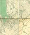 Wimbledon map.jpg 2,218 × 2,585; 4.6 MB
-
 Wimbledon station east entrance.JPG 1,600 × 1,200; 383 KB
-
 Wimbledon, UK (2023-05-12-10-39-41 UMBRA-04).tiff 13,279 × 13,280, 6 pages; 228.77 MB
-
 Wimbledon.jpg 1,920 × 1,080; 571 KB
-
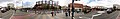
 Wimbledon1.jpg 3,795 × 600; 397 KB
-
 Wimbledon2.jpg 4,190 × 600; 379 KB
-
 Wimbledon3.jpg 3,729 × 600; 326 KB
-
 Wimbledon4.jpg 3,795 × 600; 320 KB
-
 Wimbledonto2017.svg 567 × 319; 28 KB
-
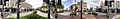
 WimbledonVillage1.jpg 3,574 × 600; 294 KB
-
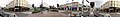
 WimbledonVillage2.jpg 3,513 × 600; 300 KB
-
 WimbledonVillage3.jpg 3,790 × 600; 324 KB
-
 Woodcock House - panoramio.jpg 3,552 × 2,000; 1.84 MB
-
 Woodhayes Road, Wimbledon - geograph.org.uk - 5826730.jpg 1,024 × 768; 234 KB


.jpg)
.jpg)
.jpg)


.jpg)

_(7061340199).jpg)


.jpg)
.jpg)
.jpg)
.jpg)
.jpg)
.jpg)
.jpg)
.jpg)


.jpg)


.jpg)


_Winthrop_and_Alice_Marble_from_1937.jpg)


.jpg)


.jpg)
.jpg)


.jpg)


.jpg)
.jpg)
.jpg)
.jpg)
.jpg)
.jpg)
.jpg)
.jpg)
.jpg)
.jpg)
.jpg)
.jpg)
.jpg)
.jpg)
.jpg)
.jpg)
.jpg)
.jpg)
.jpg)
.jpg)
.jpg)
.jpg)
.jpg)
.jpg)
.jpg)
.jpg)


