Category:London Borough of Merton
Jump to navigation
Jump to search
Boroughs of London: City of London · City of Westminster · Barking and Dagenham · Barnet · Bexley · Brent · Bromley · Camden · Croydon · Ealing · Enfield · Greenwich · Hackney · Hammersmith and Fulham · Haringey · Harrow · Havering · Hillingdon · Hounslow · Islington · Kensington and Chelsea · Kingston · Lambeth · Lewisham · Merton · Newham · Redbridge · Richmond · Southwark · Sutton · Tower Hamlets · Waltham Forest · Wandsworth
borough in the London Region in England    | |||||
| Upload media | |||||
| Instance of | |||||
|---|---|---|---|---|---|
| Location | Greater London, London, England | ||||
| Legislative body |
| ||||
| Executive body |
| ||||
| Head of government |
| ||||
| Inception |
| ||||
| Population |
| ||||
| Area |
| ||||
| Different from | |||||
| official website | |||||
 | |||||
Subcategories
This category has the following 19 subcategories, out of 19 total.
E
F
G
H
N
P
S
T
V
Media in category "London Borough of Merton"
The following 200 files are in this category, out of 1,199 total.
(previous page) (next page)-
 100-112 Morden Road - geograph.org.uk - 4219474.jpg 640 × 423; 130 KB
-
 107-111 London Road - geograph.org.uk - 4990427.jpg 640 × 517; 148 KB
-
 118 Burlington Road - geograph.org.uk - 2926058.jpg 640 × 497; 133 KB
-
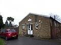
 19th Wimbledon Scout Hut, Cottenham Park - geograph.org.uk - 3412851.jpg 4,288 × 3,216; 7.08 MB
-
 233 Haydons Road, SW19 - geograph.org.uk - 3828196.jpg 640 × 428; 100 KB
-
 241 Haydons Road, SW19 - geograph.org.uk - 3828143.jpg 640 × 480; 100 KB
-
 342-4, London Rd - geograph.org.uk - 3607912.jpg 640 × 430; 66 KB
-
 5 a side pitches, New Malden - geograph.org.uk - 2580064.jpg 640 × 265; 32 KB
-
 86 Bushey Road - geograph.org.uk - 2926045.jpg 640 × 406; 117 KB
-
 A Bailey Bridge across the River Wandle in Mitcham - geograph.org.uk - 4241710.jpg 2,848 × 2,136; 1.5 MB
-
 A path in the Joseph Hood Recreation Park - geograph.org.uk - 5422450.jpg 1,125 × 1,500; 222 KB
-
 A quiet cut-through - geograph.org.uk - 4922243.jpg 1,024 × 768; 271 KB
-
 A secluded bit of the Wandle - geograph.org.uk - 5840686.jpg 1,554 × 1,600; 1.13 MB
-
 A tram approaches Merton Park Tramstop - geograph.org.uk - 5289823.jpg 4,000 × 3,000; 5.08 MB
-
 A217 - A216 junction - geograph.org.uk - 3615512.jpg 640 × 430; 64 KB
-
 A217 - A236 junction - geograph.org.uk - 3615483.jpg 640 × 430; 61 KB
-
 A3 Flyover, Shannon's Corner - geograph.org.uk - 2147039.jpg 4,320 × 3,240; 3.9 MB
-
 A3 Kingston by-pass - geograph.org.uk - 2292627.jpg 4,320 × 3,240; 3.24 MB
-
 Acer, Holland Garden - geograph.org.uk - 2170510.jpg 640 × 480; 102 KB
-
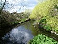
 Across the River Wandle (1) - geograph.org.uk - 2541110.jpg 3,030 × 2,016; 7.77 MB
-
 Across the River Wandle (2) - geograph.org.uk - 2541115.jpg 2,639 × 1,813; 4.36 MB
-
 Alexandra Road, Wimbledon, from the railway - geograph.org.uk - 4373492.jpg 1,600 × 899; 356 KB
-
-
 All weather pitches, Poulter Park - geograph.org.uk - 5657785.jpg 640 × 426; 61 KB
-
 All weather pitches, Poulter Park - geograph.org.uk - 5657786.jpg 640 × 426; 87 KB
-
 Amity Grove, Raynes Park - geograph.org.uk - 5774809.jpg 1,280 × 851; 507 KB
-
 An interesting chain of events^ - geograph.org.uk - 4925210.jpg 1,024 × 768; 214 KB
-
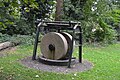 An old millstone, Ravensbury Park - geograph.org.uk - 5653524.jpg 640 × 426; 122 KB
-
 An old signpost - geograph.org.uk - 2017780.jpg 3,872 × 2,592; 4.67 MB
-
 An ornamental brick arch across the River Wandle - geograph.org.uk - 3108007.jpg 4,000 × 3,000; 4.09 MB
-
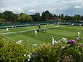 Aorangi Park Tennis Courts - geograph.org.uk - 6236442.jpg 1,280 × 960; 443 KB
-
 Apartments in Queensmere Road, Wimbledon - geograph.org.uk - 3695063.jpg 1,600 × 1,200; 376 KB
-
 Apartments, Queensmere Rd - geograph.org.uk - 2511528.jpg 640 × 430; 56 KB
-
 Apex House, Bushey Road - geograph.org.uk - 2926049.jpg 640 × 458; 154 KB
-

-

-
 Aragon Primary School - geograph.org.uk - 4136700.jpg 640 × 480; 128 KB
-
 Arc of daffodils - geograph.org.uk - 4137321.jpg 640 × 480; 118 KB
-
 Arches, River Wandle - geograph.org.uk - 5648095.jpg 640 × 426; 111 KB
-
 Area for cemetery extension - geograph.org.uk - 4137195.jpg 640 × 480; 127 KB
-
 Argyle Estate - geograph.org.uk - 2511530.jpg 640 × 430; 122 KB
-
 Armfield Crescent - geograph.org.uk - 3615509.jpg 640 × 430; 82 KB
-
 Armfield Crescent - geograph.org.uk - 4937587.jpg 6,000 × 4,000; 4.55 MB
-
 Artesian Well, Wimbledon - geograph.org.uk - 2168856.jpg 640 × 451; 69 KB
-
 Ashcombe Road bridge, Wimbledon - geograph.org.uk - 3296072.jpg 4,288 × 3,216; 5.5 MB
-
 At least the greens are green - geograph.org.uk - 5847120.jpg 4,000 × 3,000; 4.74 MB
-
 Athena House, London Road - geograph.org.uk - 2926036.jpg 640 × 366; 143 KB
-
 B ^Q tower - geograph.org.uk - 2046206.jpg 480 × 640; 39 KB
-
 B272 - A236 junction - geograph.org.uk - 3561519.jpg 640 × 430; 83 KB
-
 B285 - A24 junction - geograph.org.uk - 5648001.jpg 640 × 426; 76 KB
-
 Back alley - geograph.org.uk - 4136824.jpg 640 × 480; 141 KB
-
 Back alley access - geograph.org.uk - 4136814.jpg 640 × 480; 124 KB
-
 Back of bingo hall, Rose Hill - geograph.org.uk - 4136104.jpg 640 × 480; 100 KB
-
 Backs of houses on Aragon Road - geograph.org.uk - 4136720.jpg 640 × 480; 95 KB
-
 Baitul Futuh Mosque, Morden - geograph.org.uk - 4321125.jpg 1,024 × 768; 70 KB
-
 Bank building, Raynes Park - geograph.org.uk - 4134245.jpg 640 × 480; 112 KB
-
 Basement work on Marryat Road - geograph.org.uk - 5159865.jpg 1,600 × 1,128; 451 KB
-
 Battersea Cemetery, Morden - geograph.org.uk - 3320158.jpg 2,048 × 1,536; 1.52 MB
-
 Beck Road on the Willow Lane Industrial Estate - geograph.org.uk - 3899896.jpg 2,560 × 1,920; 1.97 MB
-
 Beddington Lane crossroads, Mitcham Common - geograph.org.uk - 3859485.jpg 1,600 × 1,064; 311 KB
-
 Belgrave Harriers HQ Denmark Road - geograph.org.uk - 4925188.jpg 1,024 × 768; 183 KB
-
 Beverley Brook - geograph.org.uk - 2172571.jpg 480 × 640; 88 KB
-
 Beverley Brook in October - geograph.org.uk - 2646227.jpg 768 × 1,024; 270 KB
-
 Beverley Brook passing through Fishponds Wood - geograph.org.uk - 3225676.jpg 4,000 × 3,000; 4.07 MB
-
 Beverley Brook, Wimbledon Common - geograph.org.uk - 3299703.jpg 4,288 × 3,216; 6.99 MB
-
 Bicycles at Colliers Wood - geograph.org.uk - 5395966.jpg 640 × 360; 85 KB
-
 Bijou Villas , Grand Drive - geograph.org.uk - 3251109.jpg 2,048 × 1,536; 901 KB
-
 Bird watching platform in Morden Hall Park - geograph.org.uk - 5692844.jpg 4,715 × 3,544; 3.92 MB
-
 Block of flats on Phipps Bridge Road, Merton - geograph.org.uk - 3763633.jpg 2,304 × 1,728; 819 KB
-
 Blockage on Beverley Brook, Wimbledon Common - geograph.org.uk - 3299716.jpg 4,288 × 3,216; 6.92 MB
-
 Blossom along the footpath - geograph.org.uk - 4137400.jpg 640 × 480; 184 KB
-

-
 Bluegate Gravel Pit - geograph.org.uk - 3059507.jpg 4,000 × 3,000; 4.01 MB
-
 Bluegate Gravel Pit - geograph.org.uk - 3059510.jpg 4,000 × 3,000; 4.11 MB
-
 Bluegate Gravel Pit - geograph.org.uk - 3059512.jpg 4,000 × 3,000; 4.03 MB
-
 Bluegate Pond - geograph.org.uk - 2169553.jpg 640 × 450; 74 KB
-
 Bluegate Pond - geograph.org.uk - 2169670.jpg 459 × 640; 104 KB
-
 Bluegate Pond - geograph.org.uk - 2169732.jpg 640 × 402; 56 KB
-
 Bluegate Pond - geograph.org.uk - 2172390.jpg 640 × 420; 82 KB
-
 Boardwalk - geograph.org.uk - 5648053.jpg 640 × 426; 88 KB
-
 Boardwalk through the Wetlands - geograph.org.uk - 5838656.jpg 5,184 × 3,456; 2.73 MB
-
 Boardwalk, Morden Hall Park - geograph.org.uk - 5648068.jpg 640 × 426; 90 KB
-
 Boddicott Close - geograph.org.uk - 2511522.jpg 640 × 430; 109 KB
-
 Bodnant Gardens by the A3, Raynes Park - geograph.org.uk - 3857306.jpg 2,560 × 1,920; 2.06 MB
-
 Boundary Business Court - geograph.org.uk - 2877879.jpg 640 × 428; 79 KB
-
 Boundary marker on the corner of Elm Road West - geograph.org.uk - 3320140.jpg 1,536 × 2,048; 1.36 MB
-
 Boundary Road, SW19 - geograph.org.uk - 5604159.jpg 1,600 × 1,067; 484 KB
-
 Bow Lane Screen - geograph.org.uk - 4136891.jpg 640 × 480; 169 KB
-
 Bowls at Haydons Road Recreation Ground - geograph.org.uk - 3094173.jpg 4,000 × 3,000; 3.84 MB
-
 Box junction, A217 - geograph.org.uk - 3615511.jpg 640 × 430; 64 KB
-
 Bramcote Court - geograph.org.uk - 3607863.jpg 640 × 430; 84 KB
-
 Bridge over Beverley Brook - geograph.org.uk - 2172547.jpg 640 × 428; 71 KB
-
 Bridge over the River Wandle - geograph.org.uk - 5653543.jpg 640 × 426; 103 KB
-
 Bridge over the River Wandle, Mitcham.jpg 3,858 × 3,215; 10.77 MB
-
 Bridges Road Mews, Wimbledon - geograph.org.uk - 3763546.jpg 2,304 × 1,728; 762 KB
-
 Britannia Point, Christchurch Road, SW19 - geograph.org.uk - 5604130.jpg 1,042 × 1,600; 376 KB
-

-
 Building site, Mitcham - geograph.org.uk - 4135130.jpg 640 × 480; 94 KB
-
 Building work on Prince George's Avenue - geograph.org.uk - 4133545.jpg 640 × 480; 110 KB
-
 Burger King on the Priory Retail Park - geograph.org.uk - 5198471.jpg 1,500 × 1,104; 166 KB
-
 Burlington Road Roundabout, Shannon's Corner - geograph.org.uk - 2147021.jpg 4,320 × 3,240; 4.33 MB
-
 Burn Bullock - geograph.org.uk - 3607899.jpg 640 × 430; 96 KB
-
 Bus in Christchurch Road - geograph.org.uk - 5671462.jpg 640 × 480; 55 KB
-
 Bus Lane past Morrisons - geograph.org.uk - 5071197.jpg 4,000 × 3,000; 2.38 MB
-
 Bus on Christchurch Road, Collier's Wood - geograph.org.uk - 4759787.jpg 1,024 × 768; 103 KB
-
 Bus stands outside Morden Station - geograph.org.uk - 4304740.jpg 640 × 360; 61 KB
-
 Bus stop in Christ Church Road - geograph.org.uk - 5671456.jpg 640 × 480; 56 KB
-

-
 Bushey Mead - geograph.org.uk - 2170557.jpg 640 × 473; 79 KB
-

-
 Bushey Mead, Greenway - geograph.org.uk - 3567201.jpg 4,320 × 3,240; 5.33 MB
-
 Bushey Mead, Meadway - geograph.org.uk - 3567206.jpg 4,320 × 3,240; 5.47 MB
-
 Bushey Mead, Merton, 1995, Messines Playing Fields - geograph.org.uk - 4693727.jpg 2,439 × 1,497; 2.99 MB
-
-
 Bushey Road flyover at the A3 junction - geograph.org.uk - 5324961.jpg 2,304 × 1,728; 856 KB
-
 Bushey Road flyover crosses West Barnes Lane - geograph.org.uk - 5794769.jpg 768 × 1,024; 154 KB
-
 Buttermere Close, Lower Morden - geograph.org.uk - 6062889.jpg 1,024 × 768; 180 KB
-
 Byegrove Road, London SW19 - geograph.org.uk - 5604147.jpg 1,600 × 1,042; 469 KB
-
 B^Q Extra, Shannon's Corner - geograph.org.uk - 2147032.jpg 4,320 × 3,240; 4.14 MB
-
 Cable bridge and flow gauge - geograph.org.uk - 2584388.jpg 1,024 × 768; 280 KB
-
 Cables entering Wimbledon substation - geograph.org.uk - 2584377.jpg 640 × 480; 105 KB
-
 Camp Road, Wimbledon - geograph.org.uk - 5775042.jpg 1,280 × 851; 625 KB
-
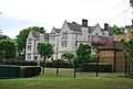
 Cannizaro House - geograph.org.uk - 3059463.jpg 4,000 × 3,000; 4 MB
-
 Cannizaro House Hotel, Wimbledon - geograph.org.uk - 2211352.jpg 4,320 × 3,240; 4.85 MB
-
 Car park off Morden Road - geograph.org.uk - 3863371.jpg 640 × 480; 101 KB
-
 Car park on Wimbledon Common - geograph.org.uk - 5159871.jpg 1,600 × 1,200; 651 KB
-
 Cardinal Avenue, Lower Morden - geograph.org.uk - 3320456.jpg 2,048 × 1,536; 1.56 MB
-
 Cardinal Avenue, near Morden - geograph.org.uk - 6062851.jpg 1,024 × 768; 180 KB
-
 Catherine Court on Lake Road - geograph.org.uk - 4121497.jpg 800 × 600; 175 KB
-
 Cecil Court - geograph.org.uk - 3615469.jpg 640 × 430; 104 KB
-
 Cedar Park Gardens, Wimbledon Common - geograph.org.uk - 2260349.jpg 1,600 × 1,200; 579 KB
-
-

-
 Christ Church, Colliers Wood, hall - geograph.org.uk - 5671469.jpg 640 × 480; 62 KB
-
-
 Christchurch Road, Collier's Wood - geograph.org.uk - 2828323.jpg 3,903 × 2,477; 7.33 MB
-
 Christchurch Road, Colliers Wood - geograph.org.uk - 3763525.jpg 2,304 × 1,728; 884 KB
-
 Christian Science church, Worple Road, Wimbledon - geograph.org.uk - 4330031.jpg 1,600 × 1,064; 402 KB
-
 Church of the Ascencion on Sherwood Park Road - geograph.org.uk - 4039422.jpg 2,560 × 1,920; 2.01 MB
-
 Church Road, Mitcham, Small block of shops 1 - geograph.org.uk - 4774880.jpg 4,912 × 3,274; 7.32 MB
-
 Church Road, Mitcham, Small block of shops 2 - geograph.org.uk - 4774881.jpg 5,692 × 3,713; 7.61 MB
-
 Church Road, Mitcham, Small block of shops 3 - geograph.org.uk - 4774884.jpg 4,911 × 3,275; 7.18 MB
-
 Circle Gardens, SW19 - geograph.org.uk - 4134590.jpg 640 × 480; 129 KB
-
 Citizens Advice Bureau, Mitcham - geograph.org.uk - 3615465.jpg 640 × 430; 107 KB
-
 Clock tower, Vestry Hall - geograph.org.uk - 3607929.jpg 430 × 640; 72 KB
-
 Club House, London Scottish Golf Club - geograph.org.uk - 5283496.jpg 1,600 × 1,200; 412 KB
-
 Clubhouse of London Scottish Golf Club - geograph.org.uk - 2408485.jpg 3,872 × 2,592; 3.59 MB
-
 Clubhouse, London Scottish Golf Club - geograph.org.uk - 2513847.jpg 640 × 430; 52 KB
-
 Coat of arms of the London Borough of Merton.svg 483 × 501; 2.88 MB
-
 Collier's Wood - Terrace Houses on Carter Road - geograph.org.uk - 5095172.jpg 4,160 × 2,336; 6.45 MB
-
 Collier's Wood, nature park - geograph.org.uk - 3754762.jpg 1,024 × 768; 195 KB
-
 Collier's Wood, power lines - geograph.org.uk - 3754765.jpg 746 × 1,024; 151 KB
-
 Collier's Wood, pumping station - geograph.org.uk - 3754752.jpg 1,024 × 768; 136 KB
-
 Colliers Wood - Overground Railway Line - geograph.org.uk - 5095180.jpg 4,160 × 2,336; 6.3 MB
-
 Colliers Wood Recreation Ground - geograph.org.uk - 2947980.jpg 4,000 × 3,000; 4.48 MB
-
 Colliers Wood Recreation Ground - geograph.org.uk - 2958278.jpg 4,000 × 3,000; 3.94 MB
-
 Colliers Wood Recreation Ground - geograph.org.uk - 2958282.jpg 4,000 × 3,000; 4.36 MB
-
 Common dog violet - geograph.org.uk - 2584283.jpg 640 × 480; 121 KB
-
 Commonside East, Mitcham Common - geograph.org.uk - 5338690.jpg 4,000 × 3,000; 5 MB
-
 Confluence of River Graveney with the River Wandle - geograph.org.uk - 2893862.jpg 4,000 × 3,000; 4.08 MB
-
 Coningsby Court, Mitcham - geograph.org.uk - 4135556.jpg 640 × 480; 129 KB
-
 Coombe Hill House, Beverley Way, London SW20 - geograph.org.uk - 2292593.jpg 4,320 × 3,240; 3.77 MB
-
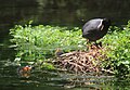
 Coot family - geograph.org.uk - 2592654.jpg 640 × 480; 141 KB
-
 Coot Nest, River Wandle - geograph.org.uk - 5840753.jpg 1,600 × 1,113; 476 KB
-
 Corner shops, St Helier - geograph.org.uk - 2878047.jpg 640 × 480; 108 KB
-
 Cottage in the Morden Hall Park Estate - geograph.org.uk - 2878248.jpg 3,673 × 2,444; 7.8 MB
-
 Cottages on Phipp's Bridge Road, Merton - geograph.org.uk - 2829371.jpg 4,482 × 3,056; 7.92 MB
-
 Cottages, the Ridgway, Wimbledon - geograph.org.uk - 4374379.jpg 1,600 × 899; 391 KB
-
 Cottenham Park Allotments - geograph.org.uk - 2017764.jpg 3,569 × 2,489; 4.58 MB
-
 Cottenham Park Road in autumn - geograph.org.uk - 3225697.jpg 4,000 × 3,000; 4.09 MB
-
 Cottenham Park Road in autumn - geograph.org.uk - 3225698.jpg 3,000 × 4,000; 4.21 MB
-
 Cottenham Park Road, SW20 - geograph.org.uk - 4118822.jpg 1,024 × 775; 186 KB
-
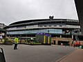 Court 1, All England Tennis Club - geograph.org.uk - 5773598.jpg 960 × 720; 75 KB
-
 Court 1, Wimbledon - geograph.org.uk - 5833189.jpg 1,600 × 1,200; 418 KB
-
 Court 1, Wimbledon - geograph.org.uk - 5833194.jpg 1,600 × 1,200; 336 KB
-
 Court 1, Wimbledon - geograph.org.uk - 5833211.jpg 1,600 × 1,200; 578 KB
-
 Cow Parsley - geograph.org.uk - 4964563.jpg 4,000 × 2,250; 6.25 MB
-
 Crossroads on Southside Common - geograph.org.uk - 4121644.jpg 800 × 600; 126 KB
-
 Crown House on Crown Lane, Morden - geograph.org.uk - 4272067.jpg 2,560 × 1,920; 1.99 MB
-
 Crown House, Crown Lane - geograph.org.uk - 2926025.jpg 640 × 540; 194 KB
-
 Crown House, Morden - geograph.org.uk - 2170730.jpg 640 × 480; 68 KB
-
 Crows on Bluegate Pond - geograph.org.uk - 2169660.jpg 515 × 640; 102 KB
-
 Croydon Road - geograph.org.uk - 4936539.jpg 6,000 × 4,000; 5.93 MB
-
 Cut through to Durnsford Rd - geograph.org.uk - 2501460.jpg 640 × 430; 83 KB
-
 Cutting Weeds in the Wandle - geograph.org.uk - 5838856.jpg 4,660 × 2,743; 2.8 MB
-
 Cycle path on Coombe Lane, near Raynes Park - geograph.org.uk - 5826735.jpg 1,024 × 768; 206 KB
-
 Cyclists on Parkside - geograph.org.uk - 4598728.jpg 640 × 428; 99 KB
-
 Dane Road, Merton - geograph.org.uk - 5837285.jpg 4,752 × 3,180; 2.26 MB
-
 Danger Deep Water, River Wandle.jpg 4,788 × 3,683; 10.91 MB
-
 Debenhams, Wimbledon - geograph.org.uk - 4951772.jpg 640 × 426; 61 KB
-
-
 Dees of Wimbledon, Plough Lane Wimbledon - geograph.org.uk - 3784921.jpg 2,048 × 1,536; 976 KB
-
 Delight, London Rd - geograph.org.uk - 3630919.jpg 640 × 430; 67 KB
-

-
 Derelict shed by the railway line - geograph.org.uk - 2580046.jpg 640 × 308; 42 KB
-
 Development of 7 new houses - geograph.org.uk - 4349936.jpg 640 × 463; 57 KB
-
 Different from all the rest - geograph.org.uk - 4121677.jpg 800 × 600; 167 KB
-
 Distributary of the River Wandle - geograph.org.uk - 5653448.jpg 640 × 426; 114 KB
-
 Disused building, Merton STW - geograph.org.uk - 2585358.jpg 1,024 × 768; 247 KB
-
 Disused filter beds (1) - geograph.org.uk - 2585339.jpg 1,024 × 768; 316 KB


_-_geograph.org.uk_-_2541110.jpg)
_-_geograph.org.uk_-_2541115.jpg)


,_Cottenham_Park_-_geograph.org.uk_-_4412425.jpg)


_-_geograph.org.uk_-_2585339.jpg)