Category:Winstanley, Greater Manchester
Jump to navigation
Jump to search
English: Winstanley is a suburb of Wigan and former civil parish, in the unparished area of Billinge Higher End and Winstanley, in the Wigan district, in the county of Greater Manchester, England.
human settlement in United Kingdom  | |||||
| Upload media | |||||
| Instance of | |||||
|---|---|---|---|---|---|
| Location | Wigan, Greater Manchester, North West England, England | ||||
 | |||||
Media in category "Winstanley, Greater Manchester"
The following 56 files are in this category, out of 56 total.
-
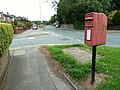
 Bus stop on A571 Pemberton Road - geograph.org.uk - 5224637.jpg 1,024 × 768; 355 KB
-

-
 Cambrian Crescent - geograph.org.uk - 6138066.jpg 1,600 × 900; 349 KB
-
 Cottages on Pemberton Road Winstanley - geograph.org.uk - 1983919.jpg 1,600 × 1,198; 305 KB
-

-
 Cricket ground at Winstanley, Wigan - geograph.org.uk - 4613164.jpg 1,024 × 769; 128 KB
-

-
 Farm track near Cranberry Ley Farm - geograph.org.uk - 4355779.jpg 1,024 × 768; 249 KB
-
 Footbridge over stream near Cranbury Ley Farm - geograph.org.uk - 4355743.jpg 1,024 × 768; 543 KB
-

-
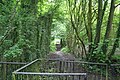
 Footbridge over stream on path in Tan Pit Wood - geograph.org.uk - 4355840.jpg 1,024 × 770; 581 KB
-

-

-

-

-

-
-
 Holmes House Avenue - geograph.org.uk - 1506585.jpg 640 × 426; 76 KB
-

-
 Houses at Springpool, Winstanley - geograph.org.uk - 5224634.jpg 1,024 × 768; 347 KB
-
 Houses on Pemberton Road (A571) - geograph.org.uk - 4015565.jpg 640 × 480; 60 KB
-

-
 Malvern Close - geograph.org.uk - 6138070.jpg 1,600 × 900; 312 KB
-
 New green fields - geograph.org.uk - 2568054.jpg 640 × 427; 69 KB
-
 Notice at Tan Pit Wood - geograph.org.uk - 4356036.jpg 1,024 × 768; 289 KB
-
 Over the wall into the Winstanley Estate - geograph.org.uk - 3228582.jpg 1,024 × 685; 295 KB
-
 Path across old mine wasteland at Winstanley - geograph.org.uk - 4356063.jpg 1,024 × 768; 511 KB
-
 Path off Tan House Drive, New Houses, Winstanley - geograph.org.uk - 4356056.jpg 1,024 × 768; 472 KB
-
 Path through scrub on slag heaps at Winstanley - geograph.org.uk - 4356074.jpg 768 × 1,024; 611 KB
-
 Path to Tan Pit Wood from Tan House Drive - geograph.org.uk - 4356044.jpg 1,024 × 768; 469 KB
-
 Pemberton Road (A571) - geograph.org.uk - 4015563.jpg 640 × 480; 69 KB
-
 Pemberton Road (A571) - geograph.org.uk - 4015566.jpg 640 × 480; 75 KB
-
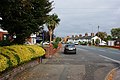 Pemberton Road at Winstanley - geograph.org.uk - 1506566.jpg 640 × 426; 88 KB
-

-
 Roadworks on the A571 Pemberton Road - geograph.org.uk - 5224649.jpg 1,024 × 769; 321 KB
-
 Roadworks on the A571 Pemberton Road - geograph.org.uk - 5224650.jpg 1,024 × 768; 481 KB
-

-
 Rylance Mill Bridge at Pony Dick - geograph.org.uk - 2466602.jpg 640 × 427; 100 KB
-
 Sandyforth Farm, Billinge - geograph.org.uk - 4190844.jpg 800 × 533; 95 KB
-
 Slacky Brow - geograph.org.uk - 3228616.jpg 1,024 × 685; 189 KB
-

-
 Stone cottage on Winstanley Hall estate - geograph.org.uk - 1983926.jpg 1,600 × 1,198; 538 KB
-
 Tan Pit Wood - geograph.org.uk - 1324782.jpg 640 × 427; 135 KB
-
 Tan Pit Wood - geograph.org.uk - 1324812.jpg 640 × 427; 122 KB
-
 Tan Pit Wood - geograph.org.uk - 1324831.jpg 640 × 427; 127 KB
-
 Terraced housing on Pemberton Road - geograph.org.uk - 3540975.jpg 3,567 × 2,034; 1.54 MB
-
 The "erratic" boulder at Springpool in Winstanley - geograph.org.uk - 1983912.jpg 1,600 × 1,198; 727 KB
-
 The Missing Link - geograph.org.uk - 1324868.jpg 640 × 427; 47 KB
-
 The tiny church on Pemberton Road Winstanley - geograph.org.uk - 1983918.jpg 1,600 × 1,198; 377 KB
-
 Track north of Tan Pit Wood, Winstanley - geograph.org.uk - 4355849.jpg 1,024 × 768; 523 KB
-
 Traffic Light controlled junction in Winstanley - geograph.org.uk - 3540976.jpg 4,098 × 2,966; 2.16 MB
-

-
 Wigan Lodge on Pemberton Road Winstanley - geograph.org.uk - 1983921.jpg 1,600 × 1,198; 564 KB
-
 Winstanley Park Cricket Pavilion - geograph.org.uk - 4613141.jpg 1,024 × 768; 235 KB
-
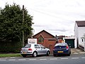
 Winstanley, Holmes House Avenue - geograph.org.uk - 6309549.jpg 800 × 600; 715 KB
-
 Woodland beside the M6 - geograph.org.uk - 4015559.jpg 640 × 539; 59 KB


_-_geograph.org.uk_-_4015565.jpg)


_-_geograph.org.uk_-_4015563.jpg)
_-_geograph.org.uk_-_4015566.jpg)


