Category:Woodham Ferrers
Jump to navigation
Jump to search
English: Woodham Ferrers is a small village about southeast of Chelmsford, located between South Woodham Ferrers and Bicknacre in the county of Essex, England. The village is often shortened to Woodham by those in the area. The village is sometimes erroneously referred to as North Woodham due to its geographical relationship with South Woodham Ferrers.
village in Essex, United Kingdom  | |||||
| Upload media | |||||
| Instance of |
| ||||
|---|---|---|---|---|---|
| Location | Woodham Ferrers and Bicknacre, Chelmsford, Essex, East of England, England | ||||
 | |||||
Subcategories
This category has the following 2 subcategories, out of 2 total.
I
- Ilgar's Manor (2 F)
Media in category "Woodham Ferrers"
The following 30 files are in this category, out of 30 total.
-
 A footpath and bridleway meeting point - geograph.org.uk - 756519.jpg 640 × 480; 110 KB
-
 Bridle Path to Ilgar's Manor - geograph.org.uk - 124738.jpg 640 × 480; 61 KB
-
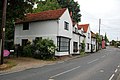 Church Cottages, Woodham Ferrers - geograph.org.uk - 1347477.jpg 640 × 425; 75 KB
-
 Ilgar's Farm - geograph.org.uk - 124760.jpg 640 × 480; 70 KB
-
 Lowest of the low. - geograph.org.uk - 236087.jpg 640 × 480; 89 KB
-
 Part of Woodham Ferrers village - geograph.org.uk - 734082.jpg 640 × 480; 66 KB
-
 River Crouch - geograph.org.uk - 127987.jpg 640 × 257; 44 KB
-
 Sheep on the sea wall - geograph.org.uk - 266096.jpg 640 × 409; 50 KB
-
 Swans At South Woodham Ferrers - geograph.org.uk - 234173.jpg 528 × 396; 48 KB
-
 The View from Bushey Hill - geograph.org.uk - 172569.jpg 640 × 238; 73 KB
-
 Water wheel and pond (geograph 2853213).jpg 2,899 × 1,792; 2.08 MB
-
 A view of Charity Farm - geograph.org.uk - 756525.jpg 640 × 437; 76 KB
-
 Alders, Marsh Farm - geograph.org.uk - 293019.jpg 472 × 640; 93 KB
-
 An old barn at Wellinditch Farm - geograph.org.uk - 757555.jpg 640 × 457; 69 KB
-
 Bushey Hill Dish - geograph.org.uk - 172554.jpg 426 × 640; 140 KB
-
 Compass Gardens - geograph.org.uk - 108938.jpg 640 × 480; 125 KB
-
 Edwin's Hall Road - geograph.org.uk - 734089.jpg 640 × 480; 76 KB
-
 Emberson Lodge - geograph.org.uk - 277623.jpg 640 × 426; 117 KB
-
 Fenn Creek - geograph.org.uk - 108949.jpg 640 × 480; 98 KB
-
 Footpath to Charity Lane - geograph.org.uk - 277642.jpg 426 × 640; 170 KB
-
 Marsh Farm Country Park - geograph.org.uk - 127976.jpg 640 × 480; 76 KB
-
 Meadow Croft Garden Centre - geograph.org.uk - 105209.jpg 640 × 480; 87 KB
-
 Path to Edwins Hall - geograph.org.uk - 129906.jpg 640 × 480; 107 KB
-

-
 Seawall west of Hullbridge - geograph.org.uk - 219710.jpg 640 × 390; 63 KB
-
 Small Creek - Brandy Hole - geograph.org.uk - 150360.jpg 640 × 480; 55 KB
-

-
 The Anchor - geograph.org.uk - 33102.jpg 640 × 453; 370 KB
-
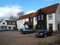 The Bell, Woodham Ferrers - geograph.org.uk - 130004.jpg 640 × 480; 72 KB
-
 Woodham Ferrers Village Hall - geograph.org.uk - 105257.jpg 640 × 480; 89 KB


.jpg)


