Category:Wootton, Isle of Wight
Jump to navigation
Jump to search
settlement on the Isle of Wight, England | |||||
| Upload media | |||||
| Instance of | |||||
|---|---|---|---|---|---|
| Location | Wootton Bridge, Isle of Wight, South East England, England | ||||
 | |||||
Subcategories
This category has the following 9 subcategories, out of 9 total.
M
W
- Woodside Bay, Isle of Wight (3 F)
- Wootton Bridge Methodist Church (13 F)
- Wootton railway station (104 F)
Media in category "Wootton, Isle of Wight"
The following 119 files are in this category, out of 119 total.
-
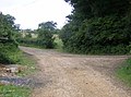 Bridleway junction - geograph.org.uk - 469572.jpg 640 × 477; 91 KB
-

-

-
 Brocks Copse Road - geograph.org.uk - 1420303.jpg 640 × 426; 137 KB
-
 Brocks Copse Road, Wootton - geograph.org.uk - 2653029.jpg 800 × 600; 336 KB
-
 Brocks Copse Road, Wootton - geograph.org.uk - 3381291.jpg 1,600 × 1,263; 372 KB
-
 Brocks Copse Road, Wootton - geograph.org.uk - 395292.jpg 640 × 428; 133 KB
-
 Bungalows on Brooks Copse Road, Wootton - geograph.org.uk - 4680388.jpg 1,200 × 799; 314 KB
-
 Car boot at Wootton (a) - geograph.org.uk - 3664550.jpg 640 × 480; 59 KB
-
 Church Road, Wootton - geograph.org.uk - 3024608.jpg 1,000 × 751; 574 KB
-
 Church Road, Wootton - geograph.org.uk - 3026091.jpg 1,000 × 750; 674 KB
-
 Coast at Lower Woodside - geograph.org.uk - 2006948.jpg 640 × 426; 179 KB
-
 Coastal path on Footways, Wootton - geograph.org.uk - 4680406.jpg 1,200 × 799; 352 KB
-
 Coastal walk on St Edmunds Walk, Wootton - geograph.org.uk - 4680428.jpg 1,200 × 799; 254 KB
-
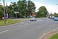 Crossroads at Wootton Common - geograph.org.uk - 519229.jpg 640 × 427; 144 KB
-
 Departing from Wootton - geograph.org.uk - 835091.jpg 480 × 640; 253 KB
-
 Dismantled railway crosses Park Road - geograph.org.uk - 519215.jpg 427 × 640; 149 KB
-
 Felled timber at Wootton Packsfield Road 2.JPG 4,000 × 3,000; 4.79 MB
-
 Felled timber at Wootton Packsfield Road.JPG 4,000 × 3,000; 4.94 MB
-
-
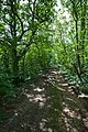
 Footpath^ Not this time - geograph.org.uk - 472504.jpg 640 × 477; 145 KB
-
 Houses at Knight's Cross - geograph.org.uk - 472495.jpg 640 × 477; 103 KB
-
 How it used to be - geograph.org.uk - 835086.jpg 480 × 640; 245 KB
-
 Island Line railway at Wootton Packsfield Lane 2.JPG 4,000 × 3,000; 4.93 MB
-
 Island Line railway at Wootton Packsfield Lane.JPG 4,000 × 3,000; 4.6 MB
-

-
 IWRFC clubhouse, Wootton recreation ground, Isle of Wight, England.jpg 4,000 × 3,000; 3.19 MB
-
 Little Egret at Wootton Creek.JPG 3,712 × 2,088; 3.27 MB
-
 New Road, Woodside - geograph.org.uk - 786408.jpg 640 × 480; 158 KB
-
 Palmers Road - geograph.org.uk - 1035027.jpg 640 × 480; 63 KB
-
 Park Road, Wootton Common - geograph.org.uk - 1332207.jpg 640 × 425; 112 KB
-
 Park Road, Wootton Common - geograph.org.uk - 1332236.jpg 640 × 425; 115 KB
-
 Ryde Pier from Wootton Woodside Beach.JPG 4,000 × 3,000; 4.26 MB
-
 Southern Vectis 1113 HW58 ATF and Wootton Bridge.JPG 3,712 × 2,088; 3.17 MB
-
 Station Road - geograph.org.uk - 1419149.jpg 640 × 426; 100 KB
-
 Station Road - geograph.org.uk - 1419180.jpg 640 × 426; 88 KB
-
 Sunset at Wootton Woodside Beach 2.JPG 3,072 × 2,304; 3.24 MB
-
 Sunset at Wootton Woodside Beach.JPG 3,072 × 2,304; 3.31 MB
-
 The Old Mill Pond, Wootton Bridge - geograph.org.uk - 170525.jpg 640 × 480; 271 KB
-
 The Old School, Wootton - geograph.org.uk - 4681643.jpg 1,200 × 799; 382 KB
-
 The Solent, view from Wootton, IW, UK.jpg 2,018 × 1,496; 1.06 MB
-
 Wightbus 5803 HW54 DCU and Wootton Common Briddlesford Road.JPG 3,712 × 2,088; 3.26 MB
-

-
 WoodBay Beach Looking West - geograph.org.uk - 1660728.jpg 640 × 480; 93 KB
-
 Wootton , Texaco Petrol Station - geograph.org.uk - 2889388.jpg 2,560 × 1,920; 2.36 MB
-
 Wootton Brannon Way car park recycling site.JPG 4,000 × 3,000; 4.87 MB
-
 Wootton Brannon Way public toilets.JPG 4,000 × 3,000; 4.8 MB
-
 Wootton Bridge 2.JPG 4,000 × 3,000; 4.79 MB
-
 Wootton Bridge 3.JPG 4,000 × 3,000; 4.49 MB
-
 Wootton Bridge 4.JPG 4,000 × 3,000; 4.85 MB
-
 Wootton Bridge 5.JPG 4,000 × 3,000; 4.42 MB
-
 Wootton Bridge and Fishbourne signs.JPG 4,000 × 3,000; 5.08 MB
-
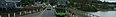 Wootton Bridge Banner 01.jpg 3,712 × 537; 1.05 MB
-
 Wootton Bridge Kite Hill village sign.JPG 4,000 × 3,000; 4.96 MB
-
 Wootton Bridge wildfowl in road sign.JPG 3,712 × 2,088; 3.16 MB
-
 Wootton Bridge.JPG 4,000 × 3,000; 4.86 MB
-
 Wootton Creek - geograph.org.uk - 22960.jpg 640 × 480; 59 KB
-
 Wootton Creek - geograph.org.uk - 25161.jpg 640 × 480; 78 KB
-
 Wootton Creek - geograph.org.uk - 371473.jpg 640 × 480; 94 KB
-
 Wootton Creek at high tide - geograph.org.uk - 1011227.jpg 640 × 480; 69 KB
-
 Wootton Creek at low tide from New Road 2.JPG 4,000 × 3,000; 4.46 MB
-
 Wootton Creek at low tide from New Road.JPG 4,000 × 3,000; 4.51 MB
-
 Wootton Creek Gardens development 2.JPG 4,000 × 3,000; 4.5 MB
-
 Wootton Creek Gardens development.JPG 4,000 × 3,000; 4.94 MB
-
 Wootton Creek harbour 2.JPG 4,000 × 3,000; 4.55 MB
-
 Wootton Creek harbour.JPG 4,000 × 3,000; 4.65 MB
-
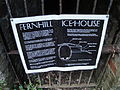 Wootton Fernhill icehouse notice.JPG 4,000 × 3,000; 4.8 MB
-
 Wootton Fernhill icehouse.JPG 4,000 × 3,000; 4.81 MB
-
 Wootton Footways Bottom bus stop.JPG 3,712 × 2,088; 3.11 MB
-
 Wootton Footways Top bus stop 2.JPG 2,088 × 3,712; 3.24 MB
-
 Wootton Footways Top bus stop 3.JPG 2,088 × 3,712; 3.28 MB
-
 Wootton Footways Top bus stop.JPG 3,712 × 2,088; 3.22 MB
-
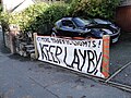 Wootton High Street bottom layby banner.JPG 4,000 × 3,000; 4.95 MB
-
 Wootton High Street bottom layby.JPG 4,000 × 3,000; 4.72 MB
-
 Wootton High Street, Isle of Wight, UK.jpg 2,048 × 1,399; 681 KB
-
 Wootton High Street, IW, UK.jpg 2,048 × 1,536; 685 KB
-
 Wootton House Christmas Lights.JPG 3,328 × 1,872; 1,023 KB
-
 Wootton Hurst Copse 2.JPG 4,000 × 3,000; 4.84 MB
-
 Wootton Hurst Copse.JPG 4,000 × 3,000; 4.93 MB
-
 Wootton Lakeside Park Hotel from Wootton Bridge 2.JPG 4,000 × 3,000; 4.51 MB
-
 Wootton Lakeside Park Hotel from Wootton Bridge.JPG 4,000 × 3,000; 4.46 MB
-
 Wootton Manor - geograph.org.uk - 1419247.jpg 640 × 426; 102 KB
-
 Wootton Mill Square.JPG 4,000 × 3,000; 4.95 MB
-
 Wootton New Road bus stop 2.JPG 3,712 × 2,088; 3.2 MB
-
 Wootton New Road bus stop.JPG 3,712 × 2,088; 3.25 MB
-
 Wootton old Tesco Express store.JPG 4,000 × 3,000; 4.59 MB
-
 Wootton Packsfield Lane railway crossing.JPG 4,000 × 3,000; 4.73 MB
-
 Wootton Sloop Inn recycling site.JPG 4,000 × 3,000; 4.64 MB
-
 Wootton St Edmund's Walk bend bus stop 2.JPG 3,712 × 2,088; 3.23 MB
-
 Wootton St Edmund's Walk bend bus stop 3.JPG 3,712 × 2,088; 3.07 MB
-
 Wootton St Edmund's Walk bend bus stop.JPG 3,712 × 2,088; 3.01 MB
-
 Wootton St Edmund's Walk Bottom bus stop 2.JPG 2,088 × 3,712; 3.1 MB
-
 Wootton St Edmund's Walk Bottom bus stop.JPG 3,712 × 2,088; 2.99 MB
-
 Wootton St Edmund's Walk Top bus stop 2.JPG 3,712 × 2,088; 3.22 MB
-
 Wootton St Edmund's Walk Top bus stop.JPG 2,088 × 3,712; 3.06 MB
-
 Wootton St Edmund's Walk Top bus stops.JPG 3,712 × 2,088; 3.1 MB
-
 Wootton Tesco Express 2.JPG 4,000 × 3,000; 4.54 MB
-
 Wootton Tesco Express.JPG 4,000 × 3,000; 4.47 MB
-
 Wootton village square notice board.JPG 3,000 × 4,000; 4.29 MB
-
 Wootton village square.JPG 4,000 × 3,000; 4.91 MB
-
 Wootton Woodlands Crescent bus stop.JPG 3,712 × 2,088; 3.12 MB
-
 Wootton Woodside Beach 2.JPG 4,000 × 3,000; 4.42 MB
-
 Wootton Woodside Beach 3.JPG 4,000 × 3,000; 4.46 MB
-
 Wootton Woodside Beach.JPG 4,000 × 3,000; 4.5 MB
-
 Wootton Youth Club - geograph.org.uk - 3026104.jpg 1,000 × 750; 614 KB
-
 WoottonCreek.jpg 3,060 × 2,298; 1.18 MB
-

-
 Aldeen, Woodside - geograph.org.uk - 786403.jpg 640 × 480; 109 KB
-
 Bungalows in Brocks Copse Road - geograph.org.uk - 1420306.jpg 640 × 426; 88 KB
-
 Car Ferry Terminal-Fishbourne - geograph.org.uk - 725754.jpg 640 × 380; 44 KB
-

-

-
 Knollwood, Whiterails Road - geograph.org.uk - 519029.jpg 640 × 427; 145 KB
-
 Leaving Fishbourne - geograph.org.uk - 470805.jpg 480 × 640; 59 KB
-

-
 Sailing Classes - geograph.org.uk - 470779.jpg 480 × 640; 86 KB
-

-
 View from a Ferry - geograph.org.uk - 470760.jpg 480 × 640; 87 KB
-
 Wootton Bridge - geograph.org.uk - 371498.jpg 640 × 480; 95 KB


_-_geograph.org.uk_-_3664550.jpg)


