File:Thistlelandslideusgs.jpg
Jump to navigation
Jump to search
No higher resolution available.
Thistlelandslideusgs.jpg (800 × 543 pixels, file size: 150 KB, MIME type: image/jpeg)
Captions
Captions
Add a one-line explanation of what this file represents
Summary[edit]
| Description |
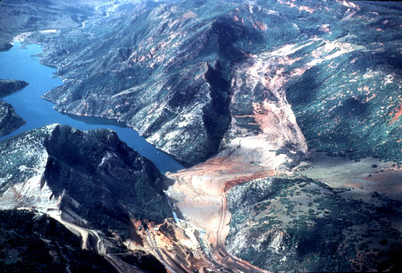
English: The lake that formed from a landslide that dammed the Spanish Fork River and destroyed the town of Thistle. The massive cut visible in the left is construction to relocate US-6 which was inundated by the landslide. |
| Date | |
| Source | http://landslides.usgs.gov/learning/imagepreviews.php |
| Author | R.L. Schuster, U.S. Geological Survey |
Licensing[edit]
This image is in the public domain in the United States because it only contains materials that originally came from the United States Geological Survey, an agency of the United States Department of the Interior. For more information, see the official USGS copyright policy.
|
This file was reviewed on 22 September 2010 by the administrator or trusted user Jappalang (talk), who confirmed the Public Domain status on that date.
|
File history
Click on a date/time to view the file as it appeared at that time.
| Date/Time | Thumbnail | Dimensions | User | Comment | |
|---|---|---|---|---|---|
| current | 02:10, 14 March 2010 | | 800 × 543 (150 KB) | Moabdave (talk | contribs) | {{Information |Description={{en|1=The Lake that formed from a landslide that dammed the Spanish Fork River and destroyed the town of Thistle, Utah, the massive cut visible in the left is construction to relocate US-6 which was inundated by the landsli |
You cannot overwrite this file.
File usage on Commons
The following page uses this file:
File usage on other wikis
The following other wikis use this file:
- Usage on arz.wikipedia.org
- Usage on en.wikipedia.org
- Usage on es.wikipedia.org
- Usage on ja.wikipedia.org
- Usage on pt.wikipedia.org
- Usage on ru.wikipedia.org
- Usage on www.wikidata.org