File:Österreich - NUTS1, NUTS2, NUTS3.png
Jump to navigation
Jump to search
Size of this preview: 733 × 600 pixels. Other resolutions: 293 × 240 pixels | 587 × 480 pixels | 939 × 768 pixels | 1,252 × 1,024 pixels | 2,200 × 1,800 pixels.
Original file (2,200 × 1,800 pixels, file size: 541 KB, MIME type: image/png)
Captions
Captions
Add a one-line explanation of what this file represents

|
This locator map image could be re-created using vector graphics as an SVG file. This has several advantages; see Commons:Media for cleanup for more information. If an SVG form of this image is available, please upload it and afterwards replace this template with
{{vector version available|new image name}}.
It is recommended to name the SVG file “Österreich - NUTS1, NUTS2, NUTS3.svg”—then the template Vector version available (or Vva) does not need the new image name parameter. |
| Description |
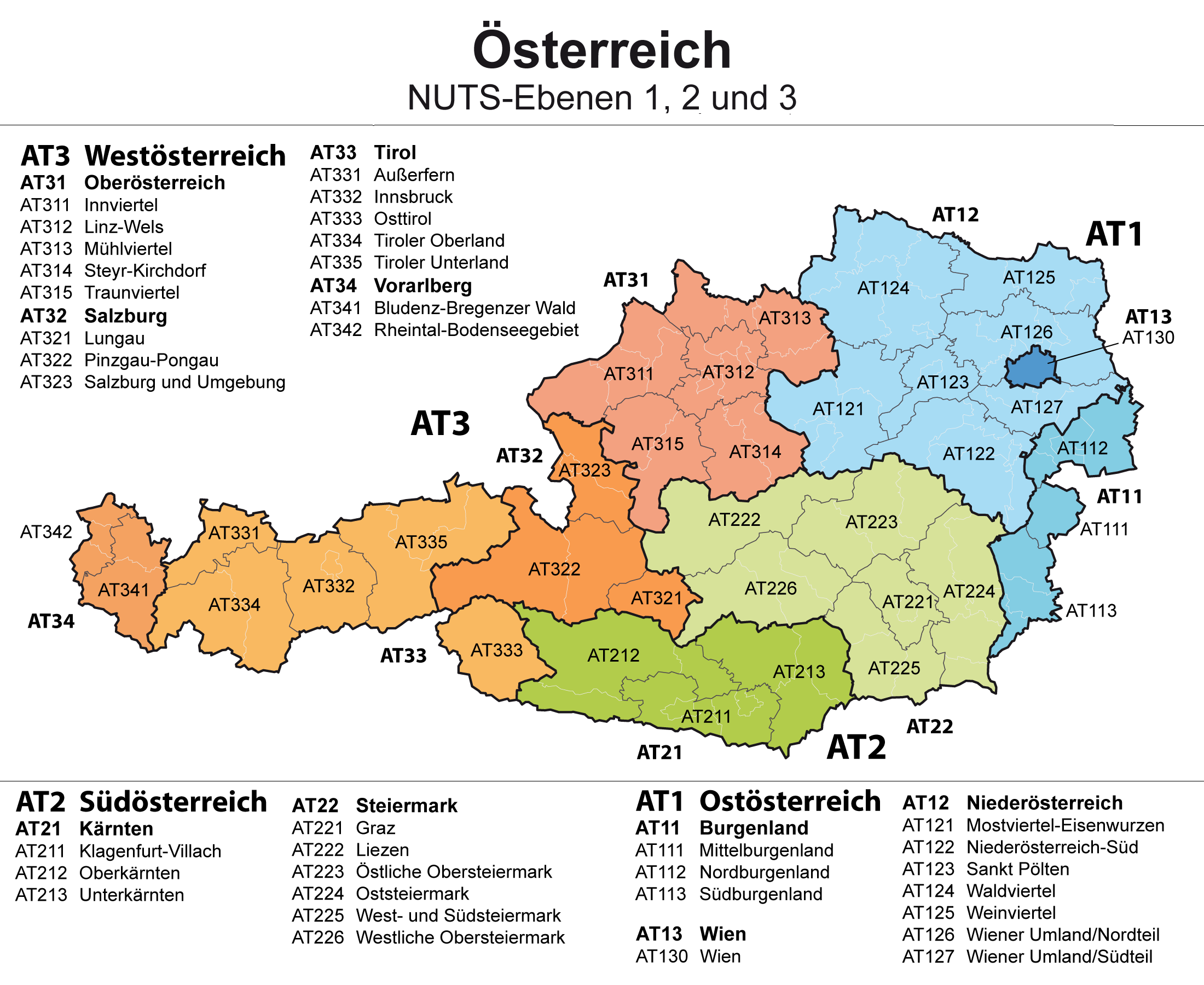
Deutsch: Karte von Österreich: NUTS-Raumeinheiten auf den Ebenen NUTS1, NUTS2 und NUTS3 mit den Grenzen der politischen Bezirke im Hintergrund
English: Map of Austria: NUTS regions on level NUTS1, NUTS2 and NUTS3 |
| Date | |
| Source | Own work |
| Author | Maximilian Dörrbecker (Chumwa) |
| Permission (Reusing this file) |
I, the copyright holder of this work, hereby publish it under the following license: This file is licensed under the Creative Commons Attribution-Share Alike 2.5 Generic license.
Sie dürfen das Bild zu den folgenden Bedingungen nutzen:
|
File history
Click on a date/time to view the file as it appeared at that time.
| Date/Time | Thumbnail | Dimensions | User | Comment | |
|---|---|---|---|---|---|
| current | 20:53, 23 May 2015 | | 2,200 × 1,800 (541 KB) | Kontrollstellekundl (talk | contribs) | cropped |
| 08:22, 9 July 2009 |  | 2,650 × 1,725 (522 KB) | Chumwa (talk | contribs) | AT23 in AT32 korrigiert | |
| 05:47, 15 May 2009 |  | 3,975 × 2,587 (531 KB) | Chumwa (talk | contribs) | {{Information |Description= *{{ de }} Karte von Österreich: NUTS-Raumeinheiten auf den Ebenen NUTS1 und NUTS2 mit den Grenzen der politischen Bezirke im Hintergrund *{{ en }} Map of Germany: NUTS regions on level NUTS1, NUTS2 and NUTS3 |Source=Self made |
You cannot overwrite this file.
File usage on Commons
The following page uses this file:
File usage on other wikis
The following other wikis use this file:
- Usage on az.wikipedia.org
- Usage on bs.wikipedia.org
- Usage on de.wikipedia.org
- Usage on ru.wikipedia.org
- Usage on tr.wikipedia.org
- Usage on uk.wikipedia.org