File:سد کوثر سد کوثر (تنگ دوک) - Kusar Dam in Gachsaran County-Iran3.jpg
Jump to navigation
Jump to search

Size of this preview: 606 × 599 pixels. Other resolutions: 243 × 240 pixels | 485 × 480 pixels.
Original file (800 × 791 pixels, file size: 148 KB, MIME type: image/jpeg)
Captions
Captions
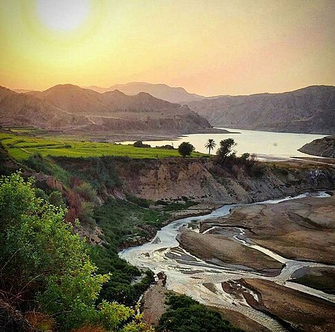
Kusar Dam in Gachsaran County-Iran
 This media file has been nominated for deletion since 15 May 2024. To discuss it, please visit the nomination page.
Do not remove this tag until the deletion nomination is closed. Reason for the nomination: The speedy deletion tag has been changed to regular deletion tag. At the bottom of the pages in the Farsi version of this news agency's website, the license for the content is displayed and mentioned that every use of the contents of this news agency website is allowed by mentioning this website as the source. Please seek help from individuals who have knowledge of the language.
| |||
| |||
_-_Kusar_Dam_in_Gachsaran_County-Iran3.jpg)
Summary[edit]
_-_Kusar_Dam_in_Gachsaran_County-Iran3.jpg&action=edit§ion=1)
| Description |
English: Kusar Dam in Gachsaran County-Iran
فارسی: سد کوثر (تنگ دوک) در فاصله ۴۲ کیلومتری شهرستان بهبهان و ۶۰ کیلومتری شمال غربی شهر دوگنبدان بر روی رودخانه خیرآباد در محل تنگ دوک قرار دارد و از جاذبههاي گردشگري جنوب غرب ايران است که داراي طبيعتي چشمنواز بوده و در ايام تعطيل هدف مسافرت گردشگران در اين منطقه است. |
| Date | |
| Source | https://akharinkhabar.ir/interestings/4527756 |
| Author | Unknown photographer of Akharinkhabar News Agency |
Licensing[edit]
_-_Kusar_Dam_in_Gachsaran_County-Iran3.jpg&action=edit§ion=2)
This file is licensed under the Creative Commons Attribution-Share Alike 4.0 International license.
- You are free:
- to share – to copy, distribute and transmit the work
- to remix – to adapt the work
- Under the following conditions:
- attribution – You must give appropriate credit, provide a link to the license, and indicate if changes were made. You may do so in any reasonable manner, but not in any way that suggests the licensor endorses you or your use.
- share alike – If you remix, transform, or build upon the material, you must distribute your contributions under the same or compatible license as the original.
File history
Click on a date/time to view the file as it appeared at that time.
| Date/Time | Thumbnail | Dimensions | User | Comment | |
|---|---|---|---|---|---|
| current | 00:02, 1 December 2023 | | 800 × 791 (148 KB) | Alireza numberone (talk | contribs) | Uploaded a work by Unknown photographer of Akharinkhabar News Agency from https://akharinkhabar.ir/interestings/4527756 with UploadWizard |
You cannot overwrite this file.
File usage on Commons
There are no pages that use this file.
File usage on other wikis
The following other wikis use this file:
- Usage on fa.wikipedia.org
_-_Kusar_Dam_in_Gachsaran_County-Iran3.jpg&oldid=876616177)