File:亜細亜大観 04 103 "新高山 (臺灣)".jpg
跳至導覽
跳至搜尋

預覽大小:800 × 574 像素。 其他解析度:320 × 230 像素 | 640 × 459 像素 | 1,024 × 735 像素 | 1,280 × 919 像素 | 2,210 × 1,586 像素。
原始檔案 (2,210 × 1,586 像素,檔案大小:591 KB,MIME 類型:image/jpeg)
說明
說明
添加單行說明來描述出檔案所代表的內容
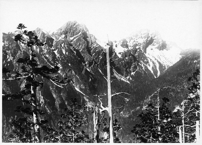
日本統治臺灣後,從事全島的資源調查,當中包含高海拔深山區域的踏查,尤其是全島最高峰玉山。在1896年的二次玉山踏查行程中,隊伍經過玉山西側的阿里山一帶時,注意到了規模廣大,堪稱是「無盡藏」的針葉林。臺灣總督府隨後開啟森林概況的調查,就林業、鐵道以及當地鄒族社會治理進行研析。
摘要
[編輯]
| 描述 |
日本語:
English: After the beginning of Japanese rule, the new colonial administration conducted resource surveys throughout the island, including surveys of high-altitude, deep mountain areas, especially the highest peak on the island, Yushan (then known as Mount Niitaka). In 1896, during two survey expeditions of Yushan, the team passed by the Alishan area, located on the western slopes of Yushan, and noticed large swathes of coniferous forest as far as the eye could see. The Government-General of Taiwan then launched a survey of the forests of Taiwan, analyzing forestry, railways, and the social governance of the local Tsou people. |
| 來源 | 亜細亜大観 第4冊 |
| 作者 |
授權條款
[編輯]
 | ||
 |
致上傳者:請提供來源及出版日期。
|
檔案歷史
點選日期/時間以檢視該時間的檔案版本。
| 日期/時間 | 縮圖 | 尺寸 | 用戶 | 備註 | |
|---|---|---|---|---|---|
| 目前 | 2022年5月8日 (日) 01:58 | | 2,210 × 1,586(591 KB) | Upload for Freedom(對話 | 貢獻) | 上載《004_103.pdf》 |
無法覆蓋此檔案。
檔案用途
下列頁面有用到此檔案:
全域檔案使用狀況
以下其他 wiki 使用了這個檔案:
- zh.wikipedia.org 的使用狀況
%22.jpg&oldid=809458885)