File:1501ANI4306 geo.pdf
Jump to navigation
Jump to search

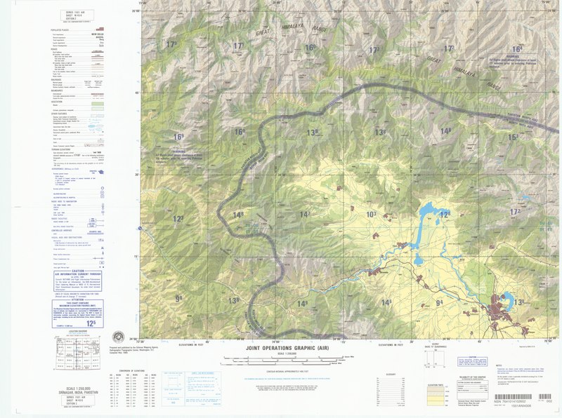
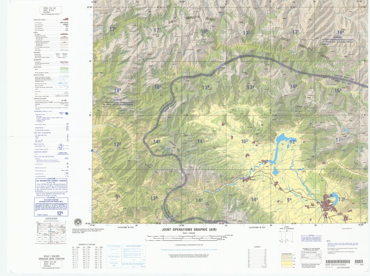
Size of this JPG preview of this PDF file: 800 × 596 pixels. Other resolutions: 320 × 239 pixels | 640 × 477 pixels | 1,024 × 763 pixels | 1,280 × 954 pixels | 2,560 × 1,908 pixels | 4,500 × 3,354 pixels.
Original file (4,500 × 3,354 pixels, file size: 9.58 MB, MIME type: application/pdf)
Captions
Captions
Add a one-line explanation of what this file represents
Summary
[edit]| Description |
English: SRINAGAR, INDIA; PAKISTAN |
| Date | |
| Source | United States Geological Survey ([1]) |
| Author | Defense Mapping Agency |
Licensing
[edit]This work is in the public domain in the United States because it is a work prepared by an officer or employee of the United States Government as part of that person’s official duties under the terms of Title 17, Chapter 1, Section 105 of the US Code.
Note: This only applies to original works of the Federal Government and not to the work of any individual U.S. state, territory, commonwealth, county, municipality, or any other subdivision. This template also does not apply to postage stamp designs published by the United States Postal Service since 1978. (See § 313.6(C)(1) of Compendium of U.S. Copyright Office Practices). It also does not apply to certain US coins; see The US Mint Terms of Use.
|
 | |
| This file has been identified as being free of known restrictions under copyright law, including all related and neighboring rights. | ||
File history
Click on a date/time to view the file as it appeared at that time.
| Date/Time | Thumbnail | Dimensions | User | Comment | |
|---|---|---|---|---|---|
| current | 04:04, 19 May 2020 |  | 4,500 × 3,354 (9.58 MB) | Geographyinitiative (talk | contribs) | Uploaded a work by {{w|Defense Mapping Agency}} from {{w|United States Geological Survey}} ([https://store.usgs.gov/assets/MOD/StoreFiles/NGA/1501ANI4306_geo.pdf]) with UploadWizard |
You cannot overwrite this file.
File usage on Commons
The following page uses this file: