File:1593 Norden's map of Westminster surveyed and publ 1593 (1).jpg
跳转到导航
跳转到搜索
没有更高的分辨率。
1593_Norden's_map_of_Westminster_surveyed_and_publ_1593_(1).jpg (712 × 446像素,文件大小:193 KB,MIME类型:image/jpeg)
说明
说明
添加一行文字以描述该文件所表现的内容
摘要
[编辑].jpg&action=edit§ion=1)
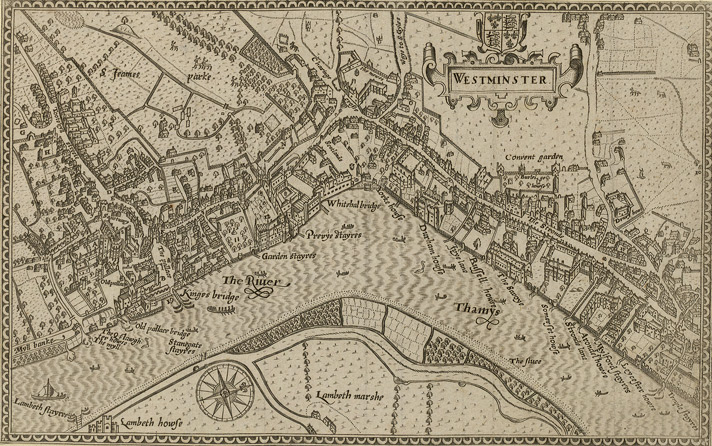
Norden's map of Westminster, surveyed and published 1593. From the Crace Collection at the British Library. The Strand, which is the main road on the right hand side of the map, was in its heyday as the favoured residence of the elite of the English aristocracy, and several of the major mansions located there are labelled on the map.
| 描述 | Norden's map of Westminster. | ||||
| 日期 | |||||
| 来源 | Crace Collection at the British Library. | ||||
| 作者 | Norden | ||||
| 授权 (二次使用本文件) |
|
||||
文件历史
点击某个日期/时间查看对应时刻的文件。
| 日期/时间 | 缩略图 | 大小 | 用户 | 备注 | |
|---|---|---|---|---|---|
| 当前 | 2006年2月16日 (四) 19:10 | | 712 × 446(193 KB) | Merchbow~commonswiki(留言 | 贡献) | Norden's map of Westminster, surveyed and published 1593. From the Crace Collection at the British Library. Category:Maps of London category:City of Westminster |
您不可以覆盖此文件。
文件用途
没有页面使用本文件。
全域文件用途
以下其他wiki使用此文件:
- de.wikipedia.org上的用途
- en.wikipedia.org上的用途
- es.wikipedia.org上的用途
- he.wikipedia.org上的用途
- ja.wikipedia.org上的用途
- nrm.wikipedia.org上的用途
- sco.wikipedia.org上的用途
- zh.wikipedia.org上的用途
.jpg&oldid=868608261)