File:15th century map of Turkey region.jpg
跳至導覽
跳至搜尋
預覽大小:800 × 600 像素。 其他解析度:320 × 240 像素 | 640 × 480 像素 | 1,024 × 768 像素 | 1,280 × 960 像素 | 2,048 × 1,536 像素。
原始檔案 (2,048 × 1,536 像素,檔案大小:884 KB,MIME 類型:image/jpeg)
說明
說明
添加單行說明來描述出檔案所代表的內容
| 描述 |
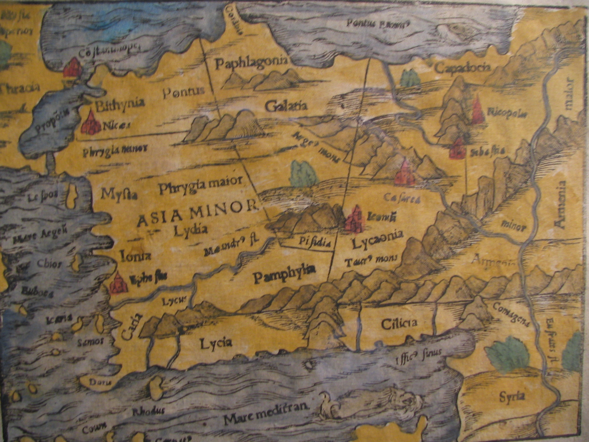
English: Picture of a map of the region of what is now Turkey from the 15th Century. I own this map, having purchased it, and have all official documentation regarding its authenticity. |
||||
| 日期 | 15世紀, Digitized on: 2006年12月10日, 19:42:23 | ||||
| 來源 |
|
||||
| 作者 | 未知, Photographer: Electionworld | ||||
| 授權許可 (重用此檔案) |
此檔案採用創用CC 姓名標示-相同方式分享 2.5 通用版授權條款。
|
||||

檔案歷史
點選日期/時間以檢視該時間的檔案版本。
| 日期/時間 | 縮圖 | 尺寸 | 使用者 | 備註 | |
|---|---|---|---|---|---|
| 目前 | 2018年2月21日 (三) 14:04 | | 2,048 × 1,536(884 KB) | Ket(留言 | 貢獻) | Reverted to version as of 09:40, 17 December 2006 (UTC) |
| 2018年2月21日 (三) 14:03 |  | 2,048 × 1,536(921 KB) | Ket(留言 | 貢獻) | better contrast | |
| 2006年12月17日 (日) 09:40 |  | 2,048 × 1,536(884 KB) | Electionworld(留言 | 貢獻) | {{ew|en|Rarelibra}} == Summary == Picture of a map of the region of what is now Turkey from the 15th Century. I own this map, having purchased it, and have all official documentation regarding its authenticity. == Licensing == {{cc-by-sa-2.5}} |
無法覆蓋此檔案。
檔案用途
全域檔案使用狀況
以下其他 wiki 使用了這個檔案:
- ar.wikipedia.org 的使用狀況
- ast.wikipedia.org 的使用狀況
- bg.wikipedia.org 的使用狀況
- ca.wikipedia.org 的使用狀況
- cs.wikipedia.org 的使用狀況
- da.wikipedia.org 的使用狀況
- de.wikipedia.org 的使用狀況
- el.wikipedia.org 的使用狀況
- en.wikipedia.org 的使用狀況
- Galatia
- Lydia
- Bithynia
- Pamphylia
- Paphlagonia
- Pisidia
- User:Mcasey666
- Seleucia (Pamphylia)
- Lyrbe
- Morka
- Cibyra Minor
- Isba
- Orokenda
- Dicitanaura
- Corycus (Pamphylia)
- Olbia (Pamphylia)
- Tenedos (Pamphylia)
- Aunesis
- Ptolemais (Pamphylia)
- Manava (Pamphylia)
- Kalelibelen
- Sennea
- Kynosarion
- Rhoscopus
- Tetrapyrgia (Pamphylia)
- Limnae (Pamphylia)
- Andeda
- User:Mawer10/sandbox3
- Template:Pamphylia-geo-stub
- eo.wikipedia.org 的使用狀況
檢視此檔案的更多全域使用狀況。