File:17 Grant Street (House), Montclair, Essex County, NJ HABS NJ,7-MONC,4-2.tif
Jump to navigation
Jump to search

Size of this JPG preview of this TIF file: 480 × 599 pixels. Other resolutions: 192 × 240 pixels | 385 × 480 pixels | 615 × 768 pixels | 821 × 1,024 pixels | 1,641 × 2,048 pixels | 4,087 × 5,100 pixels.
Original file (4,087 × 5,100 pixels, file size: 19.88 MB, MIME type: image/tiff)
Captions
Captions
Add a one-line explanation of what this file represents
Summary
[edit]| - 17 Grant Street (House), Montclair, Essex County, NJ | ||||
|---|---|---|---|---|
| Photographer |
Related names:
|
|||
| Title |
- 17 Grant Street (House), Montclair, Essex County, NJ |
|||
| Depicted place | New Jersey; Essex County; Montclair | |||
| Date | Documentation compiled after 1933 | |||
| Dimensions | 4 x 5 in. | |||
| Current location |
Library of Congress Prints and Photographs Division Washington, D.C. 20540 USA http://hdl.loc.gov/loc.pnp/pp.print |
|||
| Accession number |
HABS NJ,7-MONC,4-2 |
|||
| Credit line |
|
|||
| Notes |
|
|||
| References |
|
|||
| Source | https://www.loc.gov/pictures/item/nj1590.photos.380710p | |||
| Permission (Reusing this file) |
|
|||

| Object location | | View this and other nearby images on: OpenStreetMap |
|---|
File history
Click on a date/time to view the file as it appeared at that time.
| Date/Time | Thumbnail | Dimensions | User | Comment | |
|---|---|---|---|---|---|
| current | 16:17, 6 February 2024 | 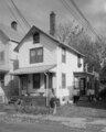 | 4,087 × 5,100 (19.88 MB) | Zeete (talk | contribs) | Cropped 8 % horizontally, 7 % vertically using CropTool with precise mode. |
| 19:57, 28 July 2014 |  | 4,460 × 5,500 (23.4 MB) | Fæ (talk | contribs) | GWToolset: Creating mediafile for Fæ. HABS 24 July 2014 (2301:2600) |
You cannot overwrite this file.
File usage on Commons
The following 2 pages use this file:
File usage on other wikis
The following other wikis use this file:
- Usage on en.wikipedia.org