File:1853 Mitchell Map of Russia - Geographicus - Russia-mitchell-1853.jpg
Jump to navigation
Jump to search
Size of this preview: 504 × 600 pixels. Other resolutions: 202 × 240 pixels | 403 × 480 pixels | 645 × 768 pixels | 860 × 1,024 pixels | 2,521 × 3,000 pixels.
Original file (2,521 × 3,000 pixels, file size: 2.45 MB, MIME type: image/jpeg)
Captions
Captions
Add a one-line explanation of what this file represents
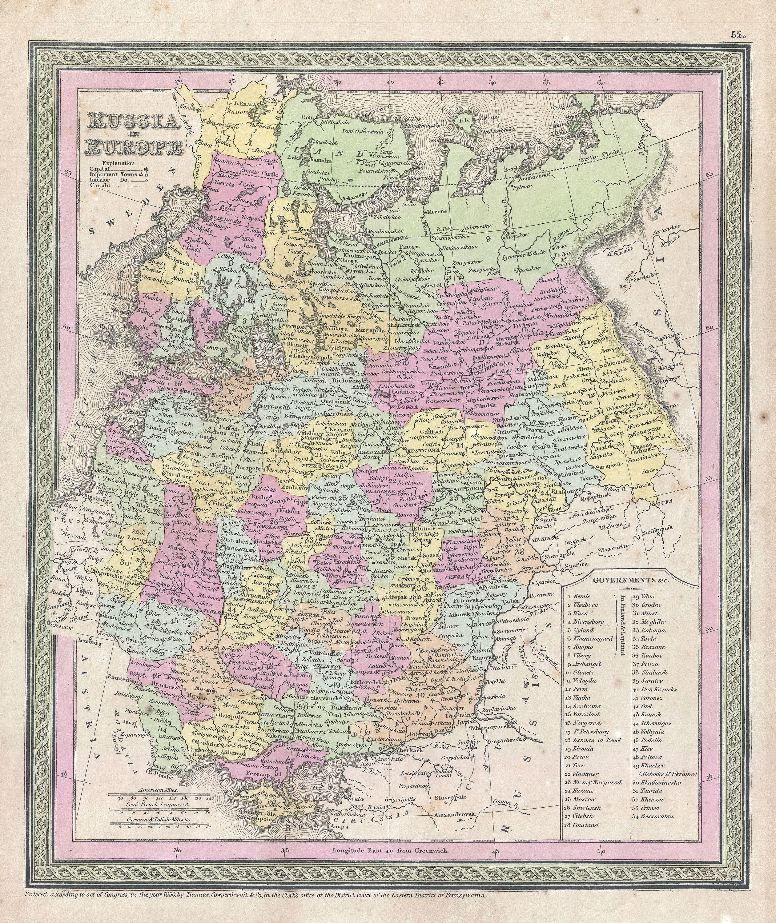
| Samuel Augustus Mitchell: Russia in Europe.
( |
||||||||||||||||||||
|---|---|---|---|---|---|---|---|---|---|---|---|---|---|---|---|---|---|---|---|---|
| Artist |
|
|||||||||||||||||||
| Title |
Russia in Europe. |
|||||||||||||||||||
| Description |
English: An attractive example of S. A. Mitchell Sr.’s 1853 map of the Russia in Europe. Includes the European portions of Russia as well as Finland, Ukraine, Latvia, Lithuania and Estonia. Depicts the entire country color coded according to individual regions. Surrounded by the green border common to Mitchell maps from the 1850s. Prepared by S. A. Mitchell for issued as plate no. 55 in the 1853 edition of his New Universal Atlas . Dated and copyrighted, “Entered according to act of Congress, in the year 1850, by Thomas Cowperthwait & Co., in the Clerks office of the District court of the Eastern District of Pennsylvania. |
|||||||||||||||||||
| Date | 1853 (dated 1850) | |||||||||||||||||||
| Dimensions | height: 12.7 in (32.3 cm); width: 10.5 in (26.6 cm) | |||||||||||||||||||
| Accession number |
Geographicus link: Russia-mitchell-1853 |
|||||||||||||||||||
| Source/Photographer |
Mitchell Sr., S. A.,A New Universal Atlas Containing Maps of the various Empires, Kingdoms, States and Republics Of The World. (1853 issue)
|
|||||||||||||||||||
| Permission (Reusing this file) |
|
|||||||||||||||||||
File history
Click on a date/time to view the file as it appeared at that time.
| Date/Time | Thumbnail | Dimensions | User | Comment | |
|---|---|---|---|---|---|
| current | 01:06, 23 March 2011 | | 2,521 × 3,000 (2.45 MB) | BotMultichillT (talk | contribs) | {{subst:User:Multichill/Geographicus |link=http://www.geographicus.com/P/AntiqueMap/Russia-mitchell-1853 |product_name=1853 Mitchell Map of Russia |map_title=Russia in Europe. |description=An attractive example of S. A. Mitchell Sr.’s 1853 map of the Ru |
You cannot overwrite this file.
File usage on Commons
The following page uses this file: