File:1860 Mitchell's Street Map of Philadelphia - Geographicus - Phili-m-60.jpg
Jump to navigation
Jump to search
Size of this preview: 708 × 600 pixels. Other resolutions: 283 × 240 pixels | 567 × 480 pixels | 906 × 768 pixels | 1,208 × 1,024 pixels | 2,417 × 2,048 pixels | 3,500 × 2,966 pixels.
Original file (3,500 × 2,966 pixels, file size: 3 MB, MIME type: image/jpeg)
Captions
Captions
Add a one-line explanation of what this file represents
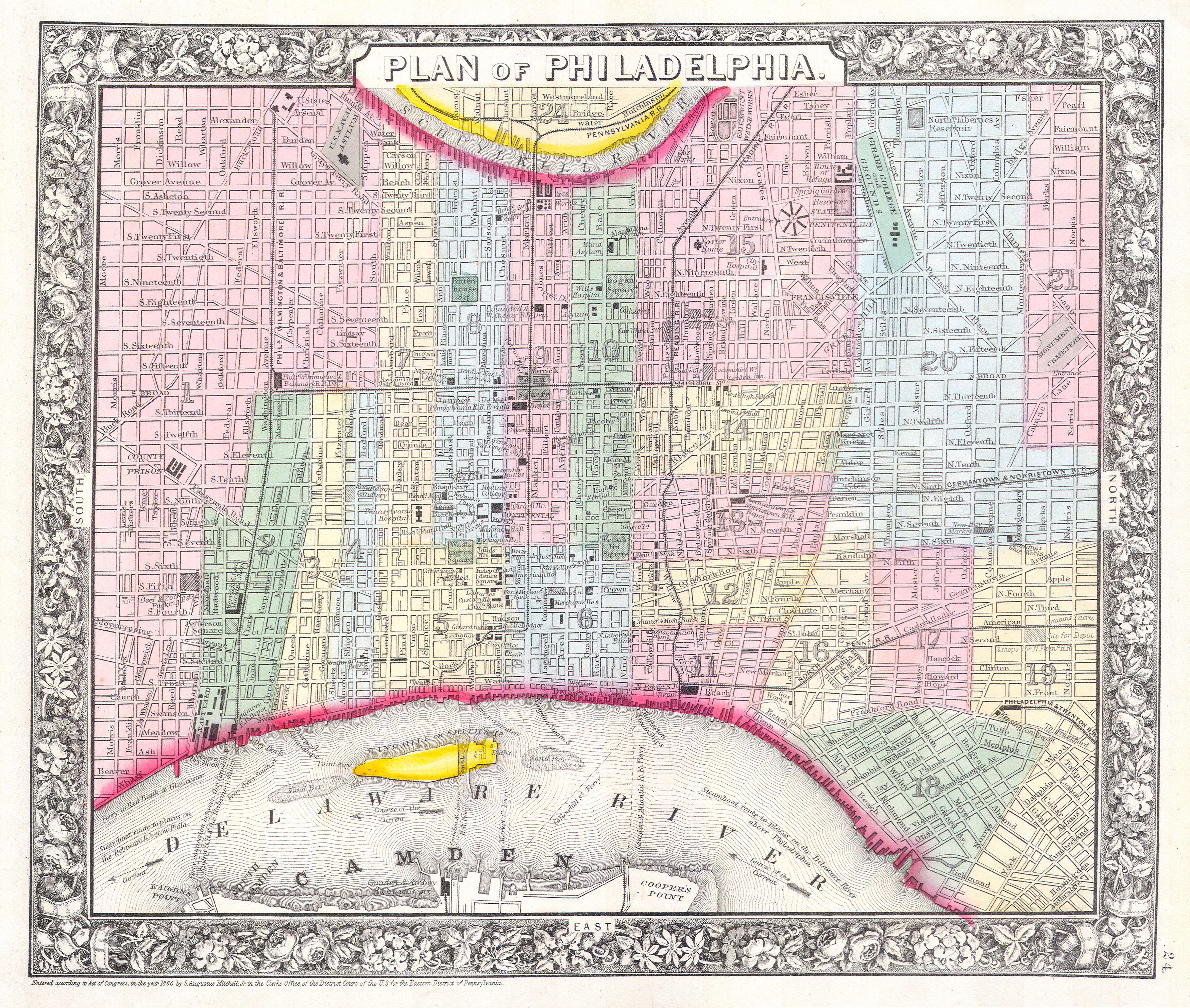
| Samuel Augustus Mitchell: Plan of Philadelphia
( |
||||||||||||||||||||
|---|---|---|---|---|---|---|---|---|---|---|---|---|---|---|---|---|---|---|---|---|
| Artist |
|
|||||||||||||||||||
| Title |
Plan of Philadelphia |
|||||||||||||||||||
| Description |
English: This hand colored item is a copper plate lithograph plan or map of Philadelphia dating to 1860. Produced by the important American cartographer S. A. Mitchell Jr. Depicts the whole of Philadelphia divided into 21 districts or wards. The remarkable detail on this map extends down to the street level and even includes important buildings, churches, and hotels. Also indicates ferries between Camden and Philadelphia and Steamboat routes on the Delaware River. Item is dated and copyrighted 1860. |
|||||||||||||||||||
| Date | 1860 | |||||||||||||||||||
| Dimensions | height: 11 in (27.9 cm); width: 13 in (33 cm) | |||||||||||||||||||
| Accession number |
Geographicus link: Phili-m-60 |
|||||||||||||||||||
| Source/Photographer |
|
|||||||||||||||||||
| Permission (Reusing this file) |
|
|||||||||||||||||||
File history
Click on a date/time to view the file as it appeared at that time.
| Date/Time | Thumbnail | Dimensions | User | Comment | |
|---|---|---|---|---|---|
| current | 21:36, 15 March 2011 | | 3,500 × 2,966 (3 MB) | BotMultichill (talk | contribs) | {{subst:User:Multichill/Geographicus |link=http://www.geographicus.com/P/AntiqueMap/Phili-m-60 |product_name=1860 Mitchell's Street Map of Philadelphia |map_title=Plan of Philadelphia |description=This hand colored item is a copper plate lithograph plan |
You cannot overwrite this file.
File usage on Commons
The following page uses this file: