File:1944-12-15GerWW2BattlefrontAtlas.jpg
Aller à la navigation
Aller à la recherche
Taille de cet aperçu : 621 × 599 pixels. Autres résolutions : 249 × 240 pixels | 497 × 480 pixels | 796 × 768 pixels | 1 254 × 1 210 pixels.
Fichier d’origine (1 254 × 1 210 pixels, taille du fichier : 633 kio, type MIME : image/jpeg)
Légendes
Légendes
Ajoutez en une ligne la description de ce que représente ce fichier
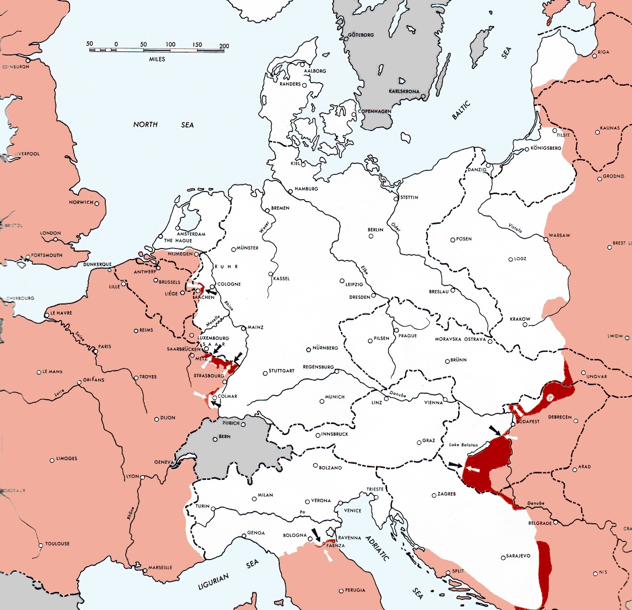
Atlas of the World Battle Fronts - War against Germany: 1944-12-15
← Previous map: 1944-12-01
→ Next map: 1945-01-01
Description[modifier]
| Description |
  July 1, 1943 to June 30 1945 To the Secretary of War". (See Cover, Forward and Map details)  |
| Date | |
| Source | Document "Atlas of the World Battle Fronts in Semimonthly Phases to August 15th 1945: Supplement to The Biennial report of the Chief of Staff of the United States Army July 1, 1943 to June 30 1945 To the Secretary of War" |
| Auteur | Army Map Service |
| Autorisation (Réutilisation de ce fichier) |
Public Domain: Work of US army |
Conditions d’utilisation[modifier]
Cette image est une œuvre d'un soldat ou d'un employé de l'U.S. Army, réalisée dans le cadre de ses activités professionnelles. En tant qu'œuvre du gouvernement fédéral des États-Unis d'Amérique, cette image fait partie du domaine public.
|
 |
Historique du fichier
Cliquer sur une date et heure pour voir le fichier tel qu'il était à ce moment-là.
| Date et heure | Vignette | Dimensions | Utilisateur | Commentaire | |
|---|---|---|---|---|---|
| actuel | 23 mai 2021 à 01:00 | | 1 254 × 1 210 (633 kio) | Hohum (d | contributions) | Reworked from original. |
| 1 mai 2020 à 08:52 |  | 1 254 × 1 210 (906 kio) | Wikirictor (d | contributions) | cropped, enhanced contrast and color | |
| 28 août 2011 à 10:44 |  | 1 254 × 1 210 (1,17 Mio) | Cropbot (d | contributions) | upload cropped version, operated by User:Finavon. Summary: caption cropped | |
| 24 décembre 2007 à 19:09 |  | 1 274 × 1 754 (1,69 Mio) | Mike Young (d | contributions) | {{Information |Description= thumb|left|75pxthumb|right|75pxMap of the front against Germany: This map is taken from the source "Atlas of the World Battle Fronts in Semimonthly |
Vous ne pouvez pas remplacer ce fichier.
Utilisations locales du fichier
Les 2 pages suivantes utilisent ce fichier :
Utilisations du fichier sur d’autres wikis
Les autres wikis suivants utilisent ce fichier :
- Utilisation sur ar.wikipedia.org
- Utilisation sur az.wikipedia.org
- Utilisation sur be.wikipedia.org
- Utilisation sur bg.wikipedia.org
- Utilisation sur da.wikipedia.org
- Utilisation sur en.wikipedia.org
- Utilisation sur en.wikisource.org
- Utilisation sur fr.wikipedia.org
- Utilisation sur id.wikipedia.org
- Utilisation sur ko.wikipedia.org
- Utilisation sur no.wikipedia.org
- Utilisation sur pnb.wikipedia.org
- Utilisation sur pt.wikipedia.org
- Utilisation sur ru.wikipedia.org
- Utilisation sur tr.wikipedia.org
- Utilisation sur uk.wikipedia.org
- Utilisation sur ur.wikipedia.org
- Utilisation sur vi.wikipedia.org