File:1963 MTA master plan of rapid transit extensions.png
Jump to navigation
Jump to search
Size of this preview: 391 × 600 pixels. Other resolutions: 156 × 240 pixels | 313 × 480 pixels | 500 × 768 pixels | 667 × 1,024 pixels | 1,335 × 2,048 pixels | 3,500 × 5,369 pixels.
Original file (3,500 × 5,369 pixels, file size: 38.01 MB, MIME type: image/png)
Captions
Captions
Add a one-line explanation of what this file represents
Summary[edit]
| Description |
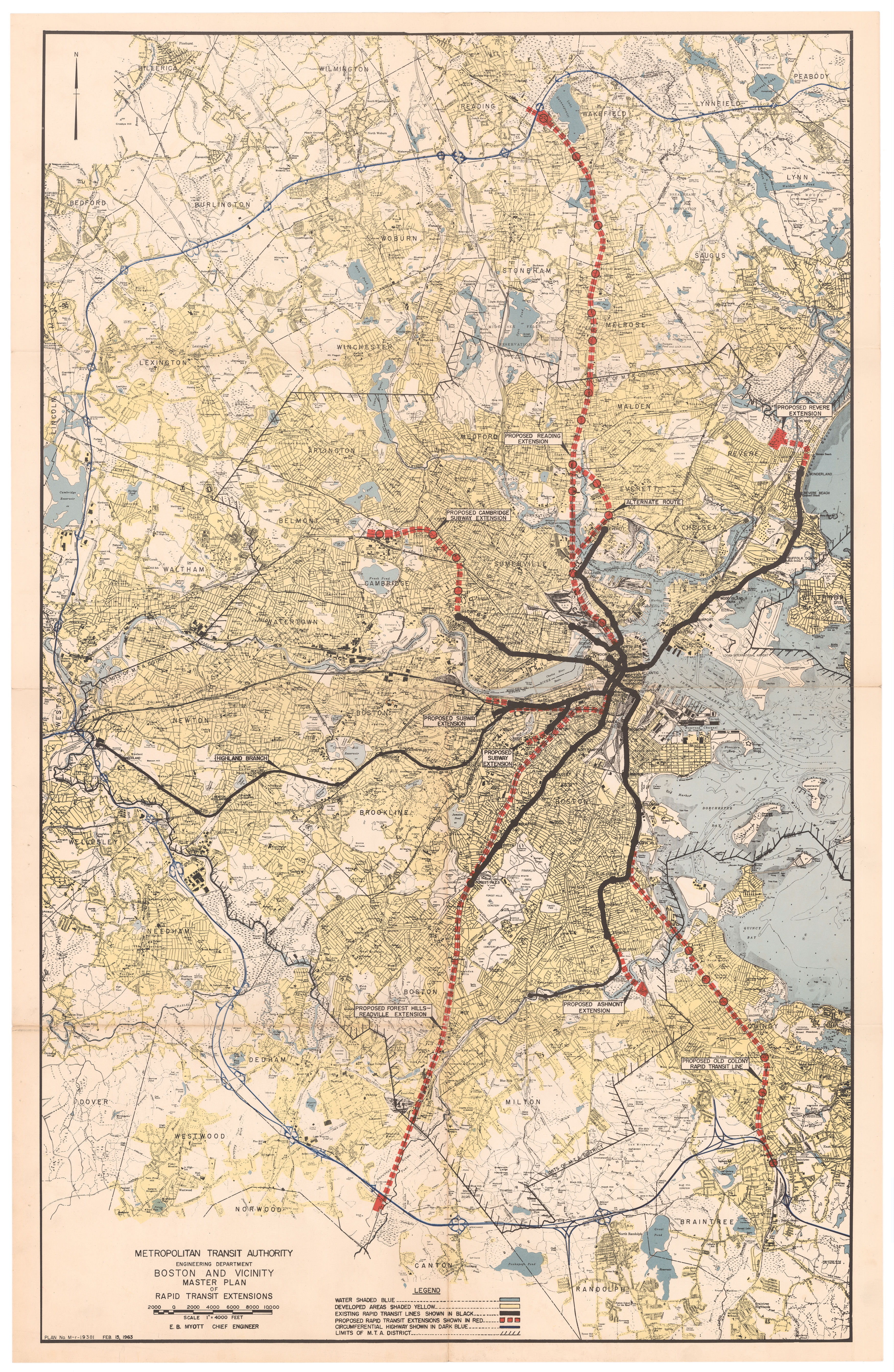
English: A February 1963 map of planned extensions by the Metropolitan Transit Authority. The plan represents the auto-oriented slant of planning at the time; all but one of the extensions terminate at a highway park-and-ride facility. |
||||
| Date | |||||
| Source | Ward Maps | ||||
| Author | Metropolitan Transit Authority | ||||
| Permission (Reusing this file) |
|


File history
Click on a date/time to view the file as it appeared at that time.
| Date/Time | Thumbnail | Dimensions | User | Comment | |
|---|---|---|---|---|---|
| current | 05:04, 11 June 2020 | | 3,500 × 5,369 (38.01 MB) | Pi.1415926535 (talk | contribs) | {{Information |description ={{en|1=A February 1963 map of planned extensions by the Metropolitan Transit Authority. The plan represents the auto-oriented slant of planning at the time; all but one of the extensions terminate at a highway park-and-ride facility.}} |date =1963-02-15 |source =[https://www.wardmaps.com/viewasset.php?aid=20770 Ward Maps] |author =Metropolitan Transit Authority |permission ={{PD-scan|PD-US-no notice}} }} [[Category:Maps of the Metropoli... |
You cannot overwrite this file.
File usage on Commons
The following 3 pages use this file: