File:54.40-navarino-cabo-de-hornos-MP0006594.pdf
Jump to navigation
Jump to search

Size of this JPG preview of this PDF file: 800 × 582 pixels. Other resolutions: 320 × 233 pixels | 640 × 466 pixels | 1,024 × 745 pixels | 1,280 × 932 pixels | 2,560 × 1,864 pixels | 4,254 × 3,097 pixels.
Original file (4,254 × 3,097 pixels, file size: 1.78 MB, MIME type: application/pdf)
Captions
Captions
Add a one-line explanation of what this file represents
Summary
[edit]| Description |
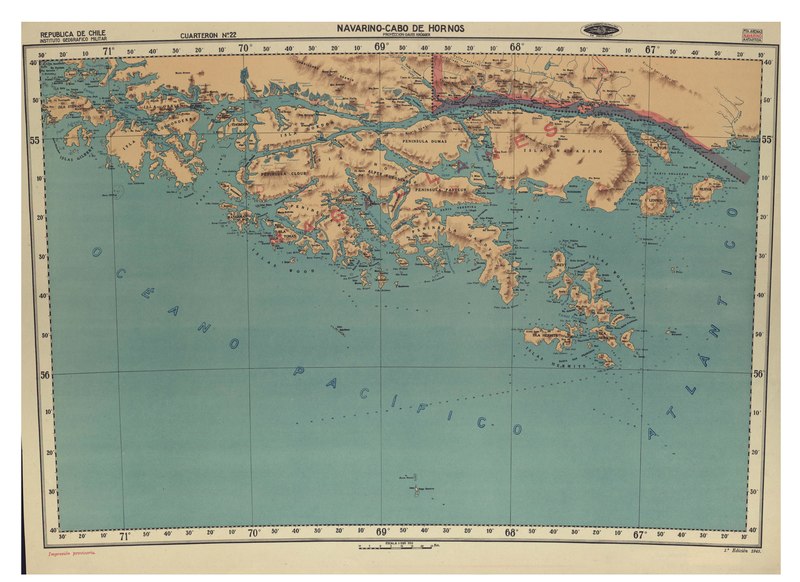
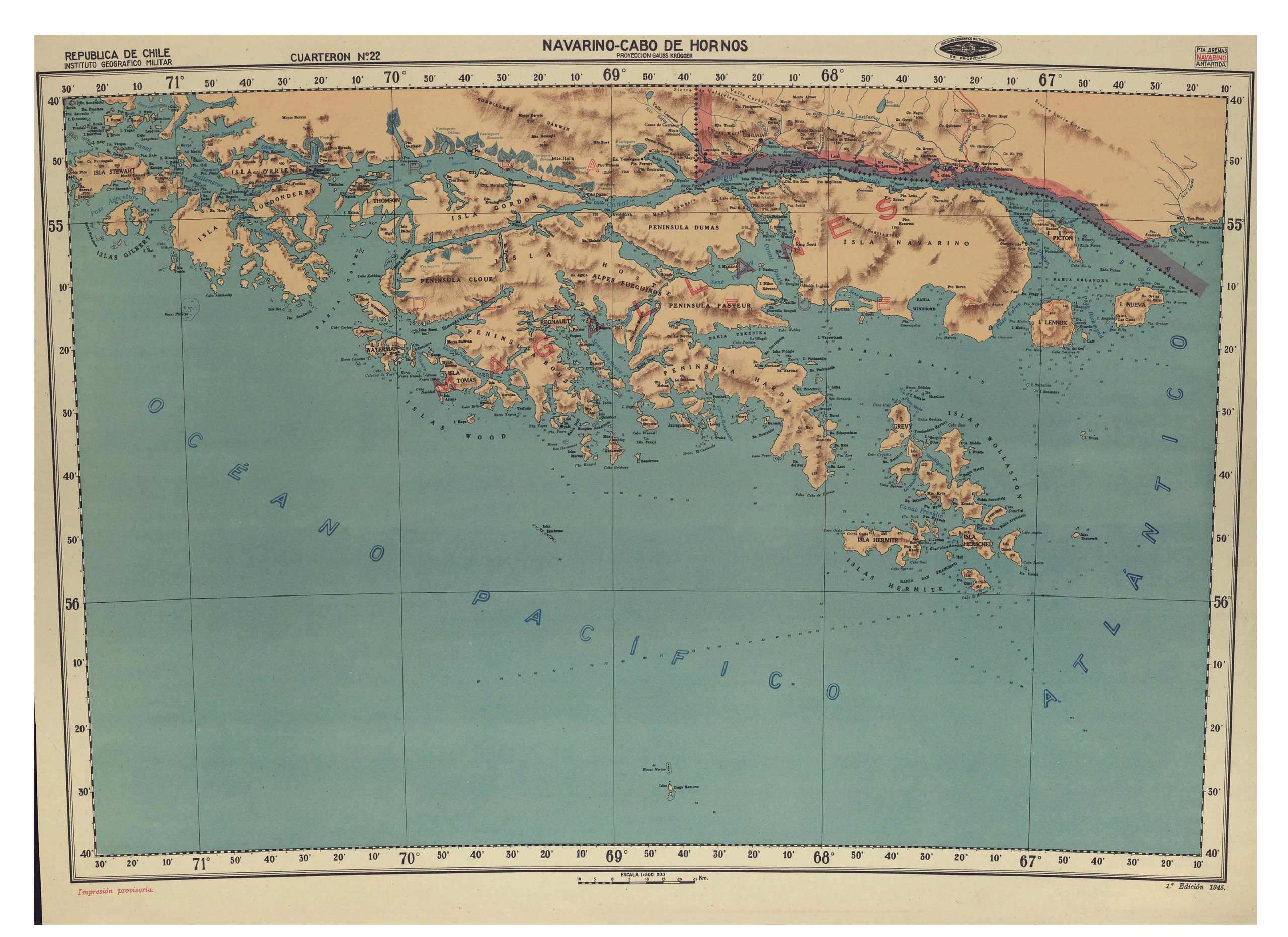
Español: Navarino - Cabo de Horno [material cartográfico] / Instituto Geográfico Militar de Chile. Santiago : Instituto Geográfico Militar de Chile, 1945 1 mapa : color ; 52 x 71 cm, en hoja 56 x 77 cm. . |
| Date | |
| Source | http://www.bibliotecanacionaldigital.gob.cl/bnd/631/w3-article-330159.html |
| Author | Navarino - Cabo de Horno [material cartográfico] / Instituto Geográfico Militar de Chile. Santiago : Instituto Geográfico Militar de Chile, 1945 1 mapa : color ; 52 x 71 cm, en hoja 56 x 77 cm. . |
Licensing
[edit]This file has fallen into the public domain according to Chilean copyright law (No. 17336 and its amendments). Nevertheless, its author and source must be acknowledged.
See here for the type of material that is in the public domain (patrimonio cultural común / common cultural heritage).
|

|
File history
Click on a date/time to view the file as it appeared at that time.
| Date/Time | Thumbnail | Dimensions | User | Comment | |
|---|---|---|---|---|---|
| current | 10:43, 1 October 2020 |  | 4,254 × 3,097 (1.78 MB) | Juan Villalobos (talk | contribs) | Uploaded a work by Navarino - Cabo de Horno [material cartográfico] / Instituto Geográfico Militar de Chile. Santiago : Instituto Geográfico Militar de Chile, 1945 1 mapa : color ; 52 x 71 cm, en hoja 56 x 77 cm. . from http://www.bibliotecanacionaldigital.gob.cl/bnd/631/w3-article-330159.html with UploadWizard |
You cannot overwrite this file.
File usage on Commons
There are no pages that use this file.