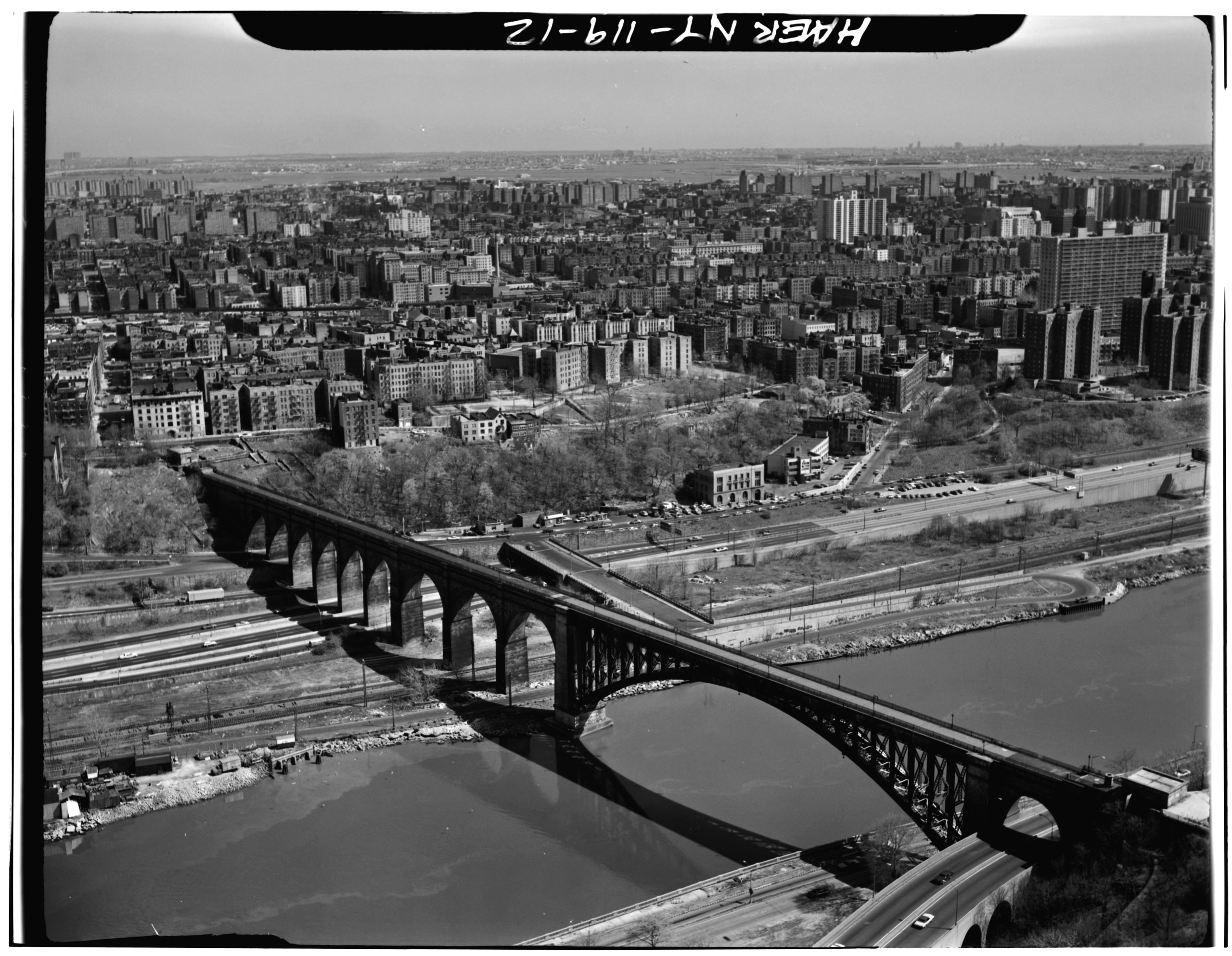
File:AERIAL VIEW OF HIGH BRIDGE LOOKING SOUTHEAST. - Old Croton Aqueduct, Harlem River Crossing, Spanning Harlem River, Bronx, Bronx County, NY HAER NY,3-BRONX,12A-12.tif
Jump to navigation
Jump to search

Size of this JPG preview of this TIF file: 772 × 599 pixels. Other resolutions: 309 × 240 pixels | 619 × 480 pixels | 990 × 768 pixels | 1,280 × 994 pixels | 2,560 × 1,987 pixels | 5,000 × 3,881 pixels.
Original file (5,000 × 3,881 pixels, file size: 18.51 MB, MIME type: image/tiff)
Captions
Captions
Add a one-line explanation of what this file represents
Summary[edit]
| AERIAL VIEW OF HIGH BRIDGE LOOKING SOUTHEAST. - Old Croton Aqueduct, Harlem River Crossing, Spanning Harlem River, Bronx, Bronx County, NY | ||||
|---|---|---|---|---|
| Photographer |
Related names:
|
|||
| Title |
AERIAL VIEW OF HIGH BRIDGE LOOKING SOUTHEAST. - Old Croton Aqueduct, Harlem River Crossing, Spanning Harlem River, Bronx, Bronx County, NY |
|||
| Description |
Includes lower Sedgwick Avenue and its police station |
|||
| Depicted place | New York; Bronx County; Bronx | |||
| Date | Documentation compiled after 1968 | |||
| Dimensions | 4 x 5 in. | |||
| Current location |
Library of Congress Prints and Photographs Division Washington, D.C. 20540 USA http://hdl.loc.gov/loc.pnp/pp.print |
|||
| Accession number |
HAER NY,3-BRONX,12A-12 |
|||
| Credit line |
|
|||
| Notes |
|
|||
| References |
|
|||
| Source | https://www.loc.gov/pictures/item/ny1175.photos.117654p | |||
| Permission (Reusing this file) |
|
|||

| Object location | | View this and other nearby images on: OpenStreetMap |
|---|
File history
Click on a date/time to view the file as it appeared at that time.
| Date/Time | Thumbnail | Dimensions | User | Comment | |
|---|---|---|---|---|---|
| current | 14:39, 29 July 2014 |  | 5,000 × 3,881 (18.51 MB) | Fæ (talk | contribs) | GWToolset: Creating mediafile for Fæ. HABS 24 July 2014 (2301:2600) |
You cannot overwrite this file.
File usage on Commons
The following page uses this file: