File:A general map of the middle British colonies in America viz. Virginia, Maryland, Delaware, Pensilvania, New-Jersey, New York, Connecticut & Rhode-Island- Of Aquanishuonigy the country of the LOC 75692295.tif
Jump to navigation
Jump to search

Size of this JPG preview of this TIF file: 800 × 584 pixels. Other resolutions: 320 × 234 pixels | 640 × 467 pixels | 1,024 × 747 pixels | 1,280 × 934 pixels | 2,560 × 1,868 pixels | 8,107 × 5,916 pixels.
Original file (8,107 × 5,916 pixels, file size: 137.22 MB, MIME type: image/tiff)
Captions
Captions
Add a one-line explanation of what this file represents
Summary
[edit]| Description |
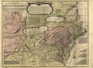
English: Scale ca. 1:2,250,000. Cover titles: An analysis of a map of the middle British colonies in America. Middle British colonies in America. Hand colored. Prime meridian: London and Philadelphia. Relief shown pictorially. "London, printed for John Bowles at the Black Horse in Cornhil, & Carington Bowles in St. Pauls Church Yard." Includes text, historical notes, 3 distance charts, and inset of "A sketch of the remaining part of Ohio R. &c." Accompanied by the author's: Geographical, historical, political, philosophical and mechanical essays. The first containing an analysis of a General map of the middle British colonies in America. 1755. 32 p. LC Maps of North America, 1750-1789, 715 Available also through the Library of Congress Web site as a raster image. Vault AACR2 |
||
| Title | A general map of the middle British colonies in America viz. Virginia, Maryland, Delaware, Pensilvania, New-Jersey, New York, Connecticut & Rhode-Island: Of Aquanishuonigy the country of the confederate Indians comprehending Aquanishuonigy proper, their places of residence, Ohio & Thuchsochruntie their deer hunting countries, Couchsachrage & Skaniadarade their beaver hunting countries, of the Lakes Erie, Ontario and Champlain. Wherein is also shewn the antient & present seats of the Indian nations; carefully copied from the original published at Philadelphia, | ||
| Shelf ID | G3710 1765 .E8 | ||
| Date | |||
| Source | https://www.loc.gov/item/75692295/ | ||
| Author | Evans, Lewis; Bowles, Carington; Bowles, John | ||
| Permission (Reusing this file) |
|
||
| Other versions |
|
||
| Location | Northeastern States · United States | ||
| Part of | Military Battles And Campaigns · American Memory · Catalog · Geography And Map Division · American Revolution And Its Era: Maps And Charts Of North America And The West Indies, 1750-1789 | ||
| Subject | Northeastern States · Maps · Early Works To 1800 · United States |


Licensing
[edit]|
This is a faithful photographic reproduction of a two-dimensional, public domain work of art. The work of art itself is in the public domain for the following reason:
The official position taken by the Wikimedia Foundation is that "faithful reproductions of two-dimensional public domain works of art are public domain".
This photographic reproduction is therefore also considered to be in the public domain in the United States. In other jurisdictions, re-use of this content may be restricted; see Reuse of PD-Art photographs for details. | ||||
File history
Click on a date/time to view the file as it appeared at that time.
| Date/Time | Thumbnail | Dimensions | User | Comment | |
|---|---|---|---|---|---|
| current | 20:14, 20 May 2018 |  | 8,107 × 5,916 (137.22 MB) | Fæ (talk | contribs) | LOC Maps https://www.loc.gov/item/75692295/ #373 |
You cannot overwrite this file.
File usage on Commons
The following page uses this file: