File:A map of the Caribbee Islands - shewing which belong to England, France, Spain, Dutch & Danes collected from the best authorities LOC 2010593377.tif
Jump to navigation
Jump to search

Size of this JPG preview of this TIF file: 388 × 599 pixels. Other resolutions: 155 × 240 pixels | 311 × 480 pixels | 497 × 768 pixels | 663 × 1,024 pixels | 1,327 × 2,048 pixels | 3,864 × 5,964 pixels.
Original file (3,864 × 5,964 pixels, file size: 65.93 MB, MIME type: image/tiff)
Captions
Captions
Add a one-line explanation of what this file represents
Summary
[edit]| Description |
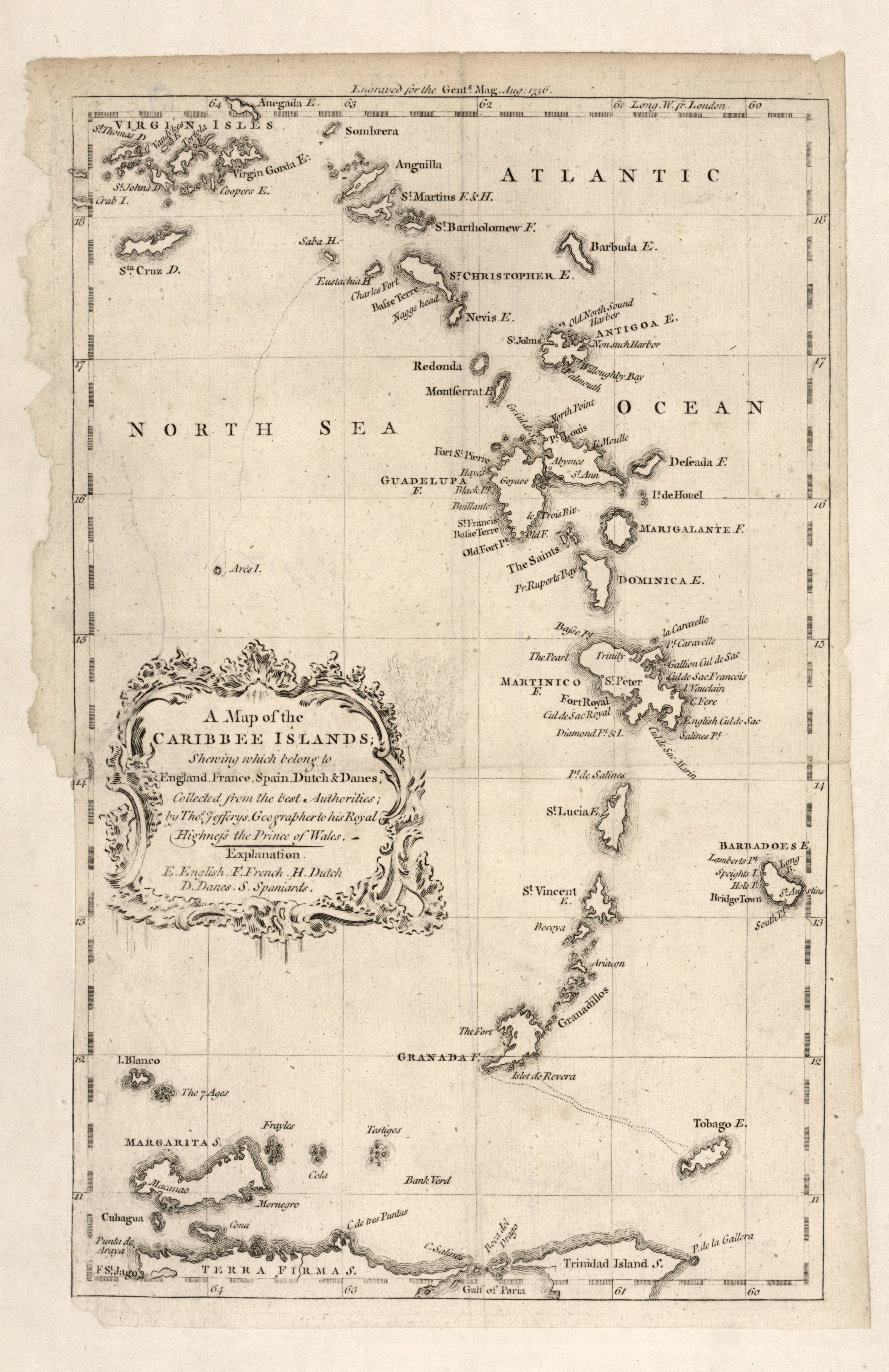
English: In upper margin: Engraved for the Gents. Mag. Aug. 1756. From Gentleman's magazine, and historical chronicle, August 1756, v. 26. LC Maps of North America, 1750-1789, 1962 Available also through the Library of Congress Web site as a raster image. |
||
| Title | A map of the Caribbee Islands : shewing which belong to England, France, Spain, Dutch & Danes collected from the best authorities | ||
| Shelf ID | G4900 1756 .J4 | ||
| Date | |||
| Source | https://www.loc.gov/item/2010593377/ | ||
| Author | Jefferys, Thomas | ||
| Permission (Reusing this file) |
|
||
| Other versions |
|
||
| Location | West Indies · West Indies. | ||
| Part of | Military Battles And Campaigns · American Memory · Catalog · Geography And Map Division · American Revolution And Its Era: Maps And Charts Of North America And The West Indies, 1750-1789 | ||
| Subject | West Indies · Maps · Early Works To 1800 |


Licensing
[edit]|
This is a faithful photographic reproduction of a two-dimensional, public domain work of art. The work of art itself is in the public domain for the following reason:
The official position taken by the Wikimedia Foundation is that "faithful reproductions of two-dimensional public domain works of art are public domain".
This photographic reproduction is therefore also considered to be in the public domain in the United States. In other jurisdictions, re-use of this content may be restricted; see Reuse of PD-Art photographs for details. | ||||
File history
Click on a date/time to view the file as it appeared at that time.
| Date/Time | Thumbnail | Dimensions | User | Comment | |
|---|---|---|---|---|---|
| current | 21:59, 26 September 2018 |  | 3,864 × 5,964 (65.93 MB) | Fæ (talk | contribs) | LOC Maps https://www.loc.gov/item/2010593377/ #9315 |
You cannot overwrite this file.
File usage on Commons
The following page uses this file: