File:A plan of the city of Philadelphia and environs (NYPL b15022058-434754).jpg

Original file (8,855 × 9,046 pixels, file size: 24.26 MB, MIME type: image/jpeg)
Captions
Captions
| Warning | The original file is very high-resolution. It might not load properly or could cause your browser to freeze when opened at full size. |
|---|
Summary
[edit]| Description |
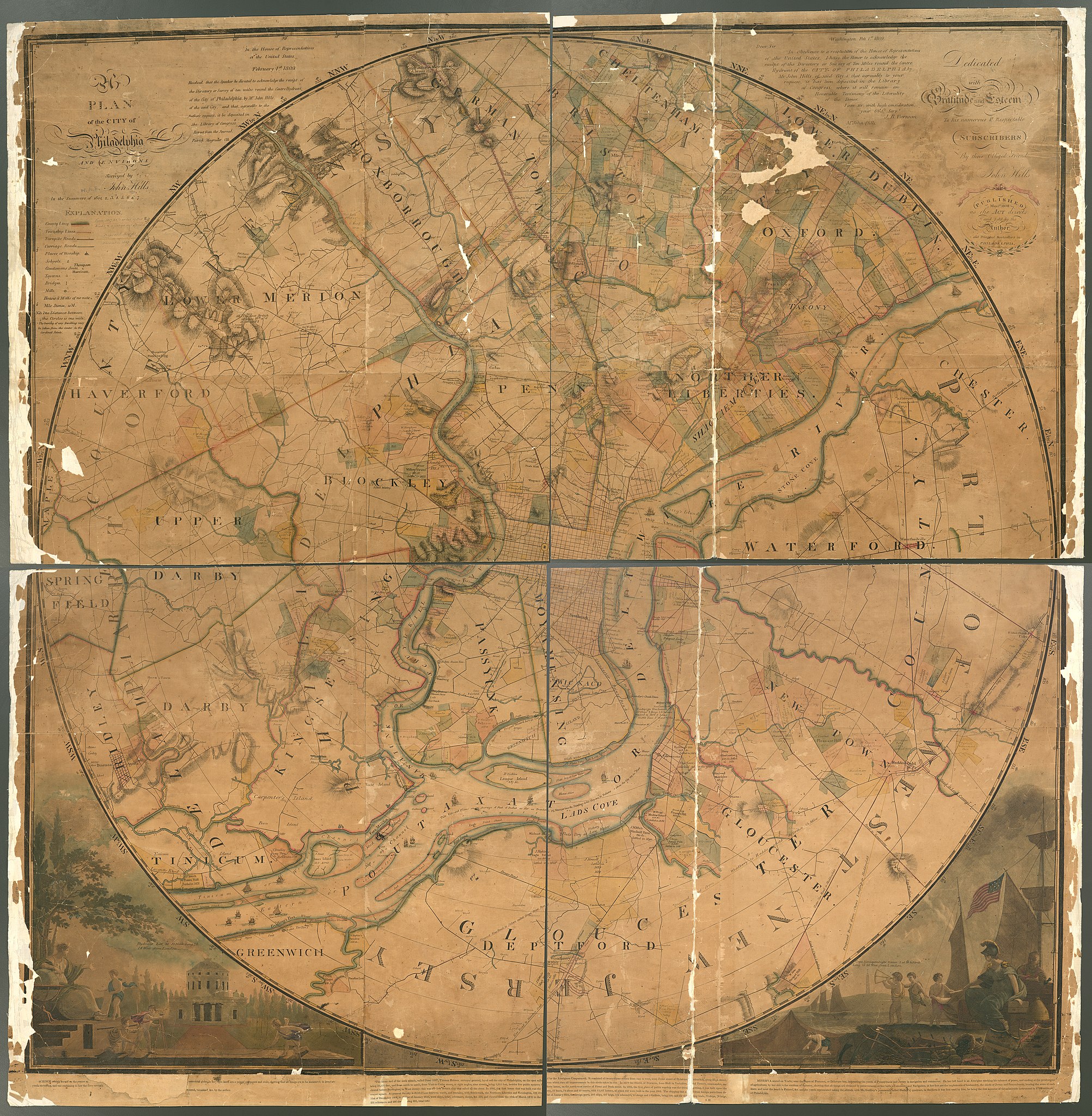
English: * "Published May 1st 1808, as the act directs and sold by the author, and principal booksellers in Philadelphia."
|
||
| Title | A plan of the city of Philadelphia and environs | ||
| Date | [i.e. 1809] | ||
| Source | https://digitalcollections.nypl.org/items/510d47da-f03d-a3d9-e040-e00a18064a99 | ||
| Author | Scan by NYPL | ||
| Permission (Reusing this file) |
|
||
| Other versions |
|
||
| UUID | 7e67e780-c52b-012f-049d-3c075448cc4b | ||
| MODS | http://api.repo.nypl.org/api/v1/items/mods/510d47da-f03d-a3d9-e040-e00a18064a99 | ||
| Origin place | Published ... by the author ... , | ||
| Image ID | 434754 | ||
| Collection | Maps of North America | ||
| Collection UUID | 510d47da-f03d-a3d9-e040-e00a18064a99 | ||
| NYPL catalog ID | b15022058 | ||
| NYPL Division | Lionel Pincus and Princess Firyal Map Division | ||
| Topics | Landowners |


.jpg&flash=no)
.jpg&action=edit§ion=1)
Licensing
[edit].jpg&action=edit§ion=2)
This image is in the public domain because it is a mere mechanical scan or photocopy of a public domain original, or – from the available evidence – is so similar to such a scan or photocopy that no copyright protection can be expected to arise. The original itself is in the public domain for the following reason:
This tag is designed for use where there may be a need to assert that any enhancements (eg brightness, contrast, colour-matching, sharpening) are in themselves insufficiently creative to generate a new copyright. It can be used where it is unknown whether any enhancements have been made, as well as when the enhancements are clear but insufficient. For known raw unenhanced scans you can use an appropriate {{PD-old}} tag instead. For usage, see Commons:When to use the PD-scan tag.  | ||||
File history
Click on a date/time to view the file as it appeared at that time.
| Date/Time | Thumbnail | Dimensions | User | Comment | |
|---|---|---|---|---|---|
| current | 12:13, 12 July 2016 | | 8,855 × 9,046 (24.26 MB) | Fæ (talk | contribs) | NYPL maps http://digitalcollections.nypl.org/items/510d47da-f03d-a3d9-e040-e00a18064a99, part of User:Fæ/Project list/NYPL J118.1118 |
You cannot overwrite this file.
File usage on Commons
The following 4 pages use this file:
- File:A plan of the city of Philadelphia and environs (NYPL b15022058-1952206).tiff
- File:A plan of the city of Philadelphia and environs (NYPL b15022058-1952207).tiff
- File:A plan of the city of Philadelphia and environs (NYPL b15022058-1952208).tiff
- File:A plan of the city of Philadelphia and environs (NYPL b15022058-1952209).tiff
.jpg&oldid=778674958)