File:Aberdeen UK location map.svg
ナビゲーションに移動
検索に移動

この SVG ファイルのこの PNG プレビューのサイズ: 719 × 600 ピクセル. その他の解像度: 288 × 240 ピクセル | 575 × 480 ピクセル | 921 × 768 ピクセル | 1,227 × 1,024 ピクセル | 2,455 × 2,048 ピクセル | 1,425 × 1,189 ピクセル。
元のファイル (SVG ファイル、1,425 × 1,189 ピクセル、ファイルサイズ: 630キロバイト)
キャプション
キャプション
このファイルの内容を1行で記述してください
| 解説 |
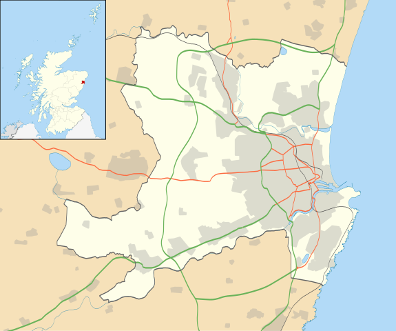
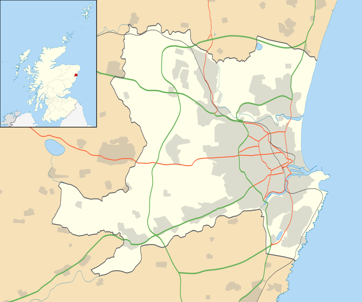
Blank map of Aberdeen, UK with the following information shown:
Equirectangular map projection on WGS 84 datum, with N/S stretched 180% Geographic limits:
|
| 日付 | |
| 原典 |
|
| 作者 | Nilfanion, created using Ordnance Survey data |
| 許可 (ファイルの再利用) |
このファイルはクリエイティブ・コモンズ 表示-継承 3.0 非移植ライセンスのもとに利用を許諾されています。 帰属: Contains Ordnance Survey data © Crown copyright and database right
|
| その他のバージョン | File:Aberdeen UK blank map.svg - Blank map |
ファイルの履歴
過去の版のファイルを表示するには、その版の日時をクリックしてください。
| 日付と時刻 | サムネイル | 寸法 | 利用者 | コメント | |
|---|---|---|---|---|---|
| 現在の版 | 2020年7月1日 (水) 17:19 | | 1,425 × 1,189 (630キロバイト) | NordNordWest (トーク | 投稿記録) | + Aberdeen Western Peripheral Route |
| 2010年9月26日 (日) 19:55 |  | 1,425 × 1,189 (821キロバイト) | Nilfanion (トーク | 投稿記録) | {{Information |Description=Blank map of Aberdeen, UK with the following information shown: *Administrative borders *Coastline, lakes and rivers *Roads and railways *Urban areas Equirectangular map projection on WGS 84 datum, with N/S stret |
このファイルは上書きできません。
ファイルの使用状況
以下のページがこのファイルを使用しています:
グローバルなファイル使用状況
以下に挙げる他のウィキがこの画像を使っています:
- ar.wikipedia.org での使用状況
- azb.wikipedia.org での使用状況
- ba.wikipedia.org での使用状況
- bg.wikipedia.org での使用状況
- ceb.wikipedia.org での使用状況
- de.wikipedia.org での使用状況
- en.wikipedia.org での使用状況
- Aberdeen
- Aberdeen Airport
- Cults, Aberdeen
- Westhill, Aberdeenshire
- Dyce
- Pittodrie Stadium
- Peterculter
- Old Aberdeen
- Mannofield
- Cruickshank Botanic Garden
- Portlethen
- Bieldside
- Milltimber
- Drumoak
- Bucksburn
- Template:Aberdeen-geo-stub
- Torry
- Kittybrewster
- Kincorth
- Bucks Burn
- Doonies Farm
- Cove Bay
- Tillydrone
- Foresterhill
- Footdee
- Aberdeen Royal Infirmary
- Royal Aberdeen Children's Hospital
- Aberdeen Maternity Hospital
- Royal Cornhill Hospital
- Woodend Hospital
- Woolmanhill Hospital
- Albyn Hospital
- Mastrick
- Aberdeen Art Gallery
- Tullos
- Danestone
- Bridge of Don
- Summerhill, Aberdeen
- Aberdeen Maritime Museum
- Kingswells
- Victoria Park, Aberdeen
このファイルのグローバル使用状況を表示する。