File:Admiralty Chart No 473 A survey of the harbour of Jacmel in the Island of St. Domingo, Published 1821.jpg
Jump to navigation
Jump to search

Size of this preview: 427 × 599 pixels. Other resolutions: 171 × 240 pixels | 342 × 480 pixels | 547 × 768 pixels | 729 × 1,024 pixels | 1,459 × 2,048 pixels | 3,300 × 4,632 pixels.
Original file (3,300 × 4,632 pixels, file size: 2.56 MB, MIME type: image/jpeg)
Captions
Captions
Nautical chart of Jacmel, St. Domingo
Summary
[edit]
| Description |
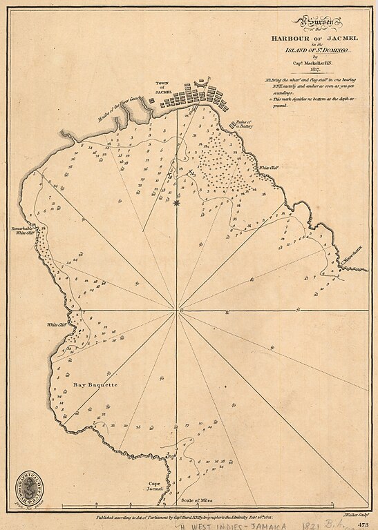
English: Nautical chart of Jacmel in the Island of St. Domingo. Surveyed by Capt. Mackellar 1817. Not current - not to be used for navigation! |
| Date | |
| Source | https://earthworks.stanford.edu/catalog/princeton-bn9999190 |
| Author | Capt. Hurd, Hydrographer |
Licensing
[edit]
This work created by the United Kingdom Government is in the public domain.
This is because it is one of the following:
HMSO has declared that the expiry of Crown Copyrights applies worldwide (ref: HMSO Email Reply)
|
 |
File history
Click on a date/time to view the file as it appeared at that time.
| Date/Time | Thumbnail | Dimensions | User | Comment | |
|---|---|---|---|---|---|
| current | 22:11, 16 July 2020 | | 3,300 × 4,632 (2.56 MB) | Kognos (talk | contribs) | Uploaded a work by Capt. Hurd, Hydrographer from https://earthworks.stanford.edu/catalog/princeton-bn9999190 with UploadWizard |
You cannot overwrite this file.
File usage on Commons
There are no pages that use this file.