File:Aerial view of Hadleigh Country Park, parking area - geograph.org.uk - 1564297.jpg
Jump to navigation
Jump to search
No higher resolution available.
Aerial_view_of_Hadleigh_Country_Park,_parking_area_-_geograph.org.uk_-_1564297.jpg (640 × 509 pixels, file size: 282 KB, MIME type: image/jpeg)
Captions
Captions
Add a one-line explanation of what this file represents
Summary[edit]
| Description |
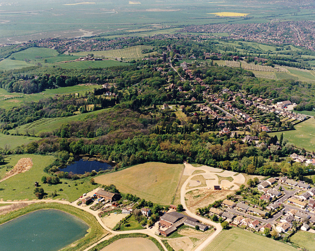
English: Aerial view of Hadleigh Country Park, parking area The car parking are for the Country Park (accessed via Chapel Lane) lies below left of centre. Chapel Lane itself lies out of view below the area of the photo. The road running from near the upper centre, down to the below centre right is Benfleet Road. The darker of the two pools visible here is long established, the paler pool (bottom left) is more recent in origin. |
| Date | |
| Source | From geograph.org.uk |
| Author | Edward Clack |
| Attribution (required by the license) | Edward Clack / Aerial view of Hadleigh Country Park, parking area / |
| Camera location | | View this and other nearby images on: OpenStreetMap |
|---|
_heading:225.00&language=en)
| Object location | | View this and other nearby images on: OpenStreetMap |
|---|
_heading:225.00&language=en)
Licensing[edit]

|
This image was taken from the Geograph project collection. See this photograph's page on the Geograph website for the photographer's contact details. The copyright on this image is owned by Edward Clack and is licensed for reuse under the Creative Commons Attribution-ShareAlike 2.0 license.
|
This file is licensed under the Creative Commons Attribution-Share Alike 2.0 Generic license.
Attribution: Edward Clack
- You are free:
- to share – to copy, distribute and transmit the work
- to remix – to adapt the work
- Under the following conditions:
- attribution – You must give appropriate credit, provide a link to the license, and indicate if changes were made. You may do so in any reasonable manner, but not in any way that suggests the licensor endorses you or your use.
- share alike – If you remix, transform, or build upon the material, you must distribute your contributions under the same or compatible license as the original.
File history
Click on a date/time to view the file as it appeared at that time.
| Date/Time | Thumbnail | Dimensions | User | Comment | |
|---|---|---|---|---|---|
| current | 16:00, 3 March 2011 | | 640 × 509 (282 KB) | GeographBot (talk | contribs) | == {{int:filedesc}} == {{Information |description={{en|1=Aerial view of Hadleigh Country Park, parking area The car parking are for the Country Park (accessed via Chapel Lane) lies below left of centre. Chapel Lane itself lies out of view below the area o |
You cannot overwrite this file.
File usage on Commons
There are no pages that use this file.