File:Agnestads kyrkoruin utanför Falköping.jpg
Jump to navigation
Jump to search
Size of this preview: 800 × 436 pixels. Other resolutions: 320 × 174 pixels | 640 × 348 pixels | 1,024 × 557 pixels | 1,280 × 697 pixels | 2,634 × 1,434 pixels.
Original file (2,634 × 1,434 pixels, file size: 4.1 MB, MIME type: image/jpeg)
Captions
Captions
Add a one-line explanation of what this file represents
Summary[edit]
| Description |
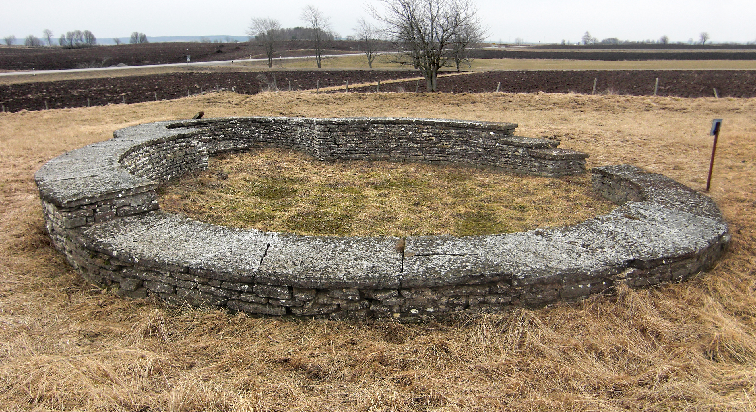
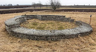
English: The Agnestad church ruin is situated 2 km southeast of Falköping in Västergötland, Sweden. The church was built in the 12th century. It was the parish church in Agnestad parish, that later bacame the Easten parish of Falköping, but the ruin is nowadays situated in Karleby parish. During the Mediaeval times the parish belonged to the Ålleberg fjärding of Vartofta hundred. The ruin is situated less than one kilometer north of the northen end of Mount Ålleberg.
Svenska: Agnestads kyrkoruin ligger två kilometer sydöst om Falköping i Västergötland, Sverige. Ruinen har beteckningen RAÄ-nummer Karleby 4:2 i Fornminesregistret. Det är ruinen efter en rundkyrka från 1100-talet. Kyrkan var sockenkyrka för Agnestads socken, som senare blev Falköpings östra socken, men ruinen ligger idag i Karleby socken. Under medeltiden tillhörde socknen Ållebergs fjärding i Vartofta härad. Kyrkoruinen ligger knappt en kilometer norr om Ållebergs norra ände.
|
||
| Date | |||
| Source | Own work | ||
| Author | Gunnar Creutz |
| Camera location | | View this and other nearby images on: OpenStreetMap |
|---|
Licensing[edit]
I, the copyright holder of this work, hereby publish it under the following license:
| This file is made available under the Creative Commons CC0 1.0 Universal Public Domain Dedication. | |
| The person who associated a work with this deed has dedicated the work to the public domain by waiving all of their rights to the work worldwide under copyright law, including all related and neighboring rights, to the extent allowed by law. You can copy, modify, distribute and perform the work, even for commercial purposes, all without asking permission.
|
File history
Click on a date/time to view the file as it appeared at that time.
| Date/Time | Thumbnail | Dimensions | User | Comment | |
|---|---|---|---|---|---|
| current | 16:15, 14 December 2012 | | 2,634 × 1,434 (4.1 MB) | Achird (talk | contribs) | Higher resolution. |
| 23:04, 27 November 2010 |  | 1,000 × 561 (465 KB) | Achird (talk | contribs) | {{Information |Description={{en|1=The Agnestad church ruin is situated 2 km southeast of Falköping in Västergötland, Sweden. The church was built in the 12th century. It was the parish church in Agnestad parish, that later bacame the Easten parish of F |
You cannot overwrite this file.
File usage on Commons
The following 9 pages use this file:
File usage on other wikis
The following other wikis use this file:
- Usage on de.wikipedia.org
- Usage on en.wikipedia.org
- Usage on sv.wikipedia.org
- Usage on www.wikidata.org