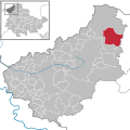
File:Am Ohmberg in EIC.svg

Original file (SVG file, nominally 1,149 × 1,140 pixels, file size: 510 KB)
Captions
Captions
| DescriptionAm Ohmberg in EIC.svg |
|
||||||||||||||||||||||||
| Date | (UTC) | ||||||||||||||||||||||||
| Source | |||||||||||||||||||||||||
| Author |
|
Licensing[edit]
| This file is made available under the Creative Commons CC0 1.0 Universal Public Domain Dedication. | |
| The person who associated a work with this deed has dedicated the work to the public domain by waiving all of their rights to the work worldwide under copyright law, including all related and neighboring rights, to the extent allowed by law. You can copy, modify, distribute and perform the work, even for commercial purposes, all without asking permission.
http://creativecommons.org/publicdomain/zero/1.0/deed.enCC0Creative Commons Zero, Public Domain Dedicationfalsefalse |
| Public domainPublic domainfalsefalse |
| I, the copyright holder of this work, release this work into the public domain. This applies worldwide. In some countries this may not be legally possible; if so: I grant anyone the right to use this work for any purpose, without any conditions, unless such conditions are required by law. |
Original upload log[edit]
This image is a derivative work of the following images:
- File:Steinrode_in_EIC.svg licensed with Attribution, Cc-by-3.0,2.5,2.0,1.0, Cc-by-sa-3.0,2.5,2.0,1.0, Cc-zero, FAL, GFDL, PD-self
- 2009-08-20T09:34:52Z Hagar66 1149x1140 (822138 Bytes) =={{int:filedesc}}== {{Information |Description= {{de|Lage von [[:de:Steinrode|Steinrode]], [[:de:Landkreis Eichsfeld|Landkreis Eichsfeld]], [[:de:Thüringen|Thüringen]], [[:de:Deutschland|Deutschland]]}} {{en|Steinrode in [
Uploaded with derivativeFX
File history
Click on a date/time to view the file as it appeared at that time.
| Date/Time | Thumbnail | Dimensions | User | Comment | |
|---|---|---|---|---|---|
| current | 17:11, 30 December 2023 |  | 1,149 × 1,140 (510 KB) | NordNordWest (talk | contribs) | upd |
| 20:45, 30 December 2022 |  | 1,149 × 1,140 (578 KB) | NordNordWest (talk | contribs) | upd | |
| 16:34, 4 January 2019 |  | 1,149 × 1,140 (578 KB) | NordNordWest (talk | contribs) | upd | |
| 07:06, 6 July 2018 |  | 1,149 × 1,140 (632 KB) | NordNordWest (talk | contribs) | upd | |
| 18:46, 17 January 2014 |  | 1,149 × 1,140 (655 KB) | NordNordWest (talk | contribs) | upd | |
| 12:29, 30 November 2011 |  | 1,149 × 1,140 (441 KB) | Hagar66 (talk | contribs) | 2011-12-01: abolition of collective municipality Eichsfeld-Südharz, creation of "Sonnenstein (Eichsfeld)" | |
| 11:40, 9 December 2010 |  | 1,149 × 1,140 (195 KB) | Hagar66 (talk | contribs) | {{Information |Description= |Source= |Date= |Author= |Permission= |other_versions= }} | |
| 16:58, 4 December 2010 |  | 1,149 × 1,140 (257 KB) | NordNordWest (talk | contribs) | {{Information |Description={{de|Lage von Am Ohmberg, Landkreis Eichsfeld, Thüringen, Deutschland}} {{en|Am Ohmberg in District Eichsfeld, [[:en:Thurin |
You cannot overwrite this file.
File usage on Commons
The following 3 pages use this file:
File usage on other wikis
The following other wikis use this file:
- Usage on arz.wikipedia.org
- Usage on ceb.wikipedia.org
- Usage on de.wikipedia.org
- Usage on en.wikipedia.org
- Usage on eo.wikipedia.org
- Usage on es.wikipedia.org
- Usage on et.wikipedia.org
- Usage on eu.wikipedia.org
- Usage on fr.wikipedia.org
- Usage on hu.wikipedia.org
- Usage on it.wikipedia.org
- Usage on mk.wikipedia.org
- Usage on nl.wikipedia.org
- Usage on pl.wikipedia.org
- Usage on pt.wikipedia.org
- Usage on sv.wikipedia.org
- Usage on uk.wikipedia.org
- Usage on www.wikidata.org
- Usage on zh-min-nan.wikipedia.org
- Usage on zh.wikipedia.org
Metadata
This file contains additional information such as Exif metadata which may have been added by the digital camera, scanner, or software program used to create or digitize it. If the file has been modified from its original state, some details such as the timestamp may not fully reflect those of the original file. The timestamp is only as accurate as the clock in the camera, and it may be completely wrong.
| Width | 1149px |
|---|---|
| Height | 1140px |