File:An LNER Azuma train at Burnmouth, geograph 6350005 by Walter Baxter.jpg
From Wikimedia Commons, the free media repository
Jump to navigation
Jump to search
Size of this preview: 800 × 538 pixels. Other resolutions: 320 × 215 pixels | 640 × 431 pixels | 1,024 × 689 pixels.
Original file (1,024 × 689 pixels, file size: 479 KB, MIME type: image/jpeg)
File information
Structured data
Captions
Summary[edit]
DescriptionAn LNER Azuma train at Burnmouth, geograph 6350005 by Walter Baxter.jpg |
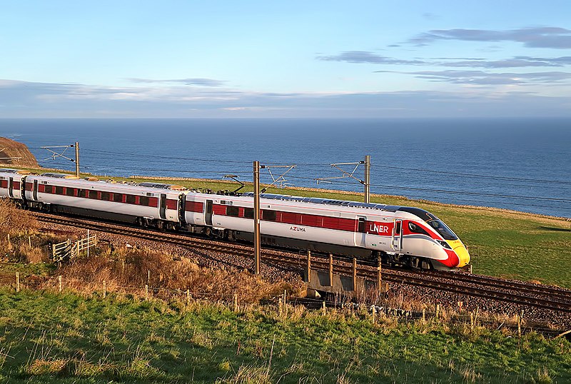
English: An LNER Azuma train at Burnmouth
This train on the East Coast Line was viewed on the southeast side of Burnmouth in December early morning light. |
||
Date | |||
Source | geograph.org.uk | ||
Author | Walter Baxter | ||
Permission (Reusing this file) |
This file is licensed under the Creative Commons Attribution-Share Alike 2.0 Generic license. Attribution: Walter Baxter
|
||
Attribution (required by the license) InfoField | Walter Baxter / An LNER Azuma train at Burnmouth / | ||
InfoField | Walter Baxter / An LNER Azuma train at Burnmouth |
Camera location | 55° 50′ 16.77″ N, 2° 04′ 06.68″ W | View this and other nearby images on: OpenStreetMap | 55.837992; -2.068523 |
---|
File history
Click on a date/time to view the file as it appeared at that time.
Date/Time | Thumbnail | Dimensions | User | Comment | |
---|---|---|---|---|---|
current | 22:49, 9 October 2021 | 1,024 × 689 (479 KB) | G-13114 (talk | contribs) | {{Information |description={{en|1=An LNER Azuma train at Burnmouth This train on the East Coast Line was viewed on the southeast side of Burnmouth in December early morning light.}} |date=2019-12-21 |source= [https://www.geograph.org.uk geograph.org.uk] |author= Walter Baxter |permission= {{Geograph|6350005|Walter Baxter}} |other_versions= |other fields= {{Credit line |Author = Walter Baxter |Other = ''An LNER Azuma train at Burnmouth'' |License = CC-BY-SA-2.0 }}}} [[Category:2019... |
You cannot overwrite this file.
File usage on Commons
The following page uses this file:
File usage on other wikis
The following other wikis use this file:
- Usage on en.wikipedia.org
- Usage on en.wikivoyage.org
- Usage on zh.wikipedia.org
Metadata
This file contains additional information such as Exif metadata which may have been added by the digital camera, scanner, or software program used to create or digitize it. If the file has been modified from its original state, some details such as the timestamp may not fully reflect those of the original file. The timestamp is only as accurate as the clock in the camera, and it may be completely wrong.
Camera manufacturer | Canon |
---|---|
Camera model | Canon EOS-1D X Mark II |
Author | Walter_Baxter |
Copyright holder |
|
Exposure time | 1/1,000 sec (0.001) |
F-number | f/16 |
ISO speed rating | 1,600 |
Date and time of data generation | 11:37, 21 December 2019 |
Lens focal length | 47 mm |
Latitude | 55° 50′ 16.77″ N |
Longitude | 2° 4′ 6.68″ W |
Altitude | 61.1 meters above sea level |
Width | 5,472 px |
Height | 3,648 px |
Bits per component |
|
Pixel composition | RGB |
Orientation | Normal |
Number of components | 3 |
Horizontal resolution | 350 dpi |
Vertical resolution | 350 dpi |
Software used | Adobe Photoshop Elements 11.0 Windows |
File change date and time | 09:32, 23 December 2019 |
Y and C positioning | Centered |
Exposure Program | Shutter priority |
Exif version | 2.31 |
Date and time of digitizing | 11:37, 21 December 2019 |
Meaning of each component |
|
APEX shutter speed | 10 |
APEX aperture | 8 |
APEX exposure bias | −0.66666666666667 |
Maximum land aperture | 4 APEX (f/4) |
Metering mode | Pattern |
Flash | Flash did not fire, compulsory flash suppression |
DateTime subseconds | 37 |
DateTimeOriginal subseconds | 00 |
DateTimeDigitized subseconds | 00 |
Supported Flashpix version | 1 |
Color space | sRGB |
Focal plane X resolution | 3,805.2851182197 |
Focal plane Y resolution | 3,807.9331941545 |
Focal plane resolution unit | inches |
Custom image processing | Normal process |
Exposure mode | Auto exposure |
White balance | Auto white balance |
Scene capture type | Standard |
GPS time (atomic clock) | 10:37:14.907 |
Satellites used for measurement | 8 |
Receiver status | Measurement in progress |
Measurement mode | 3-dimensional measurement |
Measurement precision | Poor (3.9) |
Geodetic survey data used | WGS-84 |
GPS date | 21 December 2019 |
GPS tag version | 0.0.3.2 |
Serial number of camera | 363028000333 |
Lens used | EF24-105mm f/4L IS USM |
Rating (out of 5) | 0 |
Date metadata was last modified | 09:32, 23 December 2019 |
Unique ID of original document | 0886E4E5358DD6709333C1239401A9AD |
IIM version | 101 |
Structured data
Items portrayed in this file
depicts
0.001 second
16
47 millimetre
1,600
21 December 2019
55°50'16.771"N, 2°4'6.683"W
image/jpeg
3d1ba1a85869278ef275d30ef7b97c143795e93c
490,111 byte
689 pixel
1,024 pixel
Hidden categories:
- CC-BY-SA-2.0
- Images from Geograph Britain and Ireland
- Images from Geograph Britain and Ireland missing SDC creator
- Images from Geograph Britain and Ireland missing SDC source of file
- Images from Geograph Britain and Ireland missing SDC coordinates of depicted place
- Information field template with formatting
- Files with coordinates missing SDC location of creation
- Pages with maps