File:An accurate map of the British Empire in Nth. America as settled by the Preliminaries in 1762 LOC 2002622265.tif
Jump to navigation
Jump to search

Size of this JPG preview of this TIF file: 700 × 599 pixels. Other resolutions: 280 × 240 pixels | 561 × 480 pixels | 897 × 768 pixels | 1,196 × 1,024 pixels | 2,392 × 2,048 pixels | 3,091 × 2,647 pixels.
Original file (3,091 × 2,647 pixels, file size: 23.41 MB, MIME type: image/tiff)
Captions
Captions
Add a one-line explanation of what this file represents
Summary
[edit]| Description |
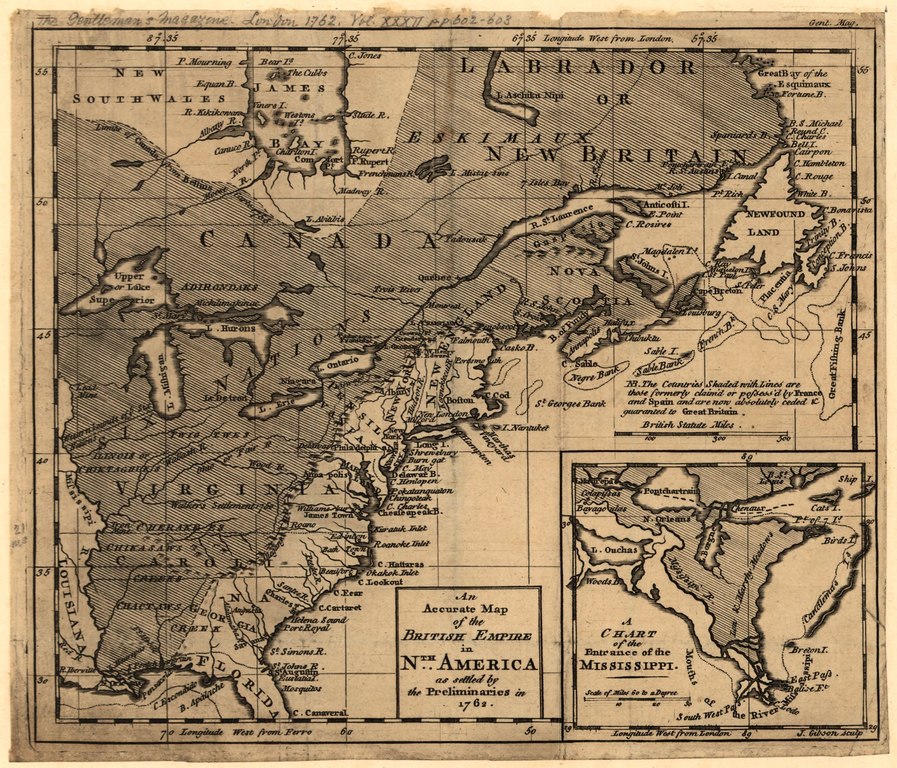
English: Relief shown pictorially. Prime meridians: London and Ferro. From the Gentleman's magazine, 1762, vol. 32, pp. 602-603. Inset: A chart of the entrance of the Mississippi. LC Maps of North America, 1750-1789, 92 Available also through the Library of Congress Web site as a raster image. |
||
| Title | An accurate map of the British Empire in Nth. America as settled by the Preliminaries in 1762 | ||
| Shelf ID | G3300 1762 .G5 | ||
| Date | |||
| Source | https://www.loc.gov/item/2002622265/ | ||
| Author | Gibson, J. (John) | ||
| Permission (Reusing this file) |
|
||
| Other versions |
|
||
| Location | North America | ||
| Part of | Military Battles And Campaigns · American Memory · Catalog · Geography And Map Division · American Revolution And Its Era: Maps And Charts Of North America And The West Indies, 1750-1789 | ||
| Subject | North America · Early Works To 1800 |


Licensing
[edit]|
This is a faithful photographic reproduction of a two-dimensional, public domain work of art. The work of art itself is in the public domain for the following reason:
The official position taken by the Wikimedia Foundation is that "faithful reproductions of two-dimensional public domain works of art are public domain".
This photographic reproduction is therefore also considered to be in the public domain in the United States. In other jurisdictions, re-use of this content may be restricted; see Reuse of PD-Art photographs for details. | ||||
File history
Click on a date/time to view the file as it appeared at that time.
| Date/Time | Thumbnail | Dimensions | User | Comment | |
|---|---|---|---|---|---|
| current | 02:19, 19 May 2018 |  | 3,091 × 2,647 (23.41 MB) | Fæ (talk | contribs) | LOC Maps https://www.loc.gov/item/2002622265/ #2138 |
You cannot overwrite this file.
File usage on Commons
The following page uses this file: