File:An ancient sunken path - geograph.org.uk - 1028345.jpg
Jump to navigation
Jump to search
No higher resolution available.
An_ancient_sunken_path_-_geograph.org.uk_-_1028345.jpg (640 × 490 pixels, file size: 155 KB, MIME type: image/jpeg)
Captions
Captions
Add a one-line explanation of what this file represents
Summary
[edit]
| Description |
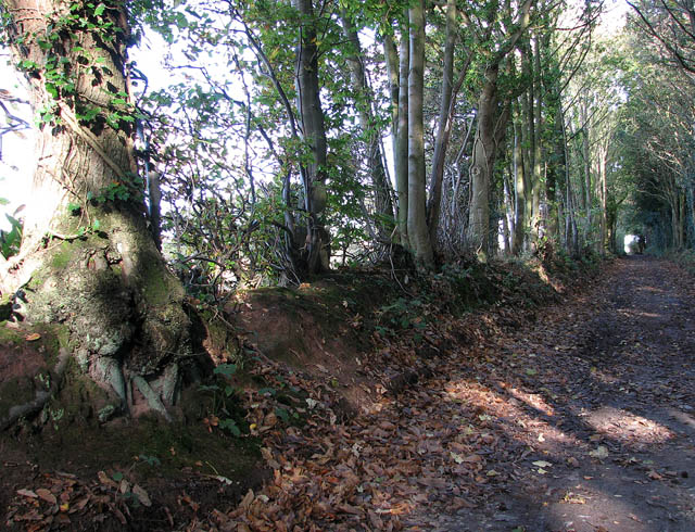
English: An ancient sunken path. Here leading past Westwick Hill. This public footpath turns off Swanton Abbott Road as it leads through Swanton Hill. The path runs in northeasterly direction, passing Westwick Hill and Woodcock Hill and Perch Lake and Heath Plantations > 1028241 - 1028235 beyond, and the derelict Strawberry Hall > 1027083 before reaching Lord Anson's Wood and a stile > 1028173. Here it emerges into a field which is the site of an ancient battle where Bishop Spencer fought the rebels under John Leicester in 1381. On the other side of the field the path joins a farm track > 1027038 leading to the B1150 (North Walsham Road) near where an old stump cross > 458419 commemorating said battle has been resited to. |
| Date | |
| Source | From geograph.org.uk |
| Author | Evelyn Simak |
| Attribution (required by the license) | Evelyn Simak / An ancient sunken path / |
| Camera location | | View this and other nearby images on: OpenStreetMap |
|---|
_heading:22.00&language=en)
| Object location | | View this and other nearby images on: OpenStreetMap |
|---|
_heading:22.00&language=en)
Licensing
[edit]

|
This image was taken from the Geograph project collection. See this photograph's page on the Geograph website for the photographer's contact details. The copyright on this image is owned by Evelyn Simak and is licensed for reuse under the Creative Commons Attribution-ShareAlike 2.0 license.
|
This file is licensed under the Creative Commons Attribution-Share Alike 2.0 Generic license.
Attribution: Evelyn Simak
- You are free:
- to share – to copy, distribute and transmit the work
- to remix – to adapt the work
- Under the following conditions:
- attribution – You must give appropriate credit, provide a link to the license, and indicate if changes were made. You may do so in any reasonable manner, but not in any way that suggests the licensor endorses you or your use.
- share alike – If you remix, transform, or build upon the material, you must distribute your contributions under the same or compatible license as the original.
- Remove redundant categories and try to put this image in the most specific category/categories
- Remove this template
- The location categories are based on information from this geonames tool and this OpenStreetMap tool combined with a database. You can also have a look at this tool from mysociety.
- The topic category from Geograph was Public footpath (find similar images footpath at Geograph)
File history
Click on a date/time to view the file as it appeared at that time.
| Date/Time | Thumbnail | Dimensions | User | Comment | |
|---|---|---|---|---|---|
| current | 13:30, 23 February 2011 | | 640 × 490 (155 KB) | GeographBot (talk | contribs) | == {{int:filedesc}} == {{Information |description={{en|1=An ancient sunken path Here leading past Westwick Hill. This public footpath turns off Swanton Abbott Road as it leads through Swanton Hill. The path runs in northeasterly direction, passing Westwic |
You cannot overwrite this file.
File usage on Commons
There are no pages that use this file.
File usage on other wikis
The following other wikis use this file:
- Usage on no.wikipedia.org