File:Angus UK location map.svg
跳转到导航
跳转到搜索

此SVG文件的PNG预览的大小:610 × 599像素。 其他分辨率:244 × 240像素 | 489 × 480像素 | 782 × 768像素 | 1,042 × 1,024像素 | 2,085 × 2,048像素 | 1,425 × 1,400像素。
原始文件 (SVG文件,尺寸为1,425 × 1,400像素,文件大小:1.14 MB)
说明
说明
添加一行文字以描述该文件所表现的内容
| 描述 |
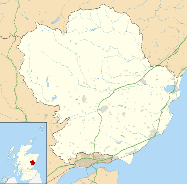
Blank map of Angus, UK with the following information shown:
Equirectangular map projection on WGS 84 datum, with N/S stretched 180% Geographic limits:
|
| 日期 | |
| 来源 |
|
| 作者 | Nilfanion, created using Ordnance Survey data |
| 授权 (二次使用本文件) |
本文件采用知识共享署名-相同方式共享 3.0 未本地化版本许可协议授权。 署名: Contains Ordnance Survey data © Crown copyright and database right
|
| 其他版本 | File:Angus UK blank map.svg - Blank map |
文件历史
点击某个日期/时间查看对应时刻的文件。
| 日期/时间 | 缩略图 | 大小 | 用户 | 备注 | |
|---|---|---|---|---|---|
| 当前 | 2010年9月26日 (日) 20:01 | | 1,425 × 1,400(1.14 MB) | Nilfanion(留言 | 贡献) | {{Information |Description=Blank map of Angus, UK with the following information shown: *Administrative borders *Coastline, lakes and rivers *Roads and railways *Urban areas Equirectangular map projection on WGS 84 datum, with N/S stretched 18 |
您不可以覆盖此文件。
文件用途
全域文件用途
以下其他wiki使用此文件:
- ar.wikipedia.org上的用途
- ba.wikipedia.org上的用途
- bg.wikipedia.org上的用途
- br.wikipedia.org上的用途
- ceb.wikipedia.org上的用途
- de.wikipedia.org上的用途
- en.wikipedia.org上的用途
- Angus, Scotland
- Arbroath
- Glamis Castle
- List of monastic houses in Scotland
- Forfar
- Montrose, Angus
- Kirriemuir
- Colliston Castle
- Brechin
- Friockheim
- Carnoustie
- Glamis
- Aberlemno
- Memus
- Airlie, Angus
- Monifieth
- Liff, Angus
- Craigowl Hill
- Edzell Castle
- East Haven, Angus
- Station Park, Forfar
- Wikipedia:WikiProject Scottish Castles
- Tealing
- RAF Montrose
- Glebe Park, Brechin
- Barry, Angus
- Strathmartine
- Auchmithie
- Scottish Junior Football East Region Premier League North
- Cortachy
- Stracathro
- Bridge of Craigisla
- Carmyllie
- Edzell
- Farnell, Angus
- Guthrie, Angus
- Inverkeilor
- Letham, Angus
- Newbigging, Angus
- Murroes
- St Vigeans
查看此文件的更多全域用途。