File:Anschlussbahnen Lüneburg.png
Jump to navigation
Jump to search
Size of this preview: 474 × 599 pixels. Other resolutions: 190 × 240 pixels | 604 × 763 pixels.
Original file (604 × 763 pixels, file size: 363 KB, MIME type: image/png)
Captions
Captions
Add a one-line explanation of what this file represents
Summary
[edit]
| Description |
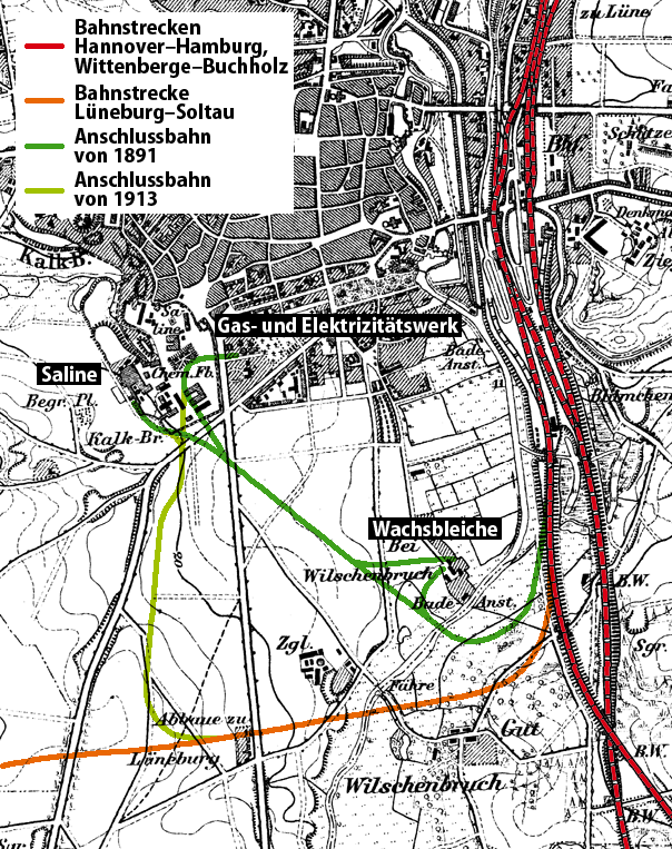
Deutsch: Karte der Anschlussbahnen der Lüneburger Wachsbleiche und Saline
English: Map of feeder lines in Lüneburg, Lower Saxony, Germany |
||||
| Date | |||||
| Source |
Own work, using
|
||||
| Author | NordNordWest | ||||
| Permission (Reusing this file) |
|
||||

|
This map has been made or improved in the German Kartenwerkstatt (Map Lab). You can propose maps to improve as well.
|
File history
Click on a date/time to view the file as it appeared at that time.
| Date/Time | Thumbnail | Dimensions | User | Comment | |
|---|---|---|---|---|---|
| current | 17:03, 20 August 2012 | | 604 × 763 (363 KB) | NordNordWest (talk | contribs) | c |
| 17:36, 19 May 2010 |  | 604 × 763 (367 KB) | NordNordWest (talk | contribs) | == {{int:filedesc}} == {{Information |Description= {{de|Karte der Anschlussbahnen der Lüneburger Wachsbleiche und Saline}} {{en|Map of feeder lines in Lüneburg, Lower Saxony, Germany}} |So |
You cannot overwrite this file.
File usage on Commons
The following page uses this file:
File usage on other wikis
The following other wikis use this file:
- Usage on de.wikipedia.org
- Usage on www.wikidata.org