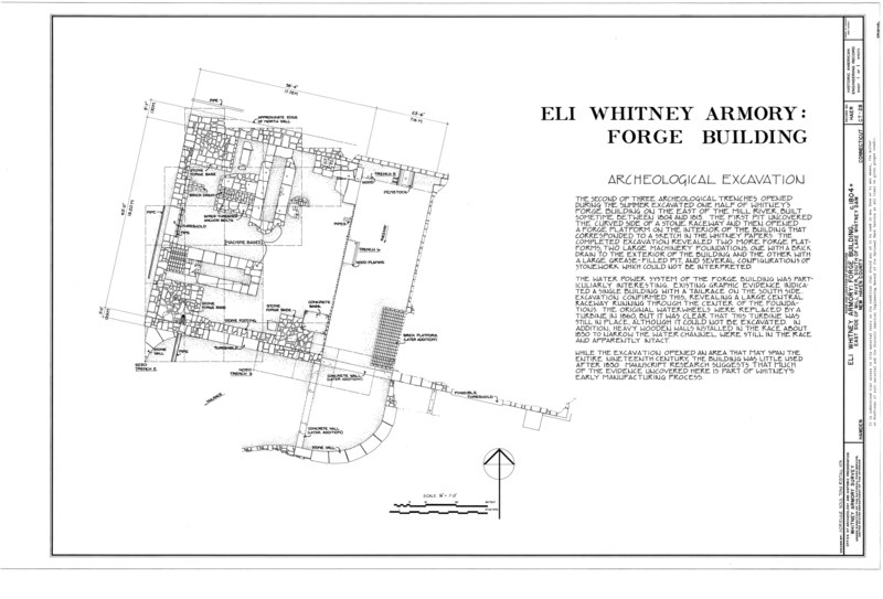
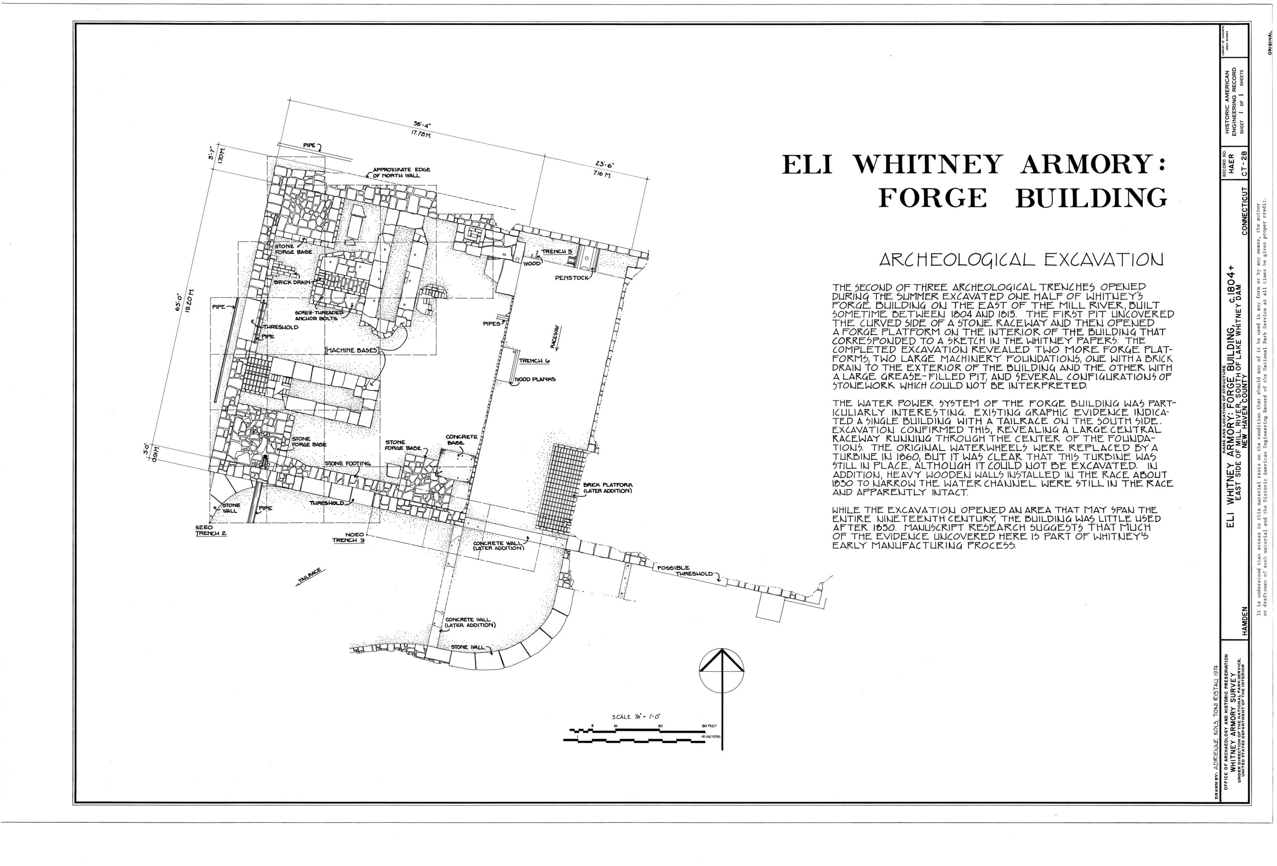
File:Archeological Excavation, Site Plan - Eli Whitney Armory, Forge Building, Mill River, Hamden, New Haven County, CT HAER CONN,5-HAM,3B- (sheet 1 of 1).tif
Jump to navigation
Jump to search
Size of this JPG preview of this TIF file: 800 × 543 pixels. Other resolutions: 320 × 217 pixels | 640 × 434 pixels | 1,024 × 695 pixels | 1,280 × 869 pixels | 2,560 × 1,737 pixels | 14,192 × 9,632 pixels.
Original file (14,192 × 9,632 pixels, file size: 920 KB, MIME type: image/tiff)
Captions
Captions
Add a one-line explanation of what this file represents
Summary[edit]
| Warning | The original file is very high-resolution. It might not load properly or could cause your browser to freeze when opened at full size. |
|---|
| Archeological Excavation, Site Plan - Eli Whitney Armory, Forge Building, Mill River, Hamden, New Haven County, CT | ||||
|---|---|---|---|---|
| Photographer |
Kols, Adrienne |
|||
| Title |
Archeological Excavation, Site Plan - Eli Whitney Armory, Forge Building, Mill River, Hamden, New Haven County, CT |
|||
| Depicted place | Connecticut; New Haven County; Hamden | |||
| Date | 1974 | |||
| Dimensions | 24 x 36 in. (D size) | |||
| Current location |
Library of Congress Prints and Photographs Division Washington, D.C. 20540 USA http://hdl.loc.gov/loc.pnp/pp.print |
|||
| Accession number |
HAER CONN,5-HAM,3B- (sheet 1 of 1) |
|||
| Credit line |
|
|||
| Notes |
|
|||
| Source | https://www.loc.gov/pictures/item/ct0138.sheet.00001a | |||
| Permission (Reusing this file) |
|
|||
| Other versions |
.png) |
|||

| Object location | | View this and other nearby images on: OpenStreetMap |
|---|
File history
Click on a date/time to view the file as it appeared at that time.
| Date/Time | Thumbnail | Dimensions | User | Comment | |
|---|---|---|---|---|---|
| current | 15:54, 7 July 2014 |  | 14,192 × 9,632 (920 KB) | Fæ (talk | contribs) | GWToolset: Creating mediafile for Fæ. HABS 06 July 2014 (611:700) |
You cannot overwrite this file.
File usage on Commons
The following page uses this file: